Circuitous Sierra Sequoia Figure-8
Visiting:
High Sierra Trail, Bearpaw, Hamilton Lakes, Kaweah Gap, Great Western Divide, Big Arroyo,
Little Five Lakes, Black Rock Pass, Redwood Meadow Grove, Mehrten Meadow, Panther Gap,
and Congress Group of Sequoia in Sequoia National Park
62.9 miles
22,140' elevation gain, 22,140' elevation loss; ERM = 151
August 28 - September 3, 2019
By Wild Vagabond (AKA Rob Jones)
Text and photos
© copyright by Rob Jones
 |

|
|---|
Sequoia Sky Seeker, Day 7
(Click the image to see the map)
|
|---|
|

|
|---|
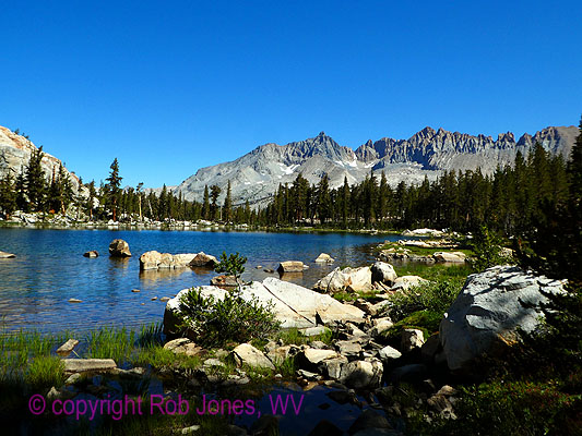
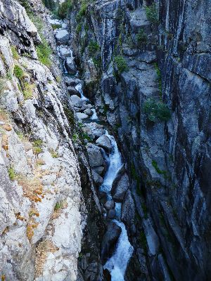
Big Arroyo, Day 3
(Click the image for the full-size image)
|
|---|
|
|
|---|
Little 5 lakes, Day 3
(Click the image for the full-size image)
|
|---|
|
|
|---|
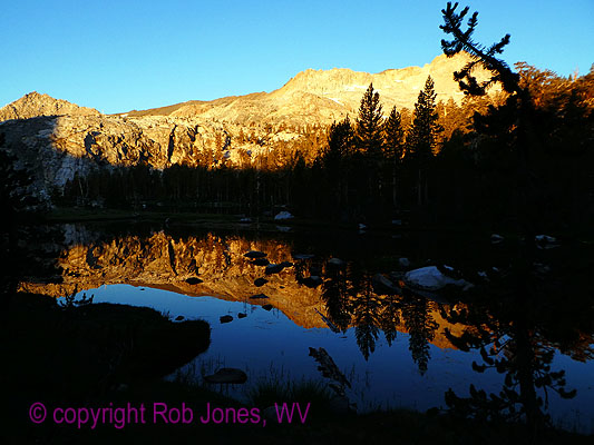
Little 5 sunrise, Day 4
(Click the image for the full-size image)
|
|---|
|

|
|---|
Spring Lake, West of Blackrock Pass-Great Western Divide, Day 4
(Click the image for the full-size image)
|
|---|
|

|
|---|
Blue Grouse, Day 4
(Click the image for the full-size image)
|
|---|
|

|
|---|
Tiger Lily, Day 4
(Click the image for the full-size image)
|
|---|
|

|
|---|
Bee & flower, Day 5
(Click the image for the full-size image)
|
|---|
|

|
|---|
Dusty Gaiter Guild on the HST, Day 6
(Click the image for the full-size image)
|
|---|
|
|
|---|
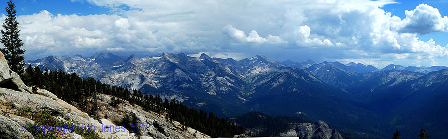
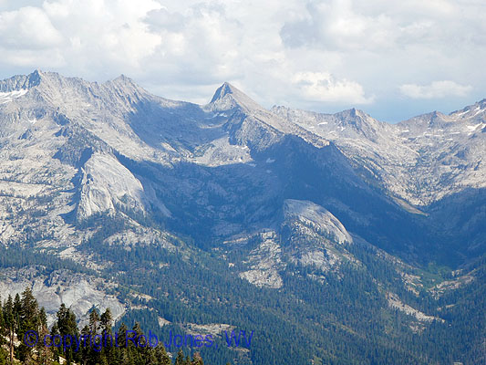
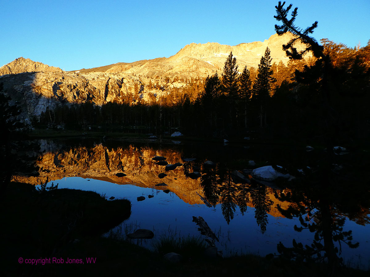
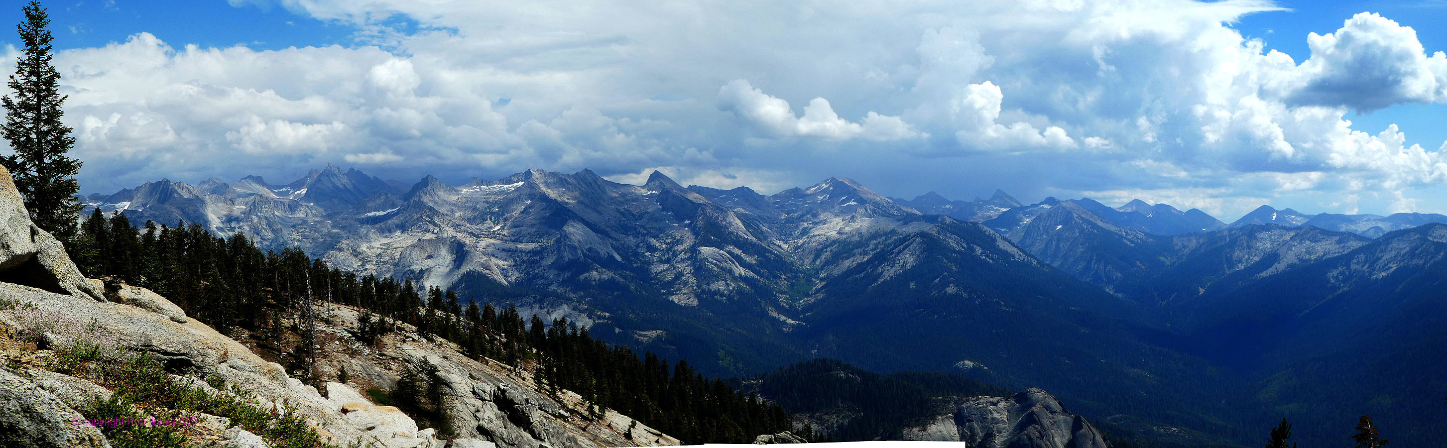
Panorama of The Great Western Divide from Alta Meadow, Day 7, 650kb, 900 x 2906
(Click the image to see the full-size image)
|
|---|
|
.


|
|---|
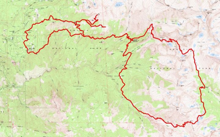
Map - Circuitous Sierra Sequoia Figure-8 map - from my Gaia mapping program
(Click the image to see the map)
|
|---|
|
Another version of the map can be found here.
This version can be enlarged and may be more useful than the above map ----> click here.
“Then it seemed
to me that the Sierra should be called, not the Nevada or Snowy Range, but the Range of
Light. And after ten years of wandering and wondering in the heart of it … it still seems
above all others."
John Muir
"Estranged from Beauty –
none can be –
For Beauty is Infinity –
And power to be finite ceased
Before Identity was leased."
- Emily Dickinson
Solo Hike; yet much of it was enjoyably shared with the Dusty Gaiters Guild; Steamer (Ken S.), Stretch (Ken I.), and Horse (Kevin G.).
Camera - Panasonic DMC-ZS60
"Between every two pines is a doorway to a
new world".- John Muir
Background/Preliminary: My trail name is Wild Vagabond. Many years ago,
I "earned" this trail name in The Grand Canyon, and brought it with me to subsequent hikes. The website
name "wildernessvagabond.com" evolved from the trail name.
This is a trip report about a figure-8 backpack in Sequoia National Park.
The ERMs, Energy Required Miles, are calculated using the
Gaia GPS app. See the
bottom of the report for a description of ERMs.
Here are my journal notes, some photos, and the daily data and trip map.
ERM = Energy Required Miles. A mile is added for
every 500' elevation gain or
loss. It's a very serviceable method of estimating energy required miles. ERM was initially used in Trails
of the Tetons (long out of print) by Paul Petzold, founder of NOLS. It's a wonderfully useful concept and
application. Add one mile for each 500' up AND down to distance = ERM. I use ERMs to calculate what the actual
day is like. It's a very serviceable method of estimating energy required miles.
Using ERMs does not account for the 'texture' of the route or trail - that
is, rocky, boulders, no trail, slimy mud, etc., yet does help approximate the route.
Because I did not track each individual day, ERMs are given for the trip
as a whole rather than for individual days. I did make a guess about daily elevation change in the narrative.
There is additional information about the valididy of using ERMS at the end of this report.
|
|---|
movie - Lone Pine Creek meets HST -32mb, Day 2
(Click the image to view the movie)
|
|---|
|
Prelim:
The yuge snow year that is 2019 has produced
difficult conditions resembling the snowmageddon of 2017 and complicating hike planning.
So, my wishes to loop the Big SEKI (Big SEKI Loop) gradually fade away with the barely
declining snowpack on some passes. I obtain the Harrison maps for Mount Whitney High
Country (the only map needed for the current hike) and Kings Canyon High Country and
ponder the hiking options. Later, I am quizzed by Ranger Michael of Little Five Lakes Patrol
Yurt and I admit that I did not consult the farcebook, the false bravado, or the internet, I looked
at a map to devise a route. Ranger M noted that this is most unusual. And, so it goes.
I finally get in gear and now I'm driving off the Colorado
Plateau and plummeting into basin and range country, crossing the beleaguered Colorado River
and sweltering in the Mojave Desert region and the population sprawl and related smog of
Bakersfield. Finally, the Subie Subaru and I are climbing to 6500' through oaks and agave, tediously,
gorgeously switchbacking to where we lilt among the gigantic stately Sequoia. Yuge cinnamon sticks
soaring, seeking sky. The Kaweah River runs clear and cold, bounding over polished granite. Yahoo.
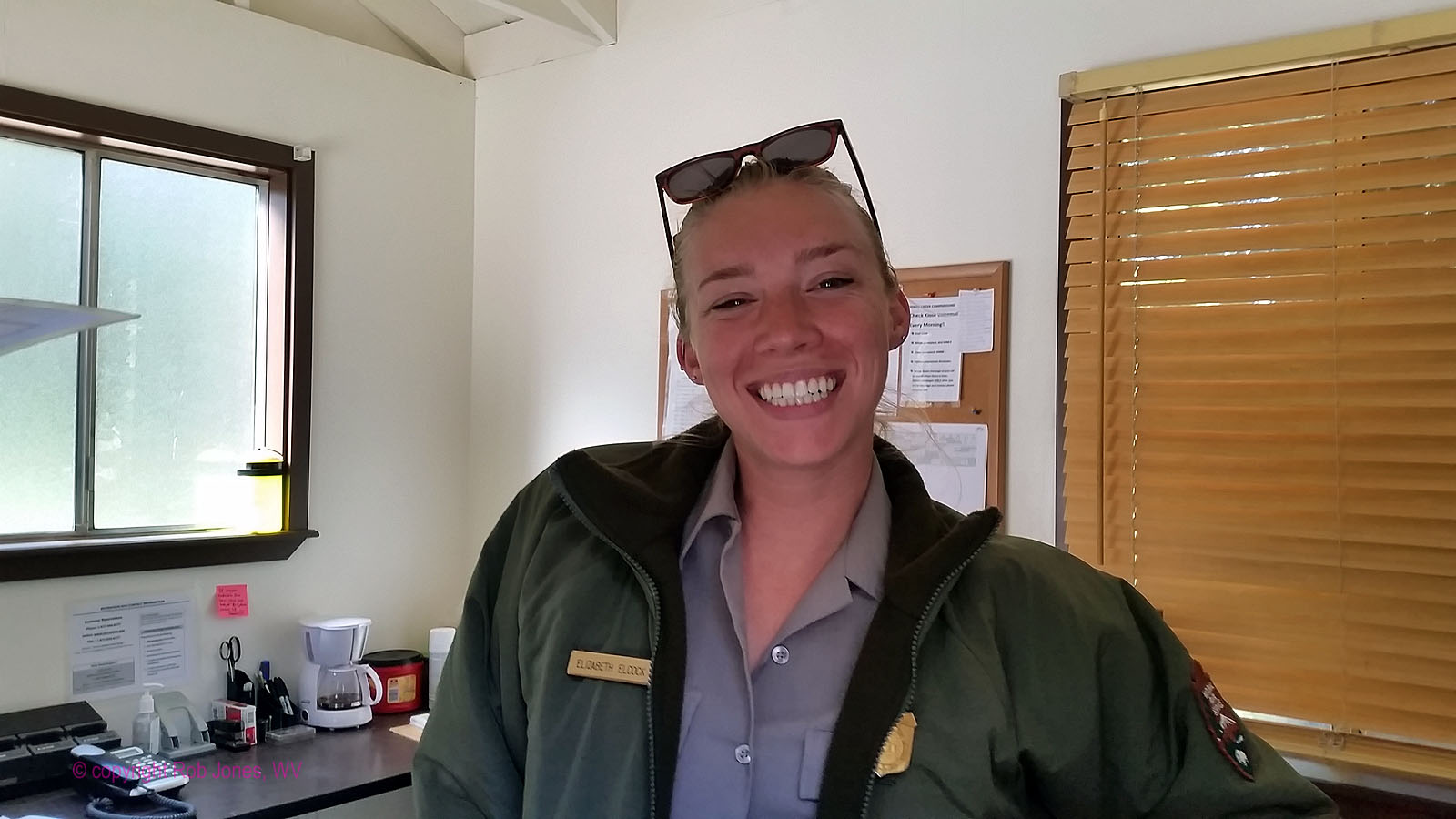
Ranger Kate comes by as I set up camp at Dorst CG and
invites me to a campfire talk about changing perspectives of preservation. With the trumpentines
in power, there is lots of reverse preservation (i.e., resource destruction) afoot. t-rump has endeavored
to transport your tax dollars and your public resources to the uber-wealthy and corporations, and have
you pay to do so.
I walk over to the Dorst Amphitheater as stars sparkle through
the high canopy. Ahh, a dark sky vista.
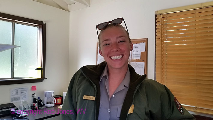
The next morning, I meet NPS Summer and negotiate to change
campsites so that I can sleep more on the level. This works out and I move camp to a walk-in site 200' from
the car amidst shady firs and away (I hope) from generators, smoky fires, and general unnatural noise. (An
ode to natural quiet.) Summer expresses interest in participating in one of the next Grand Canyon VIP
adventures. See the assortment of VIP trip reports among other
Grand Canyon reports here ----> click
|
|---|
Ranger Summer E.
(Click the image to see the full-size image)
|
|---|
|
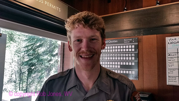
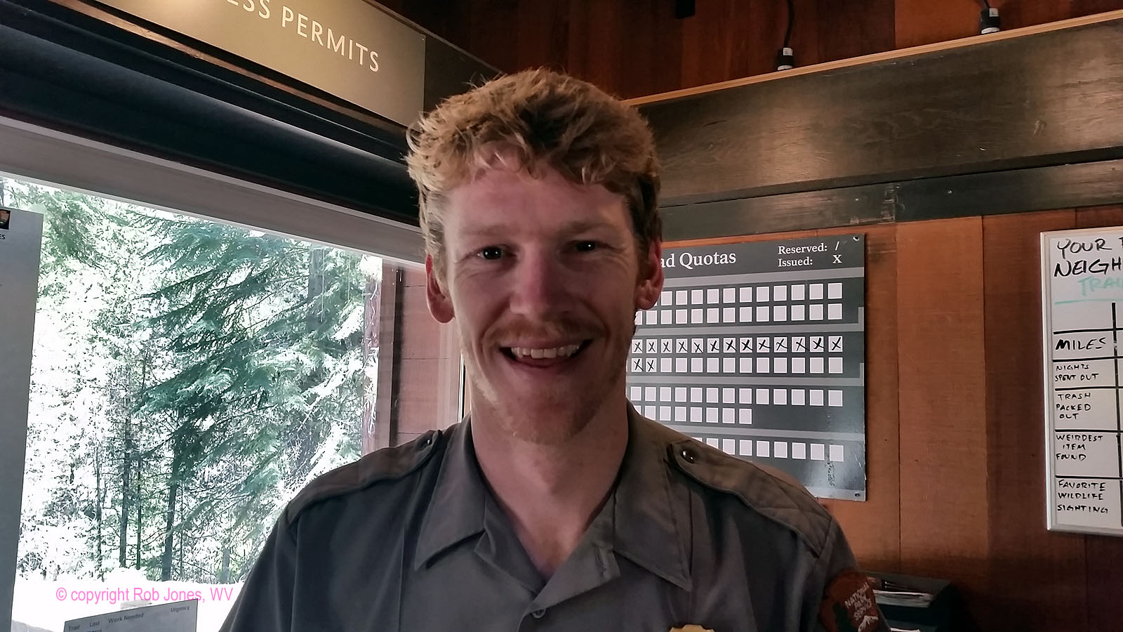
Then, it's over to Lodgepole Visitor Center to try for a walk-up permit.
I enjoy a good discussion with Ranger Wilson while waiting for the time to obtain a walk-up permit. Success!
|
|---|
Ranger Wilson
(Click the image to see the full-size image)
|
|---|
|
After securing the wilderness permit, I invest time exploring Lodgepole
CG and marking some of the best sites on the CG map. The Lodgepole area has the store, grill, showers, a
visitor center, and the Marble Fork of the Kaweah River. When operating, there's some wifi at the visitor center.
There were many glum looking adolescents roving about with apparently nothing to do because the wifi was
not working. Tragic. Following more exploring out toward Crescent Meadow I enjoy the longish (slow) drive
back to Dorst. Still tired from yesterday and last night, I lounge a bit rather than get on a local trail.
After dinner, I venture from my walk-in site 112 to 97 to chat
more with Cliff, whom I met earlier today. He took the NPS shuttle to day hike.
Prelim photos - Sequoia, 2019
Sequoia National Park is in the southern Sierra Nevada. The park was established
on September 25, 1890 to protect 404,064 acres (631 sq mi; 163,519 ha; 1,635 km2) of forested
mountainous terrain. Encompassing a vertical relief of nearly 13,000 feet (4,000 m), the park
contains the highest point in the contiguous United States, Mount Whitney, at 14,505 feet (4,421 m)
above sea level. The park is south of, and contiguous with, Kings Canyon National Park; the two parks
are administered by the National Park Service together as the Sequoia and Kings Canyon National Parks,
SEKI. UNESCO designated the areas as Sequoia-Kings Canyon Biosphere Reserve in 1976.
The park is notable for its giant sequoia trees, including
the General Sherman tree, the largest tree on Eaarth. The General Sherman tree grows in the
Giant Forest, which contains five of the ten largest trees in the world. The Giant Forest is connected
by the Generals Highway to Kings Canyon National Park's General Grant Grove, home of the General
Grant tree among other giant sequoias. The park's giant sequoia forests are part of 202,430 acres
(316 sq mi; 81,921 ha; 819 km2) of old-growth forests shared by Sequoia and Kings Canyon
National Parks. The parks preserve a landscape that still resembles the southern Sierra Nevada
before Euro-American settlement. (paraphrased from the wikipedia)
Although Congress created Sequoia and Kings Canyon Parks in
the southern Sierra Nevada at different times, they share miles of boundary. Sequoia was America’s second
national park designated in 1890, after Yellowstone NP in 1872. General Grant National Park, the forerunner
of Kings Canyon, was the third, established in 1940. (paraphrased from the Sequoia NP site)
|
|---|
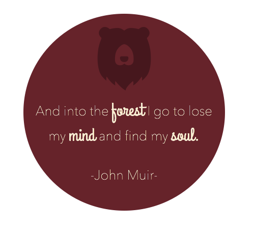
Muir knows best
(Click the image to see the full-size image)
|
|---|
|
"Writing is like the life of a glacier;
one eternal grind". - John Muir
"The mountains are calling and I must go".
- John Muir
"Wilderness is not only a haven for native plants
and animals, but it is also a refuge from society. It's a place to go to hear the wind and little else, see the
stars and the galaxies, smell the pine trees, feel the cold water, touch the sky and the ground at the same time,
listen to coyotes, eat fresh snow, walk across the desert sands, and realize why it's good to go outside of the city
and the suburbs.".
- John Muir
|
|---|
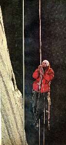
First ascent of El Capitan (Argosy article, 22mb) featuring my friend, George
Whitmore
(Click the 10 page pdf - 22 MB)
|
|---|
|
"In every walk with Nature one receives
far more than he seeks". - John Muir
(Photos and the report of the trip continue below.)
"Keep close to Nature's heart...and break clear
away, once in awhile, and climb a mountain or spend a week in the woods. Wash your spirit clean".
- John Muir
Day 1: The Bearpaw Way. To Bearpaw Meadow: 11.8 miles.
Camp @ 7600' on the High Sierra Trail (HST).
The Bufous Bear prints in the dusty trail track past the succulent
thimble berries as the HST rolls along, deeper into the magic of the wild area of Sequoia National Park.
I sample a few berries that Bufous has missed. Yummy.
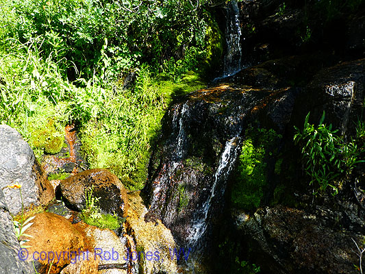
Luscious water graces many of the cleavages along the HST, providing
a respite from the sun and heat. The final boost is over a low ridge out of Buck Creek before dropping into the
Bearpaw congested camp area.
Ken, Ken, and Kevin are doing a similar loop as I am. And I see Ken
looking for a camp and invite the three Ks to join me on a fairly flat bench I've discovered. This begins an
enjoyable camaraderie with these members of the Dusty Gaiter Guild. Tall Ken is Stretch (trail name), Ken is
Steamer, and Kevin is Horse. I am Wild Vagabond.
A new Ranger Station (RS) is under construction at Bearpaw, while the
High Sierra Camp looks like a disaster and certainly won't open this year. When completed, it appears the new
RS will blend well with the area it occupies.
Running out of daylight, I'm happy to be in camp with the Ks, Ken, Ken, and
Kevin, lounging against my pack as dusk departs and dinner soaks.
"“What would it be like to live in this
place? Could a man ever grow weary of such a home? Someday…I shall make the experiment, become an ancient
baldheaded troglodyte with a dirty white beard tucked in my belt, be a shaman, a wizard, a witch doctor
crazy with solitude, starving on locusts and lizards, feasting from time to time upon lost straggler boy
scout. Madness: of course a man would go mad from the beauty and the loneliness, both equally mysterious.
But perhaps it would be – who can say? – a kind of blessed insanity, like the bliss of a snake in the
winter sun...”. - Edward Abbey
"The world is big and I want to have a good look
at it before it gets dark". - John Muir
Day 1 photos - Sequoia, 2019
Day 2: Blowout Kaweah Gap. To Big Arroyo:
11.5 miles. Up to 10,700'. Camp @ 9800'. About 9,000 feet of elevation change, yowee.
From the under construction Bearpaw Ranger Station,
the HST drops past Monkey Flower choked springs gushing from low cliffs as the trail clings to the
side of the precipitous canyon. Far below is the rumble of tumbling water, the rambling, raucous,
loquacious, fidgeting Middle Fork Kaweah. We, the Dusty Gaiter Guild and I, are heading for Kaweah
Gap, a break through and over the Great Western Divide. Yowee.
The day starts in the dim light, searching for the trump tower
with the bearpaw symbol on it. I find it farther up the hill from camp than I recall. Later, I get a photo of
Kevin departing trump tower, Bearpaw, as the sun begins to creep into the canyon fold. This unit is definitely
a trump tower and not a scenic toilet., badly odiferous, coming apart, filled with flies, not scenic, nothing to recommend it.
There will be numerous major up and down grades before the long
climb to Kaweah Gap, each making me wonder "how come we continue to lose and gain altitude, I want to stay
level, then go up." It's another of the hiker's dilemma, the contrast between your dream hike and reality.
Gorgeous cirques and hanging valleys appear. Glacier polished granite,
as noted by John Muir. I wonder if that scent is Incense Cedar? The trail smells wondrous today. Shooting Stars,
Heather, forbs and flowers of all types flourish.
The feared and hyped blowout is not bad because the NPS trail crew has
stabilized the base some. My tent pops lose from the pack as it is passed across the blowout because a pack buckle
breaks at this inopportune moment and the tent is dragged across the abrasive granite, which produces a couple of
small holes in the tent and in the stuff bag. Kevin later produces a spare buckle from the depths of his pack, one that
Tom of the Dusty Gaiter Guild has carried for many trips (sadly, Tom has missed the current trip). Thanks Tom.
We don't make it to El Big Arroyo Ranger Station before the light dims. Los
Arroyo Gigantico. Camp is about a mile short of the Arroyo-HST junction. Thanks to tall Ken, Stretch, for spotting
this delightful camp. This turns out to be a superior camp anyway, generally low mosquito population, dry, and not
in a cold sump. Did I also mention, it affords a good view of the Kaweah Range?
A cool rinse in the gathering tributary to the Kern is endured and later enjoyed.
Ahh, refreshing. I always sleep better when relieved of several trail dirt layers.
Alpenglow graces the flank of the Kaweah Range. It is after dark before I'm in the tent.
Today was a good beating, with perhaps 9,000' of elevation change.
"This I may say is the first time I
have been to church in California".
John Muir, after making the
first recorded ascent of Cathedral Peak in 1869.
Day 2 photos - Sequoia, 2019
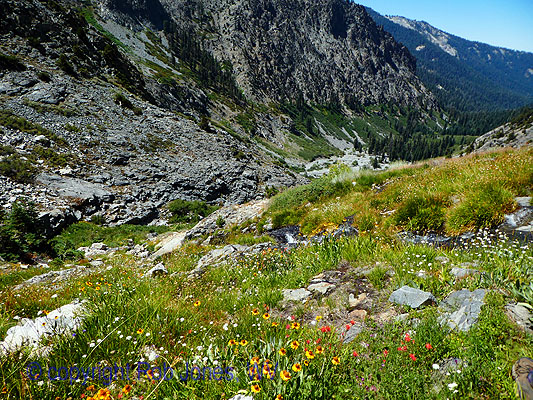
Day 3: Little Five Lakes lounge. To Little Five Lakes Basin:
3.6 miles. Camp @ 10,500'.
The day starts with a grass-lined stroll through wildflower-punctuated
high meadows bordered by stately and scrubby Lodgepole Pines, not looking much like the prototypical Lodgepole.
Ken shows how to rock hop across Big Arroyo Creek, tributary to the Kern River.
Mosquitoes, which have been mild for the most part, pounce near
the old Big Arroyo cabin, once a patrol cabin. Kevin is beset by squadrons of the blood suckers, and notes
being happy that we didn't camp near the Old Big Arroyo RS (now shuttered). Kevin is so distracted by the
mosquito attack that he does not see the deer quizzically peeking over the erratic (boulder left by the glacier)
where he leaned his pack. Throughout our time together, I was appreciative of Kevin as mosquito magnet,
drawing these fiends away from everyone else.
Then the direct route up to and among the cirques producing the
Little Five Lakes. The trail climbs steeply, quickly erasing the mosquito assault.
A day to do some laundry, lounge, and enjoy a luxurious bucket bath.
I wander over and talk with Ranger Michael R. at his yurt patrol station.
There is an electric fence around the yurt to prevent bears from walking in uninvited. Soon, the yurt will be
dismantled and stored in old metal torpedo tubes and there won't be a regular patrol in the area, allowing the
bears to cavort on the yurt platform until it snows. I can envision the bears dancing by moonlight on the raised yurt platform.
It's a gorgeous setting, bounded on the NE by the short Kaweah Peaks
Ridge, and to the West hulks the ridges holding Black Rock Pass, another 1100 feet above us.
"The power
of imagination makes us infinite". - John Muir
Day 3 photos - Sequoia, 2019
Day 4: Kaweah Downer. To Redwood Grove Meadow:
12.5 miles. Camp @ 6040'. Elevation change approximately 7,000' today.
Coyotes rupture the silence in the night. Song dogs.
We are up early, when Orion graces the sky, notifying us that Winter is not that far off.
The magenta light makes for excellent reflections in one of the Little Five Lakes.
Up to Black Rock Pass, 11,600', we trudge. After the pass, it's a steep and
exceedingly long downhill, punctuated by a fiesta of wildflowers, as we plummet into the Cliff Creek (Middle Fork
Kaweah) drainage. Gorgeous. We are enveloped by the aroma of wild Lavender and our eyes treated to the color
palette of Shooting Stars, Paintbrush, Asters, gentian, Larkspur, Lupine, and many flowers I cannot name. Delightfully deluxe.
A stack of three lake-filled cirques feed a cascade to Cliff Creek. I recall my
fascination with glacial topography during 4th grade Earth Science (several eons ago) and marvel at this sculpted scene today.
Not far above diminutive Pinto Lake, I photograph a Blue Grouse in the sage,
as it is cooing to her chick. It's a good thing that I already had out the camera so I didn't miss this shot.
Now, just before noon, I'm resting the well-beaten trail puppies in the pleasant
shade of a hutch of contorted Lodgepole Pine near Pinto Lake, having plummeted 3,000 feet from the 11,600' of Black Rock Pass. Lovely.
There's more downhill to the Cliff Creek junction, then up and down to Redwood
Meadow Grove, encountering the first of the area monarch Sequoia along the way. Hulking giants with broad bases,
these largest of trees have surprisingly small, yet intricate, cones. Steamer (Ken) and I marvel in the discovery of
additional Sequoia along the way to the Redwood Meadow Grove RS. Of course, there are no redwood trees here,
it's just that Sequoia were once called a type of redwood. Redwoods filter some of their water directly from moist
ocean breezes, while Sequoia obtain their water only trough their roots. It's fairly dry in these parts much of the year,
not conducive to survival of a Redwood tree.
Now, just after sunset, I'm ensconced in the TarpTent, away from the few
marauding mosquitoes, listening to the plaintive calls of a Saw-whet Owl? Probably not, yet which owl produces the
"saw-whet" call? Back at home, I listen to several samples, yet fail to find the "saw-whet" call paired with any owl.
Puzzling. Yet, the owl is enjoyed as he hoots his territorial boundaries, perhaps wondering "who!" else is out there?
A streamlet burbles meditatively not far away as diminutive bats flutter
amidst the ancient giants. I'm using the down bag as a quilt at the start of this well-deserved rest.
"Thousands of tired, nerve-shaken,
over-civilized people are beginning to find out going to the mountains is going home;
that wilderness is a necessity..". - John Muir
Day 4 photos - Sequoia, 2019
|
|---|
movie - Rivulet, Day 4; 20 mb
(Click the image to view the movie)
|
|---|
|
Day 5: Nine Mile Mosey. To Nine Mile drainage on the HST:
About 7.5 miles, up around 2,400'. Camp @ 8,000'.
The morning begins with a gorgeous and relaxing stroll, a saunter through the shady oak and fernbush woodlands bounded by weathered granite benches replete with fracture grooves. Even the trail tread is soothing, a ground-up granite or monzogranite. Now, this is strolling in the Muir tradition.
John Muir
"“I don't like either the word [hike]
or the thing. People ought to saunter in the mountains - not 'hike!' Do you know the origin of that word saunter? It's a
beautiful word. Away back in the middle ages people used to go on pilgrimages to the Holy Land, and when people in
the villages through which they passed asked where they were going they would reply, 'A la sainte terre', 'To the Holy
Land.' And so they became known as sainte-terre-ers or saunterers. Now these mountains are our Holy Land, and we
ought to saunter through them reverently, not 'hike' through them.” . - John Muir
Along the way we cross Granite, then Eagle Scout Creeks to arrive at a
knee-high wade of Middle Fork Kaweah River. Refreshing.
A large bear scat adorns the trail.
Now, the trail trends uphill to Little Bearpaw, then Bearpaw Meadows by lunch time.
Two more scenic, yet not savory, Bearpaw toilets, AKA trump towers, are
photographed before climbing back to the HST and thus completing the first loop of this figure-8.
Amidst gathering heat we drop into and climb out of Buck Creek and sort-of
contour to Nine Mile, traveling the Westerly return to the trailhead on the stick of the lollipop. I'll be adding another
loop to my trek, making it a lopsided circuitous Sierra Sequoia figure-8.
Ranger Wilson has escaped from the Lodgepole Visitor Center and stops by to
check permits (he wrote mine and Steamer's too) and deal with a quatermaster of food abandoned in the Nine Mile bearbox.
Kevin and I volunteer to pack out much of the discarded items that would otherwise be toted by Ranger Wilson to a
backcountry RS and from there flown out at taxpayer expense. Thoughtless, self-centered hikers, we muse. Wilson
continues on toward Elizabeth Pass, and we return to cooking some of our new found food.
A climb down to and into a water hole fed by a cascade of crisp water delights
and removes at least one layer of trail crud at the Nine Mile camp. Full immersion in the crystal waters of Nine Mile
Creek revives the soul and the exterior too.
A buck mule deer in velvet visits the camp as light fades to poor photography.
Grunge campers upslope start a fire and burn garbage, and the smoke drifts
down to sully our experience. Icky. Thankfully, this trump standard air quality soon clears.
The deer returns, apparently seeking sodium poured on the ground.
Nine Mile Creek rolls and roils, providing soothing nighttime music.
"The grand show is eternal. It is always
sunrise somewhere; the dew is never dried all at once; a shower is forever falling; vapor is ever rising. Eternal
sunrise, eternal dawn and gloaming, on sea and continents and islands, each in its turn, as the round earth
rolls". - John Muir
Day 5 photos - Sequoia, 2019
Day 6: Adieu Dusty Gaiter Guild. To Mehrten Meadow, dayhike Alta Meadow:
8 miles. Up about 1700'. Camp @ 9050'.
Thunder rolls, lightening flashes, and the clouds develop a salmon pink hue.
What is said about red sky at morning? A drizzle sets in as we finish breakfast. It's just enough rain to prompt deployment
of the rain top. A quick pack up and down the HST we stroll, heading West, and meeting doe deer along the way. The clouds
drift off for now, leaving a pleasantly dampened, not dusty, trail.
Arriving at the Alta Trail junction, I say a fond farewell to the Ks of The Dusty Gaiter
Guild. The farewell is tinged with joy of fellowship travel and also sad parting. The Guild is bound for San Diego, Vermont,
and I start up the grade to Mehrten Meadow.
It's quiet and cool at 9,000 feet at Mehrten, although the natural quiet is jolted adrift
by occasional jibber jabbering day hikers, passing above on the Alta Trail as they head toward Alta Peak or Meadow. The sun
feels wonderful as I eat a double lunch, the appetite being especially robust today.
Thunderstorms circle and rattle as I write more of these notes, yet never gather the
gumption to pounce, at least not here.
Views back to the Great Western Divide improve as I walk to Alta Meadow. "What
glorious, gorgeous country I have covered during this HST sampler," I muse. Astonishing.
Clouds are rumpling against the Divide, then spilling over to Alta Peak, which I am
not interested in tackling today anyway - and, it's looking a bit threatening right now. All the same, I will hike all I had planned
for this jaunt, except Alta Peak.
The front has delivered cooler temperatures and this emboldens the mosquitoes
near sunset. With the few dayhikers gone, I have this camp to myself. It's just me, a small cadre of mosquitoes, and
glimpses of The Great Western Divide through the trees.
Day 6 photos - Sequoia, 2019
|
|---|
movie - Tiger Lily, Day 6; 30 mb
(Click the image to view the movie)
|
|---|
|
Day 7: Congressional Oversight; Path of the Panther. To Crescent Meadow, rounding the second loop:
8 miles.
I'm lounging, back to a Sequoia, and craning my neck to see the lofty cinnamon sticks of the Congress Group oversight Sequoia grove. Fabulous. And far superior to the meager Congressional oversight of the tyrant orange monster (t-rump) who is destroying democracy in a yuge way. I thought that among the purposes of government are to serve the people (not corporations and the uber-rich) and protect us from corporations (rather than have corporations write the laws and obtain unearned corporate socialism and welfare). Not so, it's welfare for corporations and rigged capitalism for everyone else. "Socialize the loss, privatize the gain!" is the mantra of repulsicans everywhere, urged on by their corporate masters, then camouflaged with lies for the general public.
"If a man walks in the woods for love of them
half of each day, he is in danger of being regarded as a loafer. But if he spends his days as a speculator, shearing off those woods and
making the earth bald before her time, he is deemed an industrious and enterprising citizen."
Henry David Thoreau, naturalist and author (1817-1862)
Noting the lie-filled discourse and psychopathology that substitutes for policy in the t-rump administration, others have suggestions:
"Where is there dignity unless
there is honesty?". Cicero (106 BC - 43 BC)
"Anyone who has the power to make you believe absurdities has the power to make
you commit injustices". Voltaire, 1767
Truly, this Congress Group of Sequoia is spectacular, fantastic, exceeding superlatives
of any sort. Part of this aura is that there is no one else about, that this grove feels truly untrammeled, wild.
I've come through Panther Gap and down and down more, following Panther signs,
seeing no one so far today.
A whiff of wet fire drifts into the grove yet quickly clears, unlike the numerous fires
that have marred consecutive PCT adventures. This time it's a controlled burn doing beneficial work in the Park. The odor
fades, the Sequoia remain.
Other area reports are here ----> click
The water burbles, the Sequoia stand sentinels of and to time, and it's on to Crescent
Meadow I hike, somewhat reluctantly looping the Congress Group and the Giant Forest. Most excellent. Or so I think.
Having seen no one all day, I'm shocked to see a lollygag of obvious day strollers, and
on a paved trail. What!? I feel confused, as if I'm in a foreign place. I've gone from mostly wild to crowded, seemingly instantly.
I've encountered the trail from near the Sherman Tree, looping around the Giant Forest. Yikes.
Soon, I cutoff toward the Cattleman Cabin and back on the dirt, weaving the maze of
interlocking trails to Crescent Meadow; reabsorbing into a mindful séance prompted by and with the Sequoia. I'll wend my
way homeward, reflecting on this delightfully deluxe Circuitous Sierra Sequoia Figure-8.
Day 7 photos - Sequoia, 2019
|
|---|
movie - Great Western Divide from Alta Meadow, Day 6; 38 mb
(Click the image to view the movie)
|
|---|
|
.
Scenic Toilets of Sequoia, 2019
.
 .
.
*ERM: Energy Required Miles, are there data to support this
mileage adjustment?
Journal of Outdoor Recreation, Education and Leadership
Petzoldt first proposed his theory in his 1976 book “Teton Trails” to
help backpackers plan trips and calculate their energy needs on mountain trails. “Petzoldt defined one
energy mile as the energy required to walk one mile on the flat. He recommended adding two energy miles
for every 1,000 feet of elevation gain, so a person hiking one mile and 1,000 feet upward would use the
equivalent of three energy miles,” Phipps said.
Petzoldt’s energy mile theory was just a reflection of the mountaineer’s
“gut feeling,” Phipps said. The theory had never been tested in a laboratory before the study began in WCU’s
Exercise Physiology Laboratory in the spring of 2010, Phipps said.
To determine the validity of the theory, the study measured the energy cost
and perceived exertion for walking on flat ground, with and without a 44.5-pound backpack, and up an elevation
gain of 1,000 feet, with and without the backpack, through the collection of metabolic data, Phipps said.
Twenty-four student, faculty and staff volunteers, including 12 males and 12
females, went through four testing sessions as the research continued into fall semester of 2010. The study
results showed that the additional energy cost for ascending 1,000 feet ranged from 1.34 to 2.02 energy mile
equivalents, for an average of about 1.6 miles, compared to Petzoldt’s use of two energy miles for each 1,000
feet. The range revealed by the study was due to the “hikers” personal weight differences, Phipps said.
“It is remarkable that Petzoldt’s energy mile theory is so close to the actual energy cost measured during our
study,” Phipps said. “In the field of outdoor education, it’s important for leaders to include an estimation
of energy requirements during the planning of hiking trips.”
Phipps said the energy required for hiking up steep mountain trails would vary
for individuals and groups, and the variables of the trail would also factor in, but he recommends that
backpackers stick with Petzoldt’s idea of adding two energy miles for every 1,000 feet of elevation gain when
planning trips.
The Validity of Petzoldt's Energy Mile Theory, 2010
Authors: Maridy McNeff Troy, Maurice L. Phipps
Publication: Journal of Outdoor Recreation, Education, and Leadership
.
.
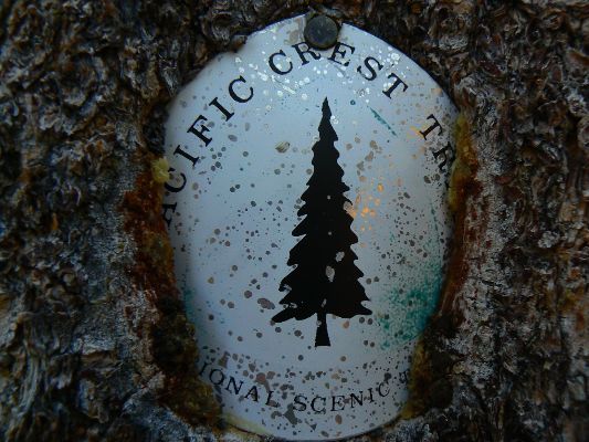
All WV PCT, JMT, Sierra hike reports:
Click here or on the PCT trail marker to go to all WV reports about The PCT, JMT, Sierra hikes
|
|---|
Looking for All Wilderness Vagabond trip reports about the PCT, JMT, Sierra hikes?
Click the image to go to All WV reports about The PCT, JMT, Sierra hikes
|
|---|
|
Links and books:
Click here to: see the First ascent of El Capitan, Argosy Magazine, 1959 (10 pages) 22 MB.
Marc Reisner (1993) Cadillac Desert: The American West and Its Disappearing Water,
Revised Edition, Penguin Books
Bill McKibben – suggested books include: Falter, Maybe One, Eaarth, The End of Nature
Map:
Another version of the map can be found here.
This version can be enlarged and may be more useful than the above map ----> click here.
Related Sites:
Scenic Toilets of Inner Earth:
Scenic Scatology of the Wilderness Vagabond
Has Conservatism Lost Its Soul?
The Tea Party passions are the rancid emissions of class-based greed disguised with flags and Christian symbols.
We Are Breeding Ourselves to Extinction (click here for full article)
or at:
Breeding ourselves to extinction?
.
More Truth Than Joke:

|
|---|
xylophile
(Click the image for the full-size image)
|
|---|
|
|
|---|
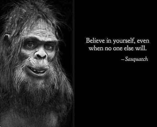
Believe in yourself
(Click the image for the full-size image)
|
|---|
|

|
|---|
health tip
(Click the image for the full-size image)
|
|---|
|

|
|---|
hoax
(Click the image for the full-size image)
|
|---|
|
.
"What luck for the rulers that
men do not think". - Adolph Hitler
.

|
|---|
America is under attack from the GOP
(Click the image for the full-size image)
|
|---|
|

|
|---|
I believe
(Click the image for the full-size image)
|
|---|
|
|
|---|
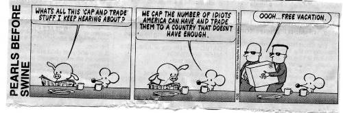
Cap & trade
(Click the image for the full-size image)
|
|---|
|

|
|---|
Reach
(Click the image for the full-size image)
|
|---|
|

|
|---|
t-rump future tweets
(Click the image for the full-size image)
|
|---|
|

|
|---|
Orwell, now
(Click the image for the full-size image)
|
|---|
|

|
|---|
we are in the twilight zone
(Click the image for the full-size image)
|
|---|
|


