Gold Knob, Manns Peak, Oowah, Haystack Mountain
Text and photos © copyright by Rob Jones
|
| ||||||
|
| ||||||
| ||||


| ||||
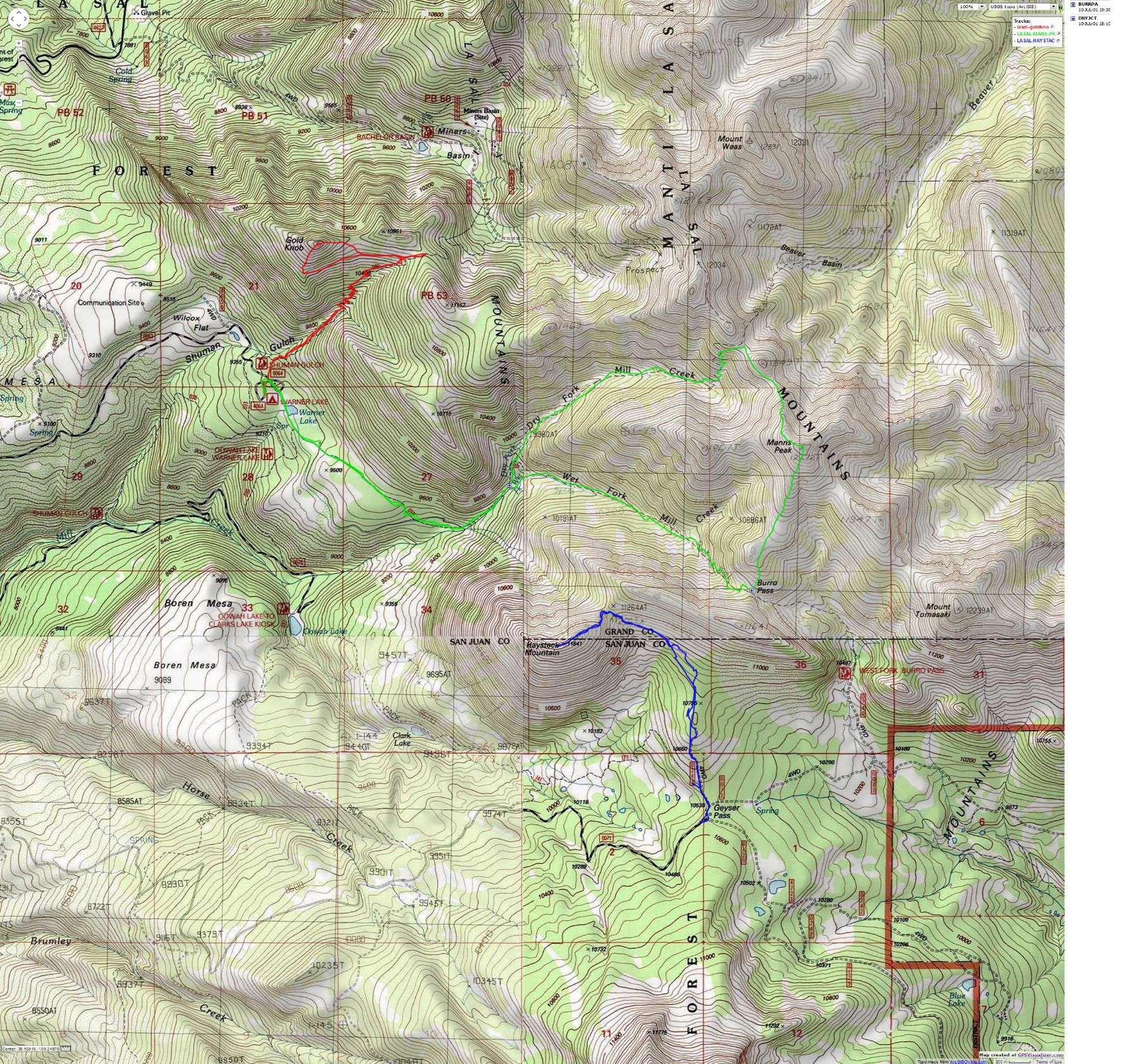
for a full-resolution map, click here. Caution - do not use this map or gps track for navigating the route.
| ||||
 |
 |
 |
 |
 |
 |
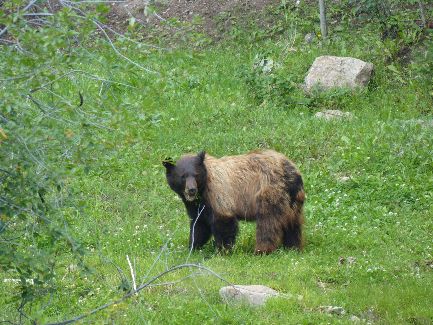
Day 1: Oowah! Beary Good.
K and I drive and drive to Moab to visit the Manti-LaSal NF (National Forest)
office. No one seems to know if all of the LaSal camps are under reservation, so we drive the LaSal Mountain
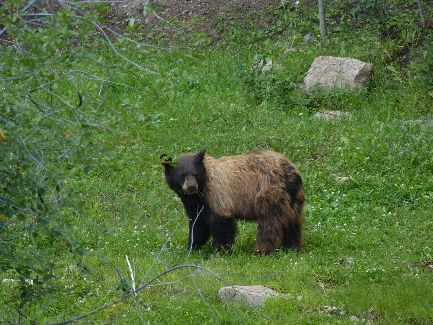
Loop Road and then the 3 rough miles of dirt/gravel to Oowah Lake. Oowah! Mostly, it's a pond.
Looking off the end of the road as we swing around a switchback while climbing
the dirt road - to almost 9,000', I see a big bufous bear (Ursus Americanus) in a streamside meadow. Turning off
the truck and leaving it in the middle of the road, I sneak around back of the truck with my camera - short videos
and some photos of bufous eating grass and perhaps some wild dwarf strawberries. He's near a rushing stream,
so he doesn't hear us. And, there is no breeze. Wonderful! Or, as apparently is said locally - Oowah!
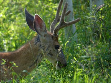
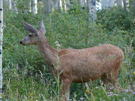
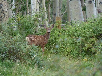
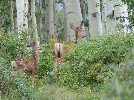
Then, on to Oowah to camp, where we find several overly friendly deer.
Much of the public service/rehabilitation work done in the LaSals, including
most of the trail construction, Oowah reservoir, was performed by the venerable CCC crews (Civilian Conservation
Corps) in the late 1930s. If we did not have such an obstructionist, selfish, elitist, welfare for
corporations - rigged capitalism for everyone else Congress, and so many people who vote against their best
interests (most repulsicans, except the rich - see Lakoff references in links section), we could deal with
the unemployment and infrastructure problems we currently face - by bringing back the CCC. Not likely.
Religionists, tea-baggers, and the rich will not allow help to go to anyone but big banks and other corporations.
Still, the CCC model has many merits. We spend so much $ on the military (more than the next 25 highest-spending
countries in the world, most of whom are supposedly our allies) that we should invade the U.S. and do some
nation-building here.
| ||||
Turn your face to the sun and the shadows fall behind
you. Maori proverb.
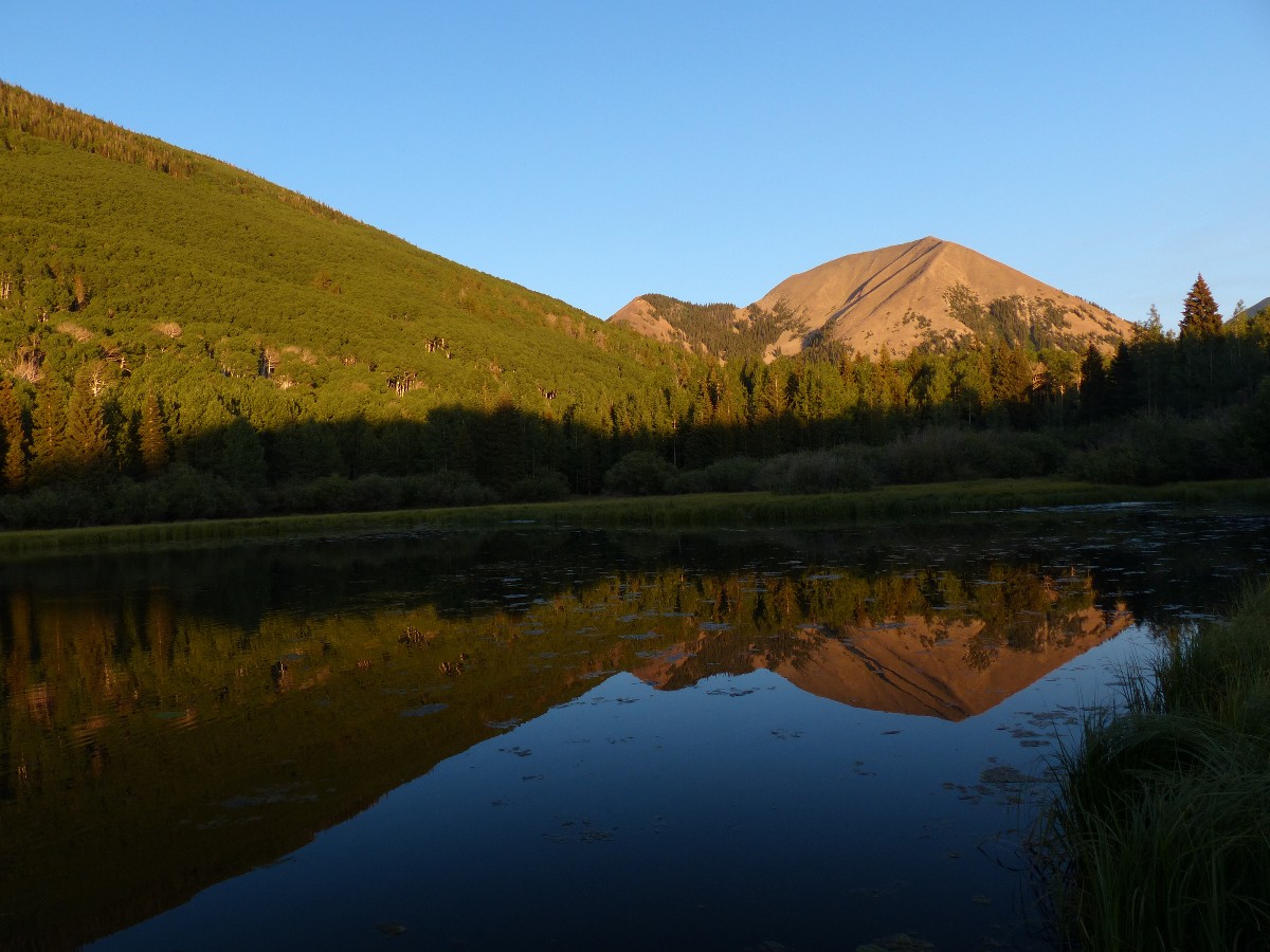
The only difference between a rut and a grave is the depth. Day 2: Gold on that there Knob, Gold Knob, 11,055',
4.9 miles; ERM = 11 (+/- 1800'):
The swept-wing Swift hurtles just above our heads while we eat lunch on Gold
Knob, barrel-rolling as she shrieks past. Excellent flying.
We've packed up and moved to another camp, after a morning discussion with
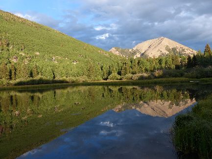
two FS guys. Yes, one can camp at-large in much of the forest. Things are very quiet this morning. We move
and camp to where we have a view of Haystack Mountain. Picturesque.
So, it's nearly afternoon before we begin the hike to Gold Knob. Tall grass,
flowers, deer, encroaching cows, mature Aspens, and few people. A couple of types of composite sunflower-type
flowers grace the slanty meadows. Gold on Gold Knob. Delightful. Back and forth the switchbacks roll up to
the pass into Miner Basin, then there is a less used route that contours around and below Gold Knob. We walk
this horse track before deciding to just go up the knob. Gorgeous views of Castle Valley, the Moab Fault, to
the Henry and Abajo Mountains, and many of the LaSal peaks too. Golden.
We're down in time for a sun shower - then lots of minor chores before enjoying
a fire. Amazing - a fire feels good up here above 9,000', while those tin-can tourists are roasting in and
around Moab, enjoying temperatures approaching 100F. Yikes.
Of course, all future catastrophic storms and extreme weather events should
be named after climate-change deniers. Can you see the headlines? For example, "Rehabilitation costs from
Hurricane Paul Ryan have been offset by cancelling all tax breaks for big oil..." Heat waves (e.g., "today,
the Boehner Broast claimed another 500 people...for-profit hospitals torched by uninsured part-time wal-store
workers..."). "Beach erosion" (rising ocean levels) "from the Marco Rubio tidal surge has now persisted
for 20 years....thousands of structures have been submerged...hedge fund managers swim for higher ground...demand
someone replace "their" sand...and bail out these criminals once again by rebuilding their flooded mansions").
| ||||
 |
 |
 |
 |
 |
 |
 |
 |
 |
 |
 |
 |
Day 3: Manning the Peak: To Manns Peak, 12,272'; 9.75 miles; ERM = 22
(+/- 3000'):
Something or someone barks a squeak at me as I lounge atop Manns Peak.
What? I've seen no one all day and wonder what is this diminutive barking. Quiet yet fierce. A Pika,
telling me I've violated his territory.
A falcon zips past, then a Swift, then a few more clouds. It's been a
steep and unyielding climb up the Dry Fork Mill Creek to Jackass Pass, and from there the climb around
Dry Peak and then up Manns, some nearly 2,000' of gain to the pass and another 1,000' to the peak. A real grunt.
Along the way, tree glyphs of yore grace many Aspens. Bear claw marks
where this bruin scaled high into the tree. Deluxe views and no wind - so getting back on the route is
difficult to do from the lounge on Manns. My ancient body isn't very cooperative. The route down, via
Burro Pass and Wet Fork Mill Creek is easier, yet my energy fades as I approach the lollipop junction.
After 7 hours, I'm plodding back to camp, ready for a shower and some recovery time. I don't see another
hiker or biker all day.
 |
 |
 |
 |
 |
 |
 |
 |
 |
 |
 |
 |
 |
 |
 |
 |
 |
 |
 |
 |
 |
Day 4: Oowah. 3 miles; ERM = 5 (+/- 600'):
7.5 miles; 14 ERM.
Kathleen hurt her knee on the Gold Knob hike, so we're taking it easy today,
planning to hike a few short hikes. Then, thunder rolls across the cirque and a few drops of rain fall
as soon as we hurry back from a hike to Oowah on the Trans-Mountain Trail. Just in time for lunch. Soon,
I'm in the tent and napping. Storm threats continue and we don't get out for the planned afternoon hikes.
The morning hike takes us down and back on the short chunk of the Trans-Mountain Trail between Warner and
Oowah. Bear scat and service berries and rose hips punctuate the trail. Not much rain, but cooler tonight.
| ||||
 |
 |
 |
 |
 |
 |
Day 5: Hail Haystack. 4.4 miles, 11,642'; ERM = 8.5 (+/- 1150'):
The hail bounces all about our cloister under the sheltering fir tree. Drat.
A short while ago it had been "yikes!" as a thunderhead appeared like magic directly above. Yes, the LaSals,
like many other big mountain ranges, produces its own weather. This was a prime example, as the clouds quite
literally boiled into being above Haystack as we ramble across the plates of shattered rock forming the ridge.
With thunder cracking and booming, we quickly gather our lunch bits and scurry across the piled plates of porphyry
(or whatever this big crystalline rock is) along the ridge of Haystack and back down to the saddle, where we now
cower from the stationary storm parked above. The local weather is leaking down my neck.
The wade through soggy wildflowers on the descent back to the fir forest soaks
boots. We surprise a Coyote lounging in the dry umbra of a monarch fir. About this time, the drizzle stops
and we finish lunch when we get back to the TH.
Our camp area is even quieter - perhaps the storm or the work week has prompted
most everyone to leave? Tomorrow, we must leave the LaSal Mountains, a beary nice place.
| ||||
 |
 |
 |
 |
 |
 |
 |
 |
 |
| ||||
 |
 |
 |
| ||||
See Canyon Country's La Sal Mountains: Hiking and Nature Handbook by Jose' Knighton (Canyon Country Publications, Moab, Utah) for trail and more geologic and natural info. There is a well-designed Hiker's & Skier's Map of the La Sal Mountains, also published by Canyon Country Pub., that links the Knighton routes, by number, to the ground (map).
Lakoff, George. Don't Think of an Elephant!: Know Your Values and Frame the Debate--The Essential Guide for Progressives, 2004, Chelsea Green Publishing, Vermont.
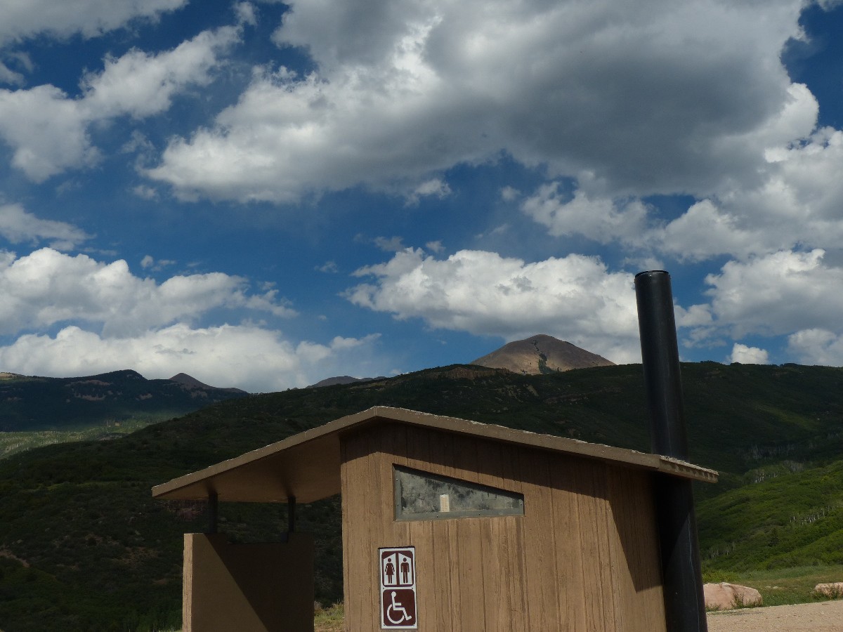
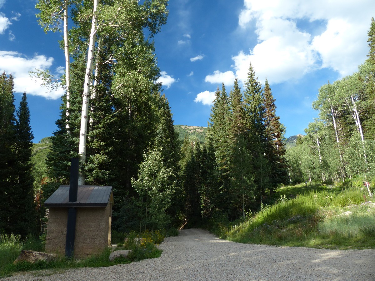
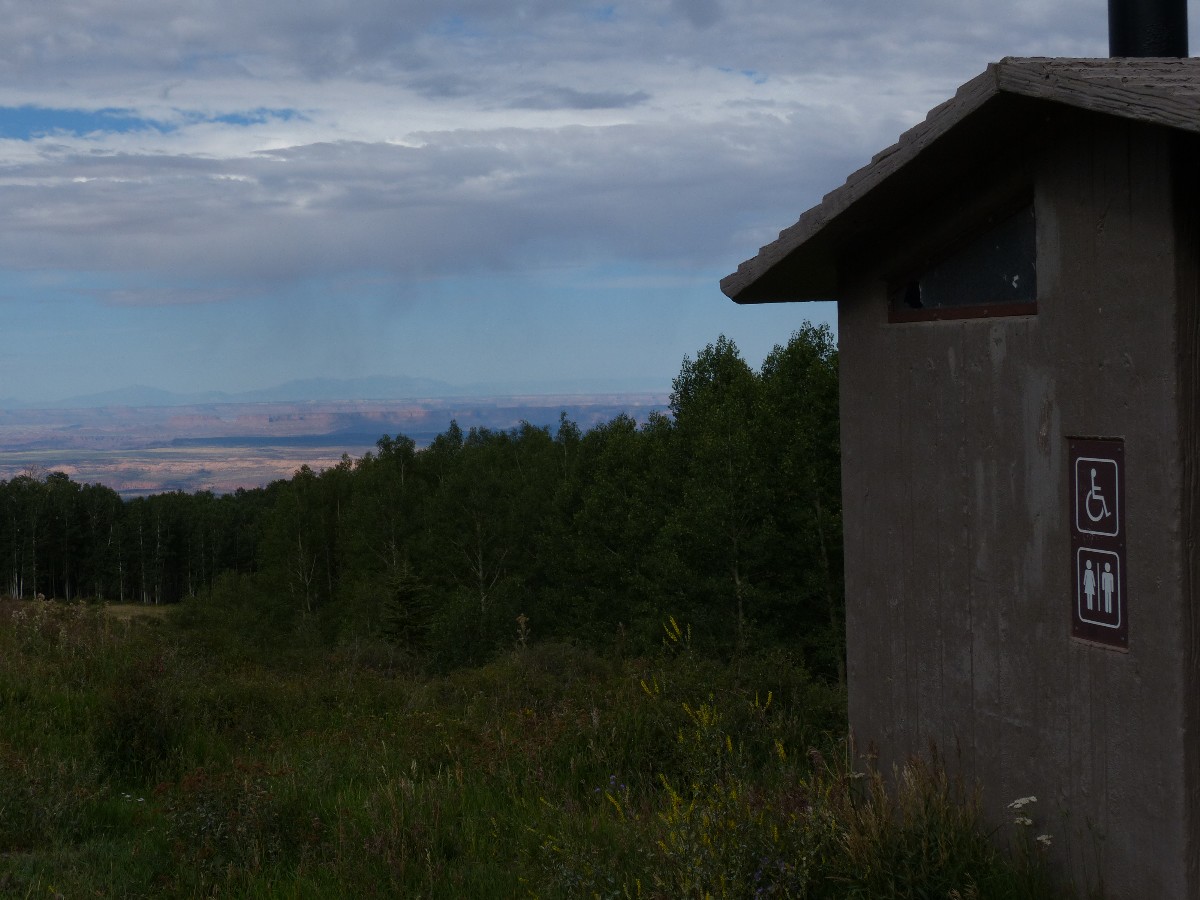
Scenic Toilets of Inner Earth: Scenic Scatology of the Wilderness Vagabond
Click here to see Ben's Scenic USA - Picture of the Day.
Click here to see Steve's excellent photos - birds in flight, panoramas, etc.
| ||||
for a full-resolution map, click here. Caution - do not use this map or gps track for navigating the route.
| ||||
| ||||
| ||||
| ||||
| ||||
|
Wild Vagabond Main |
Trip Report Index  |
Caveat  |
|---|


