Finding Phantom:
GCHBA Volunteer Service Project At Phantom RS (Ranger Station) and Bright Angel CG, Grand Canyon NP /
Grand Canyon Hikers and Backpackers Ass. (GCHBA) / day trip to Utah Flats and Phantom Canyon
(October 24th to November 2nd, 2016)
Text
© copyright by Rob; and Photos © copyright by Rob Jones
|
 |
Co-Adventurer VIPs: Annette A., Holly B., Kathy H., Mike H., India H., Denise H., Bill J., Rob J., Barry J.,
Tim K., & Marcos S.
Mule packing by packers of the NPS
(National Park Service).
Site-based planning by Jeff S. and Elyssa S. (with thanks to Debbie B., Canyon Ranger
District; and Jerome C., Waste Water Treatment Plant)
GCHBA planning and organization by Rob Jones, GPP-SP
(Grand Penultimate Poobah of GCHBA Service Projects).
VIP is Volunteer In Park.
This volunteer service project was supported by the NPS people who put the "Service!"
in NPS; and by the members and Board of the GCHBA (Grand Canyon Hikers and Backpackers Association). Thanks for
your stewardship of our precious public lands.
camera: Panasonic DMC-ZS19
Note: the opinions in this report are not necessarily those of the GCHBA or its Board. However, the
phantoms of Phantom Creek approve this trip report.
|
|---|
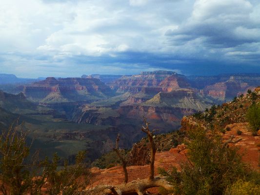
Into The Canyon, Cedar Ridge, Day 1
(Click the image for the full-size image)
|
|---|
|
|
|---|
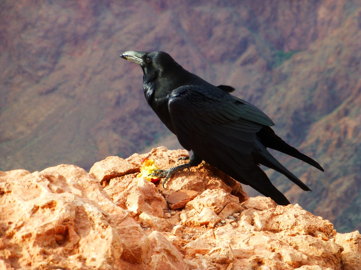
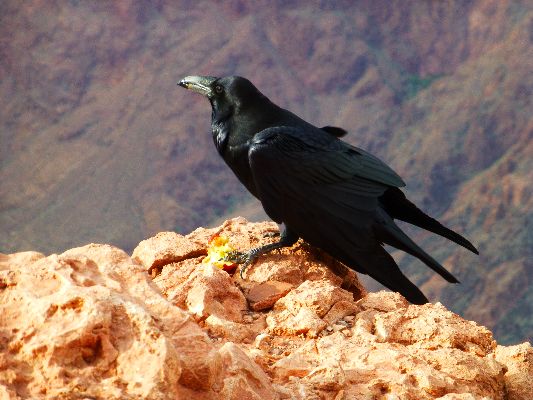
Raucous Raven, Day 1
(Click the image for the full-size image)
|
|---|
|

|
|---|
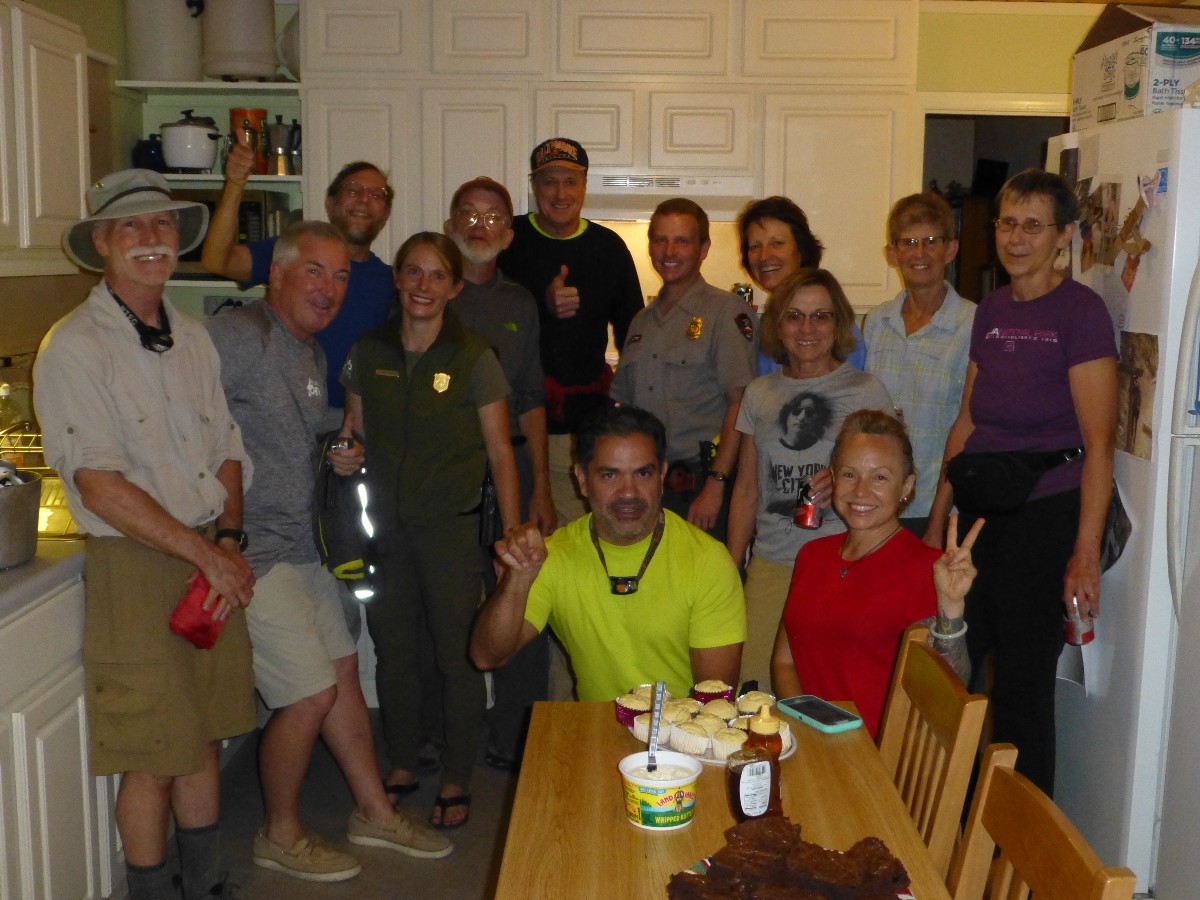
VIPS and Rangers of the Finding Phantom project, Day 6
(Click the image for the full-size image)
|
|---|
|
|
|---|
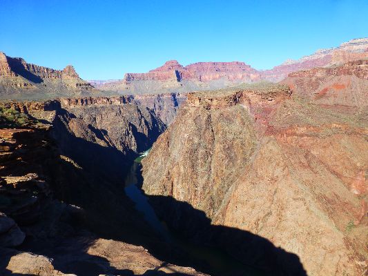
View of the North Rim from IG, Day 8
(Click the image for the full-size image)
|
|---|
|
|
|---|
Movie: video from Plateau Point, 9.5mb, Day 10
(Click the image to see the short video)
|
|---|
|
ERM = Energy Required Miles. A mile is added for
every 500' elevation gain or
loss. It's a very serviceable method of estimating energy required miles. ERM was initially used in Trails
of the Tetons (long out of print) by Paul Petzold, founder of NOLS. It's a wonderfully useful concept and
application. Add one mile for each 500' up AND down to distance = ERM. I use ERMs to calculate what the actual
day is like. It's a very serviceable method of estimating energy required miles. Remember, however, that the
ERMs are estimates because they depend on GPS satellite coverage and math functions.
Using ERMs does not account for the 'texture' of the route or trail - that
is, rocky, boulders, no trail, slimy mud, etc., yet does help approximate the route.
See more information about ERMs at the end of this report.
Preliminary: 10-24-2016; To IG. The long way, South Kaibab to Tonto to IG
: 8.5 miles. ERM = 17. Camp @ 3650'.
It's raining hard. I'm happy to be in the IG Bunkhouse, sprawled on
paco pads on the floor. Lightning flashes as cool air floods through the open door. Glorious. I'm
keeping an eye out for rats, so they don't get into the Bunkhouse. With some regret, I close the door
and slip into dreamland.
Earlier today, Mike, Kathy, and I hike into The Canyon early to talk
with Elyssa about the next project, in March of 2017. This after we've prepared the food boxes on the
rim for transport into The Canyon tomorrow.
I take the long way in, via the South Kaibab to the Tipoff, then across
the Tonto to Indian Garden (IG). It's a long lope across the Tonto when the light is fading. Yet,
all is good in the Bunkhouse.
|
GCHBA Task List, Bright Angel CG, 10-2016 (pdf)
(Click the image for the document)
|
|---|
Day 1: Finding Phantom
Day 2: BA. Getting started at Bright Angel Campground
5 miles. ERM 9. Camp @ 2500'.
The rock layers are piled above and below as I swirl the switchbacks into The Canyon.
Looking up, I see Rocks made by time.... aided by the pneumonic. Know the Canyon's History, Study Rocks Made By Time.
Know - Kaibab Limestone
The - Toroweap Formation
Canyon's - Coconino SS
History - Hermit Shale
Study - Supai Group (including the Esplanade)
Rocks - Redwall Limestone
Made - Mauv Limestone
By - Bright Angel Shale
Time - Tapeats SS
Know The Canyon's History, Study Rocks Made By Time.
Clouds hover in the crevasses of Zoroaster Temple as I lilt along
the Bright Angel, nearing the Silver Bridge. Up ahead I see the ramp that forms the shelf holding
the Miner's Route. Not today, I muse, this adventure will have to wait for another trip. Easing
into the campground area, I see that Sjors has already transported some of our food buckets to the
group camp. I grab a wheelbarrow and gather the buckets we left stored here last year. As I'm
positioning buckets and boxes, Marcos arrives and goes to transport banana boxes of food to camp.
Other VIPs start arriving as we sharpen hoes with which to clean the campground irrigation ditches.
We accomplish quite a bit this first partial day. Mike and I walk
the area with Rangers Jeff and Elyssa, discussing items on the task list.
It's a fairly late end to the day and we finish cleaning up under a
glaring Milky Way striping the narrow sky shining between the close walls of basement rock.
Day 2: Finding Phantom
Day 3: Sling Low 3 miles
The surface of Bright Angel Creek glows pink salmon as the evening
light glints off the walls and bounces around in the canyon. It's been a day of hard work in The
Canyon. Starting off, we build sling loads of junk. Later, the Hornet (helicopter) drops off
benches to rehabilitate for the amphitheater and leaves with a sling of junk. Marcos and I straighten
the lumber behind the NPS mule corral, then go to continue on the irrigation system cleaning. As
the Hornet swings the last sling out today, I see two high flying Condors drifting toward Utah.
Lovely, these flying planks are struggling to make a comeback. Mike, Holly, Annette, and Tim start
work on the disgusting toilet cleaning and painting project.
After sunset, a Ringtail Cat comes to the enclosures, apparently
exploring for snacks. His long fluff tail hangs down from the abutment of roof and basement rock, tempting a tug.
Day 3: Finding Phantom
Day 4: Roofarama 5 miles.
The thick plywood flops onto the kiosk roof. Whump. Mike,
Marcos, and I wrestle it into place. The re-roofing has begun. It's a day of good progress on
the restroom cleaning and painting, re-roofing, sign rehab, and completion of the irrigation
system cleaning. Marcos and I walk up to the Ranger Station and back, and to the sewage treatment
facility and back, several times, hiking perhaps 5 miles today.
There's yet another scrumptious tortilla filled with cheese,
eggs, tomato, cabbage, mayonnaise, and onion for lunch. Another breakfast burrito with onion,
potato, eggs, green chili, and cheese for dinner. Few other Canyon adventures allow one to gain
weight, but this one might. Ranger Jeff opens the Rock House for luxurious showers. The camp
Ringtail Cat returns as do the evening bats. One bat swoops and gyrates circling Kathy and Mike's
tent, apparently because the light inside the tent is drawing in insects.
Day 4: Finding Phantom
Day 5: Basement Rocks 4 miles.
The Sharpshin Hawk cruises easily through the heavy vegetation on the
bank of Bright Angel Creek, broad wings and long tail designed for forest travel. Gorgeous.
Marcos and I are finishing the asphalt shingling of one of the
pumphouses, Mike is attaching cedar shakes to the information kiosk, Barry is painting a bathroom,
India, Kathy, Sjors, and Bill are ditch riding with the trial run of water through the irrigation
system, Holly, Annette, and Denise are sanding and oiling signs, and Tim is replacing fixtures in
the bathrooms. Again, lots is accomplished.
Marcos and I climb the basement rocks in the lower section of the Utah
Flats route to a weather repeater to spray paint it so it doesn't glare in the sun.
Jerome again comes through with welcoming showers. Thanks.
Day 5: Finding Phantom
Day 6: Transcanyon Hike 4 miles.
Rain surprises us as we clean up the tools. More bathroom work,
sign rehab, other stuff. Again, Jerome provides short and wondrous showers prior to dinner and
Elyssa's presentation.
Ranger Elyssa is presenting a program about her and Matt's hike
the length of the Grand Canyon, on the North side of the River, from Grand Wash to Lee's Ferry.
Elyssa may be the first woman to hike the length of The Canyon, and Matt is only about the 12th
person to do so. Amazing. Congrats to you.
Earlier, we volunteers were treated to a scrumptious dinner at
the Ranger Station. Chili, corn bread, brownies, beer, all excellent. Wow, the Rangers are
taking super care of us volunteers during this project. Thanks are given to Rangers Jeff and
Elyssa. Wow, I need to get that brownie recipe. Yummy.
Stars fill the slot of sky above BA Camp as the rolling raucous
creek provides mellow background music.
Day 6: Finding Phantom
Day 7: Finding Phantom. Day trip to Utah Flats 7 miles. ERM = 13.
The accurately acupunctured leg pumps out a surprising quantity of blood,
some of it on my pants, now more is running through my fingers. It's appropriate that one of the yuccas is
called a bayonet plant, I muse. Looking along the faint Utah Flats route, I was not attending to the pokey
things. Ouch.
Eight of us have climbed up through the cheese grater basement rocks and
the jumbled Tapeats Sandstone boulders of piano alley to the flats above.
After Holly bandages my leg, we're soon rambling through cactus alley,
around several bumps, and are dropping drastically into Phantom Canyon to Phantom Creek.
Annette takes a header off the slippery slickrock after lunch at Phantom,
dislocating her shoulder. She's hanging part-way in Phantom Creek until pulled out by Holly. Yikes.
The dislocation pops back in, yet damage is done. Sadly, it would be a long night for Annette.
Barry spies a rope dangling near Phantom Falls and wonders if other
obstacles continue down Phantom Creek to where it meets Bright Angel Creek in The Box. (Sjors later
tells us that the falls is the major issue in the canyon and that we could have traveled to BA via
Phantom Canyon.) Another option is to work around the falls by climbing up to the start of the Cattle
Route, then dropping back into Phantom via game trails, where we would be about a quarter of a mile
below the falls. For now, retracing the route seems like the proper option. We return to camp to
find Mike and Kathy working on projects and Jerome irritated after arguing with a volunteer about who
should be cleaning the toilets. Even so, we are again treated to a short yet refreshing shower.
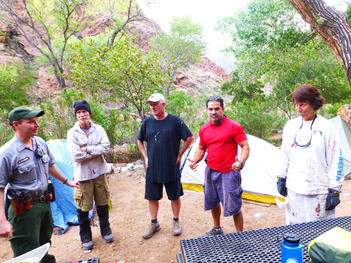
Ranger Jeff comes to camp, and finding out about Annette's injury,
offers her care in the RS clinic. Annette declines.
Jeff also brings the last of the scrumptious brownies from last night,
and they quickly disappear, most of them down my gullet.
A last dinner of breakfast burritos and the final mango tango and some
of India's fireball prompts an early bed time.
Day 7: Finding Phantom
Day 8: Final Tasks. Happy Halloween. 4 miles.
We VIPs hustle throughout the BA area finishing signs, painting,
mirror installation, lots of cleaning up and sorting and returning tools and materials.
The Canyon Wren who has been singing behind the camp enclosures
pops out to display his cuteness. It's a Halloween Wren. We await the nightly appearance
of the Ringtail, perpetually in costume, yet he is off raiding and tricking elsewhere.
Day 8: Finding Phantom
Day 8: Finding Phantom
Day 9: Fond Goodbye. IG via South Kaibab - Tonto. 7.5 miles. ERM = 10.
The multiple-tined antlers of the big buck protrude above the blackbrush
in the drainage at the Tipoff. Soon, he's lounging in the soft sand, mostly obscured by a rock ledge,
waiting for the ladies to browse into view.
I'm ready to launch onto the Tonto to Indian Garden. Perhaps this time
across I'll see some of the sheep I seek?
The day starts with cleaning up the campsite. Stack and tape 20 buckets
and store them in Jerome's shed for next year. Flatten and tape banana boxes to recycle by mule.
Return the wheelbarrows to the Ranger Station. Finally, on the trail about 10:30, saying my fond goodbyes
to the BA area and setting out for Indian Garden the long way, via the South Kaibab and the Tonto Trail.
There is no one on the Tonto, certainly not the sheep that I am hoping
to find. The Cottonwood leaves at Burro and at Pipe Springs are still green, in contrast to the leaves
elsewhere on the Colorado Plateau, which have displayed their Fall colors and mostly dropped their leaves.
Arriving at Indian Garden, Mike and I meet with Elyssa about future
projects. Elyssa gives us a page-long list of tasks she hopes to accomplish when the GCHBA crew next
volunteers for service in The Canyon (March of 2017).
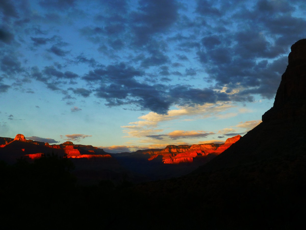
An evening glow creeps across the rocks made by time of the North
Rim. The Indian Garden Ranger Station affords one of the glorious views of The Canyon.
Day 9: Finding Phantom
Day 10: Out of It. Or, one pitch to Winter. To the Rim.
7.5 miles. ERM = 14.
It's a little nippy this morning. I'm out on the deck of the IG Ranger
Station admiring the North Rim vista. It's cool but not crisp.
I head out to Plateau Point, knowing that the mulies will not deliver
the GCHBA boxes (mostly Annette's pack) to the Pack & Fly before early afternoon. Recall that Annette
took a header into Phantom Creek, and is nursing a previously dislocated shoulder. To my surprise, I
see Ed the packer and the mulies coming up through the Tapeats narrows and into the Indian Garden zone.
Ed reports that Junior (NPS mule - see the 2015 report) is coming down in another string and that
they hope to make it to the rim for a late lunch.
Beginning the climb out of Indian Garden for the rim, a wash of paisley
emotions rolls over me. A bit of sadness at leaving this place, a bit of longing to get home. When
I am about 2 miles below the rim, I start seeing hikers with wool hats, some with gloves, and I am
reminded that the wondrous days of Fall are closing out and Winter is dropping on The Canyon. By the
time I reach the 1.5 mile rest house, the air is crisp and the breeze piercing.
Day 10: Finding Phantom
"Truth is always the enemy of power. And power the enemy of truth." Edward Abbey
"There is some goodness in this world and it's worth fighting for."
J.R.R. Tolkien, The Two Towers
*ERM: Energy Required Miles, are there data to support this
mileage adjustment?
Journal of Outdoor Recreation, Education and Leadership
Petzoldt first proposed his theory in his 1976 book “Teton Trails” to
help backpackers plan trips and calculate their energy needs on mountain trails. “Petzoldt defined one
energy mile as the energy required to walk one mile on the flat. He recommended adding two energy miles
for every 1,000 feet of elevation gain, so a person hiking one mile and 1,000 feet upward would use the
equivalent of three energy miles,” Phipps said.
Petzoldt’s energy mile theory was just a reflection of the mountaineer’s
“gut feeling,” Phipps said. The theory had never been tested in a laboratory before the study began in WCU’s
Exercise Physiology Laboratory in the spring of 2010, Phipps said.
To determine the validity of the theory, the study measured the energy cost
and perceived exertion for walking on flat ground, with and without a 44.5-pound backpack, and up an elevation
gain of 1,000 feet, with and without the backpack, through the collection of metabolic data, Phipps said.
Twenty-four student, faculty and staff volunteers, including 12 males and 12
females, went through four testing sessions as the research continued into fall semester of 2010. The study
results showed that the additional energy cost for ascending 1,000 feet ranged from 1.34 to 2.02 energy mile
equivalents, for an average of about 1.6 miles, compared to Petzoldt’s use of two energy miles for each 1,000
feet. The range revealed by the study was due to the “hikers” personal weight differences, Phipps said.
“It is remarkable that Petzoldt’s energy mile theory is so close to the actual energy cost measured during our
study,” Phipps said. “In the field of outdoor education, it’s important for leaders to include an estimation
of energy requirements during the planning of hiking trips.”
Phipps said the energy required for hiking up steep mountain trails would vary
for individuals and groups, and the variables of the trail would also factor in, but he recommends that
backpackers stick with Petzoldt’s idea of adding two energy miles for every 1,000 feet of elevation gain when
planning trips.
The Validity of Petzoldt's Energy Mile Theory, 2010
Authors: Maridy McNeff Troy, Maurice L. Phipps
Publication: Journal of Outdoor Recreation, Education, and Leadership
Links:
|
|
GCHBA Task List, Bright Angel CG, 10-2016 (pdf)
(Click the image for the document)
|
|---|
|
Related Links:
Grand Canyon Hikers and Backpackers Association site (GCHBA)
GCHBA Service Projects Page
GCHBA Task List, Bright Angel CG, 10-2016 (pdf; same list as seen above)
VIP Cottonwood Rehabilitation Cruise:
GCHBA Volunteer Service Project At Cottonwood RS, 3-2016
Bonus Feature from the 3-2016 volunteer project: A Second Ribbon Oasis - AZ Daily Sun 3-30-2016, pdf
VIPs at IG - Volunteering at Indian Garden RS, 2015
GCHBA Gusher at BA - Volunteering at the bottom of The Canyon, 2015
Scenic Toilets of Inner Earth
the geology of the Grand Canyon by the NPS
Eaarth - Living on a fundamentally altered planet by Bill McKibben
Other WV reports about the Grand Canyon:
Click here or on the Looking Lizard to go to all WV reports about The Grand Canyon

|
|---|
Looking for All Wilderness Vagabond trip reports about the Grand Canyon?
Click the image to go to All WV reports about The Grand Canyon
|
|---|
|
More Truth Than Joke:

|
|---|
gropenfuhrer in chief
(Click the image for the full-size image)
|
|---|
|

|
|---|
a fool in the whitehouse, predicted
(Click the image for the full-size image)
|
|---|
|