Another VIP (Volunteer In Park) Service Project with the NPS at Grand Canyon National Park / This time on the North Rim
(September 30th - October 8th, 2019)
Text © copyright by Rob; and Photos © copyright by Rob Jones

|
Autumn VIP Shimmer on the North Rim:
Another VIP (Volunteer In Park) Service Project with the NPS at Grand Canyon National Park / This time on the North Rim (September 30th - October 8th, 2019) Text © copyright by Rob; and Photos © copyright by Rob Jones |
 |
Co-Adventurer VIPs: Co-VIPs: Annette A., Holly B., Barry B., Dan E., Kathy H., Mike H., Bill J., Rob J., Roger S., and Cheryl S.
Ranger Elyssa S. is our fabulous NPS coordinator/contact and project director.
NPS Rangers: Elyssa S., Mandi T., Ceili B., Brendan O., Todd N.
VIP is Volunteer In Park.
This volunteer service project was supported by the NPS people who put the "Service!" in NPS. Thanks for your stewardship of our precious public lands.
camera: Panasonic DMC-ZS60
Note: the opinions in this report are not necessarily those of the NPS or my fellow VIPs.
| ||||
|
| |||||
|
| |||||
|
| |||||
|
| |||||
|
| |||||
ERM = Energy Required Miles. A mile is added for
every 500' elevation gain or
loss. It's a very serviceable method of estimating energy required miles. ERM was initially used in Trails
of the Tetons (long out of print) by Paul Petzold, founder of NOLS. It's a wonderfully useful concept and
application. Add one mile for each 500' up AND down to distance = ERM. I use ERMs to calculate what the actual
day is like. It's a very serviceable method of estimating energy required miles. Remember, however, that the
ERMs are estimates because they depend on GPS satellite coverage and math functions.
Overview: This report is about the second of three VIP (Volunteer In Park)
volunteer service projects to provide stewardship assistance to Grand Canyon National Park (NPS, National Park Service)
during 2019. A rarity, during this project we are on the North Rim, while our typical service projects occur in the Inner
Canyon. During this VIP adventure, we 10 VIPs invested over 400 hours of volunteer time in service to our public lands
and the NPS. See the below list of tasks accomplished. You may see a complete list of VIP reports, mixed in with other
Canyon adventure reports, at
Click here to go to all WV reports about The Grand Canyon
Day 1: Screaming Yellow Shimmer. .
Quaking Aspen: The tremble, shimmer, and quake of aspen (Populous Tremuloides)
leaves are the result of the nature of the leaf stem design. The petiole, the stalk which attaches a leaf blade to its stem, is flat on
aspen leaves, allowing the petiole to act as a pivot on which the leaves can easily move, in response to even the mildest breeze.
The CCC: It was 1933 and severe economic depression challenged the
confidence of the people of the United States. One in four people was unemployed. Many were homeless. Serious drought
gripped large areas of the West and Midwest. The nation’s leaders felt that the economic and social problems demanded
immediate action. Franklin Delano Roosevelt was sworn into the presidency on March 4. He called Congress into emergency
session on March 9, introduced legislation for the Civilian Conservation Corps (CCC) on March 27. By the end of 1935 the CCC
employed more than 500,000 men at over 2,650 camps in every state. The creation of the CCC was a model of speediness -
something we do not see today because the repulsicans in the Senate will not advance bills. The CCC program became the most
popular of Roosevelt’s New Deal programs.
Grand Canyon National Park’s first CCC contingent arrived on May 29, 1933. CCC crews worked on the South Rim, North Rim,
and in the inner canyon until 1942. Companies 818, 819, 847, 2543, 2833, 3318, and 4814 served not only at Grand Canyon, but
a few companies also under-took projects near Tucson and Phoenix, Arizona during the winter months. The original purpose of
the CCC was to put young men to work on worthwhile conservation projects that would benefit the country. Early in its existence,
however, the program added emphasis to teach “the boys” skills and trades.
Civilian Conservation Corps at Grand Canyon: North Rim and Inner Canyon Projects. Company 818 worked on the higher
and cooler North Rim during the summer months. Projects completed included buildings, fences, and roads. The crews also helped
fight forest fires when necessary. The men moved to inner canyon areas such as Phantom Ranch during the winter months. Today’s
Bright Angel Campground at Phantom Ranch sits on the footprint of the Company 818 camp. More challenging projects included a
number of inner canyon trails. The Ribbon Falls Trail, a half-mile (0.8 km) spur off the North Kaibab Trail, still leads hikers to a beautiful
waterfall. Part of this trail leads to Upper Ribbon Falls - about a mile from the crossing of Bright Angel Creek. Even more ambitious
was the nine-mile (14 km) Clear Creek Trail (1933-36). (paraphrased from an NPS brochure)
Using ERMs does not account for the 'texture' of the route or trail - that
is, rocky, boulders, no trail, slimy mud, etc., yet does help approximate the route.
See more information about ERMs at the end of this report.
These VIP adventures would not be possible without the dedication and extra
work of Rangers of the NPS who put the "Service!" in NPS. Our primary contact has been Ranger Elyssa Shalla, winner
of the Intermountain Region 2018 Freeman Tilden Award, among numerous accolades. During the current VIP project,
Elyssa is training other Interpretive Rangers (Ceili, Brendan) in how to organizing projects, materials, and work with a
full-throttle group of VIPs as exemplified in this report. Mandi T. also helped organize this project. In addition, Todd N.
of the NPS VIP office provided tools and support for this project. I wish to dedicate this report to the many NPS public
servants who go far beyond their regular duties to meet the goals of the NPS, caring for our public lands. My thanks to
Elyssa, Ceili, Brendan, Todd, Mandi, and my fellow VIPs. Hoorah!
Pure Shimmer Photos - Autumn VIP Shimmer
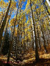
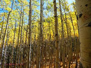
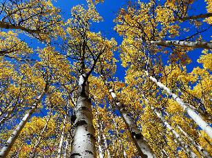
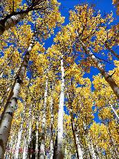
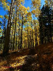
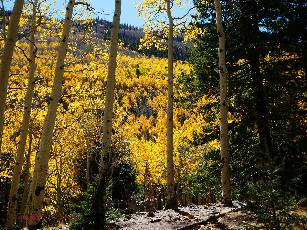
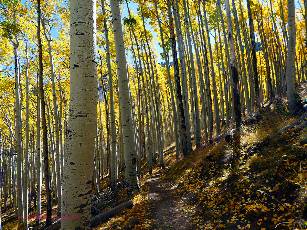
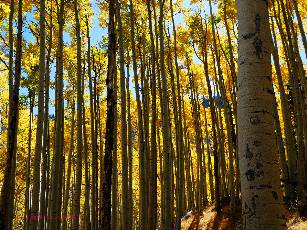
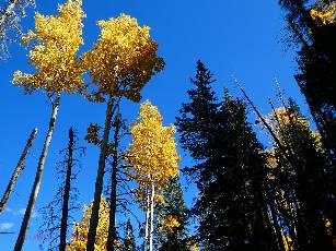
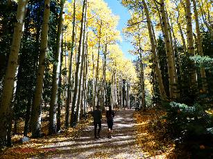
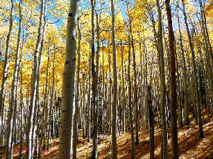
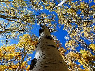
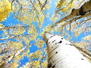
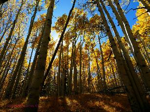
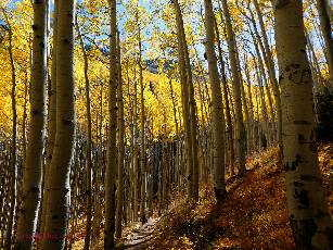
I drive onto the North Kaibab Plateau among screaming yellow aspen, stopping
at Jacob Lake for lunch with Dan. All along the road to the North Rim of The Canyon, Populous Tremuloides (aspen)
shimmer gold; the shimmer enhanced by the elliptical shape of the leaf stems. More stops, then some more.
Dan and I Meet Mandi T. and Elysia S. of the NPS (National Park Service) and tour
some of the projects.
Dan and I set up camp at the VIP (Volunteer In Park) site on CCC (Civilian Conservation
Corps) Hill. Barry, Cheryl, and Bill arrive and we dismantle the yurt entrance platform and steps, partly because it's getting cool,
portending cold. We want and need more firewood, lest hypothermia and frozen phalanges set in. Also, removing these structures is on our task list.
Dan builds a fire and we enjoy dinner near it as Roger, Holly, and Annette arrive.
Everyone is now here except Kathy and Mike, who are ensconced in there diminutive trailer down by the helipad. We are
camped in the administrative VIP site above the North Kaibab Trailhead. This area is called CCC Hill. CCC for Civilian Conservation
Corps, which had a camp here in the 1930's. The concession mules are also on this hill, and we learn not far enough away. There will
be clanging and banging, yipping and whooping, and the thunder of heavy hoofs very early each morning, issuing from the
concession mule depot, just as one is savoring the last two hours of sleep.
The wind blows cold, the Milky Way glows, and I'm sheltered nicely in the 40+ year old,
US-made, VE-24, tucked cacoon-like in my -5F Marmot Aiguillé bag. Ahh.
| ||
|
Tasks Accomplished List 10-2019 VIP (pdf)
(Click the image for the document) | ||
|---|---|---|
| ||||
 |
 |
 |
Day 2: Widforss.
7 miles.
It's lower than cool this morning and I'm happy Barry has started the fire and
Roger has coffee and hot water on the stove. 30F something, or less (probably, it's in the 20sF) last night and the
wind bustled vociferously through the P-Pines all night.
We are all standing with arms out in the sun, warming like Condors
hoping to fly when Elyssa arrives to review the day's tasks.
Roger and I drive to the Widforss TH and begin excavating the brochure post,
discovering that it's buried in concrete. After finally extracting the post, we walk the Widforss Trail to where one looks
directly down the line of the Transept, looking for information posts to dig out and remove. Finding a prow of Kaibab
Limestone extending out into The Canyon, we pause for lunch before toting back the numbered info posts we
removed on the way out.
We find it is too late to oil the BIC deck, so we go haul carpets for Mike and Kathy's
cabin floor project and discard it before scoping the trailhead sign location at the beginning of the Ken Patrick trail.
Others have been painting Mandi's office and moving cabinets to newly cleaned
storage boxes.
Returning to camp, we fuss with dinner, then assist Holly in baking a chocolate dump cake
in the Dutch oven. Yes, it's called a "dump cake" because you dump the ingredients in the Dutch oven, then bake. Holly's
inaugural Dutch oven cake is, well, Yummy.
Conversation around a sometimes uncooperative swirling fire lasts almost to hiker midnight,
9 p.m. By now, the stars are brilliant. Nevertheless, the wind screams above. It takes several minutes to warm up once in the
Marmot Aiguillé -5F fluffster.
Gunnar Widforss, an early twentieth-century artist, lived and painted at the Grand Canyon in the 1930s and produced a large collection of watercolors prized for their geologic detail. Many were landscape paintings. In his paintings Widforss captured the Grand Canyon environment as he saw it then. The Canyon has changed a bit, most changes are due to concessions and other development.
 |
 |
 |
 |
 |
 |
 |
 |
 |
Day 3: Ken Patrick.. 4 miles, remove sign, install
new information sign at the Ken Patrick TH.
The below freezing morning starts with the rumble of Bob Muler (who
will not tolerate redactions of any type) and his mule buddies, followed by Baker Barry talking about a flat
super-size blueberry muffin, hot in the Dutch oven.
Dig, dig, scrape, chisel rocks, Cheryl, Roger, and I are digging holes for the
new information sign. After hours of work, the sign is leveled, plumbed, and cemented in and we clean up, dump the old sign parts, drop off the old post to cut up and burn and head to the old gas station to locate the twin showers in this administrative area.
Cheryl and I bop in for a side by side shower to save time because this
is also one of the few toilets around.
Dan and Barry have been oiling the BIC deck, Annette, Holly, and Bill are
out trimming brush along the Roosevelt Trail. Kathy and Mike are replacing the floor in a residential cabin.
It's a pleasant, warm late afternoon in camp, embellished by the feeling
of a clean body and refreshingly calm breeze.
Tonight is Dutch oven Hershey chocolate cake that I made from scratch,
topped with spray ice cream (whipped cream); again a yummy conclusion to a productive day.
Ken Patrick: The Ken Patrick Trail is named after Kenneth C. Patrick, a National Park Ranger in the GC in the 1960s and later at Point Reyes National Seashore in California. Patrick was shot three times while tracking poachers in August of 1974. He was the first Park Ranger to be killed in the line of duty, and is buried in Shrine of the Ages, at Grand Canyon’s South Rim. The trail is named in honor of him.
 |
 GC-VIP-Fall-2019-day3-2 Roger, removing Ken Patrick sign w.jpg |
 |
Day 4: 24F to Widforss. 3 miles
Water is freezing in the bottles and dishes this morning. Barry's
thermometer reads 24 degrees Fahrenheit. Burr.
Leftover chocolate cake warms by the warming fire and remains yummy.
Elyssa, Ceili, and Brendan, Interpretive Rangers all, come by to organize work groups and finish the cake. We VIPs
suspect a pattern here, with the Rangers arriving just in time to finish whatever has come out of the Dutch oven.
We are happy to share the cake, etc. and conversation around the fire with these Rangers who put the "Service!" in NPS.
It's a decent day by the time Dan, Barry, and I tote the vintage juniper post
to the Widforss Trailhead, plant it, and repaint the sign and letters "No pets on the Trail." It seems than many visitors
have a "special" pet that is exempt from any restrictions or guidelines of common decency, so such signs are needed, then ignored.
Then we finish applying linseed oil to the deck and railing at the BIC (Backcountry
Information Center) before helping clean windows and relocate vehicles from the administrative VIP camp to other parking areas.
Cheryl and Bill anchor new food storage boxes in the hiker-biker camps. Holly
and Annette clean and paint the laundry room, then clean up the community shower area. Mike and Kathy continue
dealing with the floor in the less than square historic cabin.
Dan and I combine to make a potato, egg, onion, green chili hash that is most
excellent and enjoyed in the P-Pines and yet to bloom aspens on CCC Hill and the VIP Camp.
I go over to my Subie Subaru to get the bag of corn chips I stored in the car. Yikes,
the chips and my emergency toilet paper are shredded about the car. Rats! Vicious, nasty rats. How did they get in the car?
I did not put anything back in the car (such as a box where they might be hiding) since taking out things to set up camp.
Back at home, I would trap three of these interlopers before declaring the Subie rat-free. I am still wondering if there
might be rats chewing on the wiring harnesses. Argh.
The Dutch oven cake of the evening is pumpkin by Cheryl, with a ginger bread crust,
decorated with M&M candies.
 |
 |
 |
 |
 |
 |
 |
 |
 |
Day 5: Omelet Overbite. 4 miles.
The Dutch oven egg, onion, and cheese omelet is baking, the lid loaded with
charcoal briquettes and coals from the morning fire. Alongside it Baker Barry is testing another blueberry flat muffin.
Double Dutch oven delight. Both turn out yummy +.
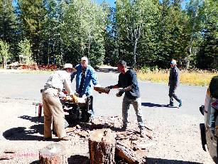
Several sign and wood tasks are accomplished today, including: re-anchor a
Transept Trail sign, retrieve wood from the gulch near amphitheater, split this wood and transport it to a Ranger
residence and the CCC Camp, and paint and letter signs along the Bridle and Transept Trails.
Bill and Cheryl clean out the interpret connex while Holly and Annette finish
cleaning and painting the community shower/laundry.
Dan and Barry sweep the pine needles off all the NPS residential cabins after
wood duty.
A "connex" is a large metal cargo container used by the U.S. Army for
shipping supplies, as to overseas bases.
Roger is still on sabbatical, chaperoning 4th graders on a South Rim adventure.
Mike and Kathy are on an equipment run to Kanab and they repair the shower area baseboard when they return.
Some of us drive to and enjoy the campground concession shower because
the community shower is out of commission - drying grout and paint.
Tonight it's Dutch oven deluxe dump cake by Holly, with yellow cake mix, apple
and cherry pie filling, and a drizzle of butter. Yummy.
The wind drops and we enjoy a pleasant evening. Cold rolls over us during the night.
 |
 |
 |
 |
 |
 |
Day 6: Free The Inner Kaibab. Free Day hiking the North
Kaibab Trail. The scourge of the North Kaibab. 12 miles, ERM = 26, Elevation change of +/-3600'.
24F again this morning, so we hang around the warming fire until down the North
Kaibab Trail, Kathy, Bill, Cheryl, Dan, and I stroll. Dan and I continue ahead as the vista slows the others. Brilliant colors
entrance hikers, with the streaked Coconino Sandstone cliffs as a backdrop. Lovely.
Down to the Coconino Overlook. Down into the heat of the sun and the Supai
Tunnel. Down to the Redwall Bridge, sadly meeting a now seemingly continuous scourge of entitled trumpian (me-Me-ME!)
rim runners and walkers, always expecting trail courtesy, no reciprocation. The scourge rampages entitled all day.
A group of larks is called an exaltation, a group of crows is called a murder of crows,
a group of rim-to-rim runners is called a scourge.
The North Kaibab Trail continues down along the gorgeous Redwall Limestone space
walkways seemingly suspended and edged into the Redwall Limestone cliffs. Across from Roaring Springs we enjoy more
diversity to the spectacular Canyon views. And, finally, down some more to the Manzanita rest area for lunch and respite.
trump tower, Manzanita (the toilet), hulks in the corner of the rest area.
Now it's time for the slog back to the rim, meeting more entitled scourge along the way.
Grind, grind, up, up some more.
Then there is a soothing shower enjoyed in the newly reconditioned community bathroom. Ahh.
Dan and I order pizza from the North Rim deli and wander over to watch the sunset
from the Grand Canyon Lodge patio while it cooks. As we return to the deli, the line is out the door and the deli runs out of
pizza and other foods. The scourge tsunami has hit here too. We return to camp for conversation around the fire, joined by
Helen R. and Theresa from the Grand Canyon Conservancy. Roger has returned and thus helps keep the discussion going, which
results in getting to bed long after hiker midnight.
North Kaibab Trail: From the NPS trail description: The North Kaibab Trail is (once was)
the least visited but most difficult of the three maintained corridor trails at Grand Canyon National Park. Almost a thousand feet higher
at the trailhead than South Rim trails, hikers on the North Kaibab Trail pass through every ecosystem to be found between Canada and
Mexico. At the rim, hikers will glimpse the vast maw of Bright Angel Canyon through fir trees and aspen, ferns and wildflowers. The
trail as it descends through the Redwall Limestone is blasted directly into the cliff, "literally hewn from solid rock in half-tunnel sections."
Farther down, the ecology progresses so that hikers look up at the surrounding canyon walls
through a blend of riparian and desert
vegetation. Along the way, Roaring Springs and Ribbon Falls both offer rewarding side trips that are wonderfully juxtaposed to the
often hot conditions of the main trail. Built throughout the 1920s to match the quality and grade of the South Kaibab Trail, the
present-day North Kaibab Trail replaced an older route infamous for crossing Bright Angel Creek 94 times (the present-day trail
crosses only 6 times). Even though it is masterfully constructed and is a maintained trail, don't be deceived by the apparent
ease and convenience of hiking it; from beginning to end, the North Kaibab Trail has its challenges.
 |
 |
 |
 |
 |
 |
| ||||
Day 7: Ranger Dinner. 4 miles; ERM = 4.5.
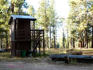
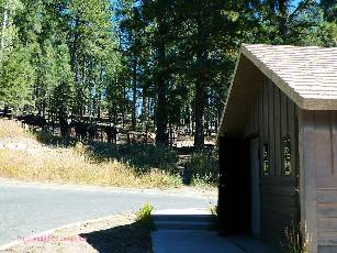
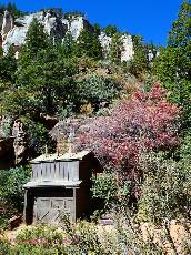
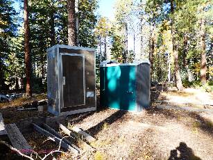
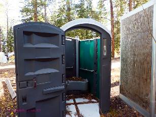
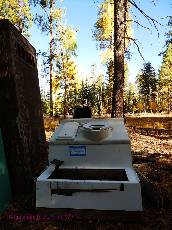
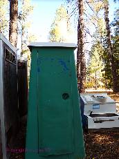
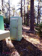
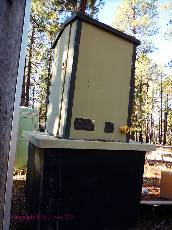
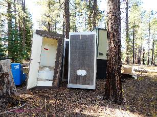
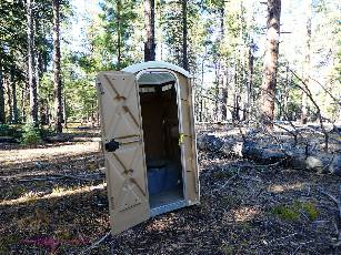
The sun filters through the scenic toilet graveyard, softly highlighting
the various eras of toilets gone to stool heaven. Scattered about are shimmering aspens, many with the first
blush of Fall trending rapidly toward Winter. It appears that many of these aspen will be frozen before attaining
the saturated yellow hue associated with the changing season.
It's another quite cool morning, and I set about scraping signs, painting
them as the day warms.
Passing through the administrative area, I enjoy a good discussion with
Ranger Steve B. about the Ikes Fire that has terminated my chances to use the rare North Bass permit I had obtained
for less than a week from now. Argh.
The wind drifts cold up from the Transept as I tediously paint sign letters
on a "Transept Trail" directional sign.
Holly, Annette, and Barry have left early for home, and Roger has returned
from his chaperon duties.
I luxuriate in a shower in the refurbished community shower/laundry in the
admin area and have just enough time to update these notes before a scrumptious Ranger Elyssa dinner of chili,
salad, brownies. Delightful.
 |
 |
 |
Day 8: Finishing up. 5 miles.
Red Bigtooth Maples dot the slopes of the Transept as I paint more signs
along this namesake trail. I walk back and forth on the Transept and Bridle Path, first scrubbing the signs with a wire
brush, painting them GC brown, and later returning to tediously paint the letters and numbers with an oil-base white gloss.
Eating lunch in the rocking chair on the BIC porch, gazing at the contrast
between green conifers and shimmering yellow aspens is spectacular and fantastic.
It's after dark when running Rangers join us at our campfire and finish off a
Dutch oven dump cake, sadly the last of the project.
A chorus of Coyotes yip, yowl, and howl accompanying background music.
Song dogs.
Spirited conversation about the lack of governing in the interest of the country
takes us well past hiker midnight.
Day 9: Autumn Shimmer. Off the plateau.
The aspen shimmer is coming to an end, reports Elyssa, because high winds
and temps in the low teens are blasting into the area tomorrow. Yikes.
So today, as I roll out of The Park after packing up camp, I stop a few
times to photograph and store in digital form for later enjoyment the spectacular Fall colors of this Autumn VIP shimmer.
|
| |||||
"I measure your health by the number of shoes and hats and clothes you have worn out." Ralph Waldo Emerson
"Under the desert sun, in the dogmatic clarity, the fables of theology and the myths of classical philosophy dissolve like mist. The air is clean, the rock cuts cruelly into flesh; shatter the rock and the odor of flint rises to your nostrils, bitter and sharp. Whirlwinds dance across the salt flats, a pillar of dust by day; the thornbush breaks into flame at night. What does it mean? It means nothing. It is as it is and has no need for meaning. The desert lies beneath and soars beyond any possible human qualification. Therefore, sublime." Ed Abbey
 |
 |
 |
 |
 |
 |
 |
 |
 |
 |
 |
 |
 |
 |
 |
*ERM: Energy Required Miles, are there data to support this
mileage adjustment?
Journal of Outdoor Recreation, Education and Leadership
Petzoldt first proposed his theory in his 1976 book “Teton Trails” to
help backpackers plan trips and calculate their energy needs on mountain trails. “Petzoldt defined one
energy mile as the energy required to walk one mile on the flat. He recommended adding two energy miles
for every 1,000 feet of elevation gain, so a person hiking one mile and 1,000 feet upward would use the
equivalent of three energy miles,” Phipps said.
Petzoldt’s energy mile theory was just a reflection of the mountaineer’s
“gut feeling,” Phipps said. The theory had never been tested in a laboratory before the study began in WCU’s
Exercise Physiology Laboratory in the spring of 2010, Phipps said.
To determine the validity of the theory, the study measured the energy cost
and perceived exertion for walking on flat ground, with and without a 44.5-pound backpack, and up an elevation
gain of 1,000 feet, with and without the backpack, through the collection of metabolic data, Phipps said.
Twenty-four student, faculty and staff volunteers, including 12 males and 12
females, went through four testing sessions as the research continued into fall semester of 2010. The study
results showed that the additional energy cost for ascending 1,000 feet ranged from 1.34 to 2.02 energy mile
equivalents, for an average of about 1.6 miles, compared to Petzoldt’s use of two energy miles for each 1,000
feet. The range revealed by the study was due to the “hikers” personal weight differences, Phipps said.
“It is remarkable that Petzoldt’s energy mile theory is so close to the actual energy cost measured during our
study,” Phipps said. “In the field of outdoor education, it’s important for leaders to include an estimation
of energy requirements during the planning of hiking trips.”
Phipps said the energy required for hiking up steep mountain trails would vary
for individuals and groups, and the variables of the trail would also factor in, but he recommends that
backpackers stick with Petzoldt’s idea of adding two energy miles for every 1,000 feet of elevation gain when
planning trips.
The Validity of Petzoldt's Energy Mile Theory, 2010
Authors: Maridy McNeff Troy, Maurice L. Phipps
Publication: Journal of Outdoor Recreation, Education, and Leadership
Links:

| ||
|
Tasks Accomplished List 10-2019 VIP (pdf)
(Click the image for the document) | ||
|---|---|---|
| ||||
| ||||
Related Links:
You may see a complete list of VIP reports, mixed in with other
Canyon adventure reports here.
Bonus Feature from the 3-2016 volunteer project: A Second Ribbon Oasis - AZ Daily Sun 3-30-2016, pdf
the geology of the Grand Canyon by Canyon Dave
Falter - we've used up our chances, Earth is now Eaarth by Bill McKibben
Other WV reports about the Grand Canyon:
Click here or on the Looking Lizard to go to all WV reports about The Grand Canyon
| ||||
More Truth Than Joke:
| ||||
| ||||
| ||||
|
Wild Vagabond Main |
Trip Report Index  |
Caveat  |
|---|