Tuckup "Trail"/ 150-Mile / Esplanade / Corkscrew Spring / Little Joe and Hotel Spring
46.9 miles; ERM = 62.7
April 14 - 21, 2017
Text © copyright by Rob; and Photos © copyright by Rob Jones

|
Grand Canyon: Tuckup Trace
Tuckup "Trail"/ 150-Mile / Esplanade / Corkscrew Spring / Little Joe and Hotel Spring 46.9 miles; ERM = 62.7 April 14 - 21, 2017 Text © copyright by Rob; and Photos © copyright by Rob Jones |
|
|
| |||||
|
| |||||
|
| |||||
| ||||

| |||||
46.9 miles; ERM = 62.7 Co-Adventurers: Bob Bordasch and Ben Mahlab camera: Panasonic DMC-ZS19
ERM = Energy Required Miles. A mile is added for
every 500' elevation gain or
loss. It's a very serviceable method of estimating energy required miles. ERM was initially used in Trails
of the Tetons (long out of print) by Paul Petzold, founder of NOLS. It's a wonderfully useful concept and
application. Add one mile for each 500' up AND down to distance = ERM. I use ERMs to calculate what the actual
day is like. It's a very serviceable method of estimating energy required miles. Remember, however, that the
ERMs are estimates because they depend on GPS satellite coverage and math functions.
Preliminary: All who wander may be lost.
Day 1: Hotel Grand Canyon:
4.76 miles; ERM = 9.
Using ERMs does not account for the 'texture' of the route or trail - that
is, rocky, boulders, no trail, slimy mud, etc., yet does help approximate the route.
Starting out from Kanab, Utah, the long dirt drive ensues.
Dust, more dust. Some roads are on the ground yet not on the map while others are on the
map but not on the ground. Confusion and consternation are options. The quality of road
surface deteriorates as Bob drives toward The Canyon, and we cannot find nonexistent roads
to the twilight, and we camp. Initially, the wind makes it cold as stars pop. Chilly night.
Down we slide on the vestiges of an old horse trail through the Kaibab,
Toroweap, and Coconino layers, tediously descending to Buckhorn Spring, where we find a tiny oasis supported
by a slip of a seep. Canyon Tree Frog, hummingbird, spiny lizard share the oasis. Glorious.
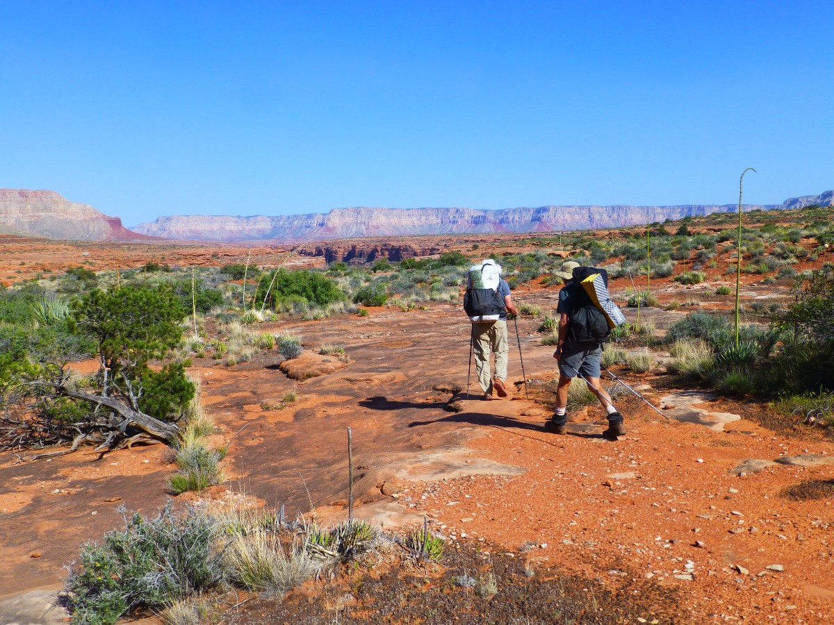
I am calling this route the Tuckup Trace because there is nary a trace of
it anywhere, except remnants of the drop from rim to Buckhorn Spring. I suspect what happened is that
the historic cow people and others take the contour tour approach - weaving around the canyon heads as
efficiently as possible, avoiding dramatic elevation changes. Most of the hydra heads piercing the
Esplanade don't really allow cutting through the canyons anyway - barrier cliff bands abound. All
the same, there are occasional traces of the Tuckup. The route may seem obvious, yet it is difficult
to see many of the intruding canyons as one scans across the Esplanade, suggesting that keeping track
of one's position on a good map is useful indeed. Bob and Ben provide numerous insightful course corrections.
On the Esplanade, whence we go up to it from the 150-mile creekbed and
contour atop this walkway through and around side canyons until finally dropping into and working our
way down to Hotel Spring. Hotel Grand Canyon. Bob performs his usual excellent navigation on the trace.
Water courses through the slickrock sluicebox and Canyon Tree Frogs chortle as the air cools and it's
night far too early. Our narrow slice of desert sky is crowded with billions and billions of stars.
Bats ply the crepuscular.
Tuckup Trace Photos - Day 1


Day 2: Pothole Promenade: To the froggy potholes: 8.8 miles; ERM = 13.
A salmon pink sunrise paints the blocky Esplanade Sandstone as morning
arrives in Hotel Spring Canyon. Excellent. It's up and out onto the top of the Esplanade and into the
low angle light of The Canyon. Nary a human footprint sullies the cryptobiotic soil, which is developed
enough to resemble the pleated surface of a laureate's brain. A lithic field appears along with a racer
snake who blinks at me from under a blackbrush. Ben and I explore the field as Bob surges ahead on the
contour of the Tuckup Trace. Bits of scrapers and broken arrow points are visible, most sharp enough to
use to trim your beard. The base rock appears to be a chert, a rock not in local evidence and probably
toted here during hunting or foraging trips.
Now, we're beyond Boysag Point, lounging in the deep shade of a towering
Coconino Sandstone boulder and enjoying lunch.
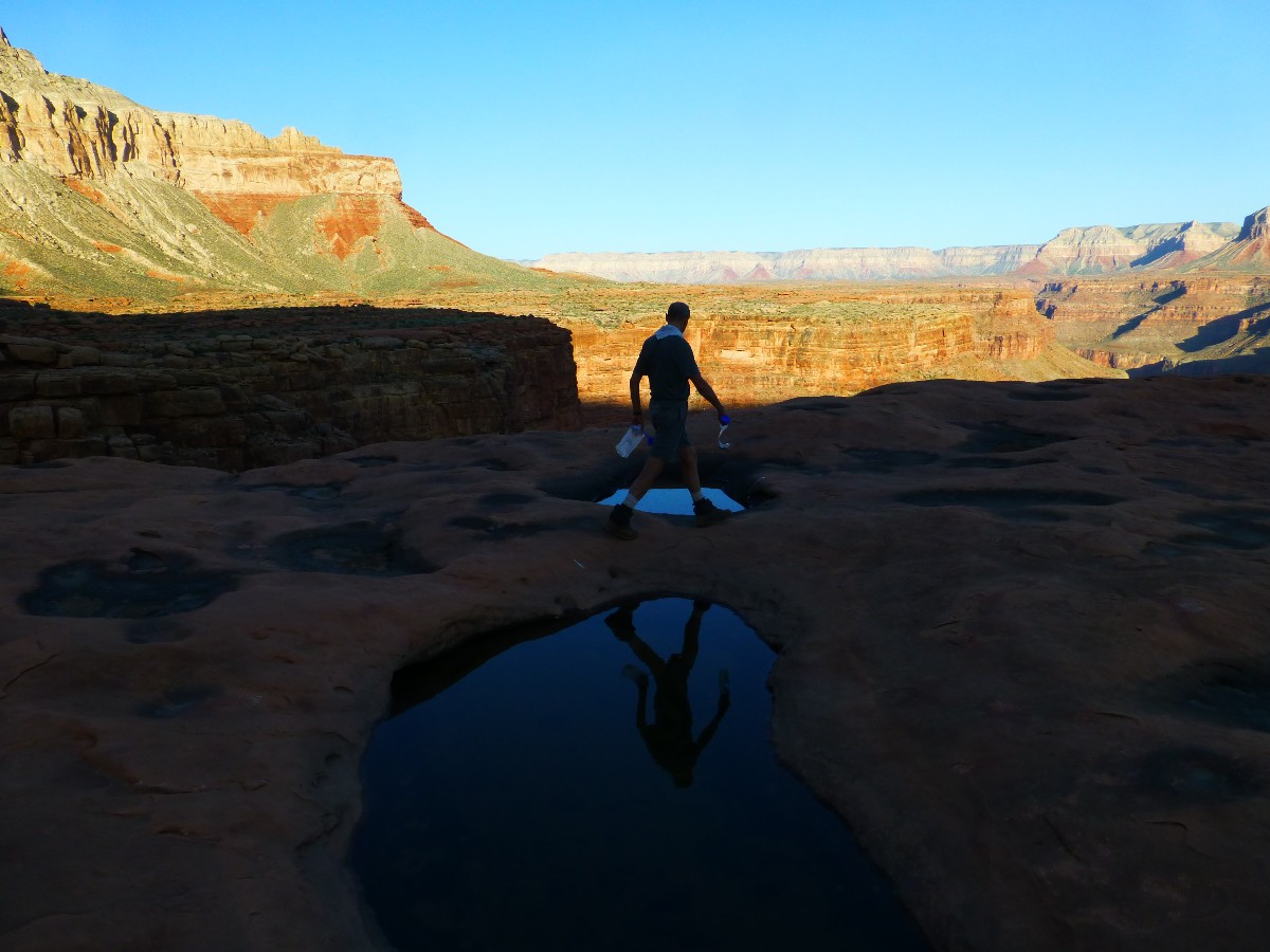
Farther along, we find a series of delightful potholes partially filled with desert water. Reassuring.
Peeling off our route and relaxing under an overhang seems like the sensible thing to do before continuing
on the trace of the Tuckup. Mostly, there is no trail, no trace, no Tuckup Trace or trace of Tuckup.
On we hike, occasionally imagining a trace of the Tuckup in the torrid
feeling solar load.
Some of the sidecanyons protrude nearly to the foot of the cliff slope,
making the route sweep wide. Out on a point between canyons, I hear the sheepish sounds of froggies. And
a good place to camp not far from another deeply drilled set of precious potholes. Bob notes that it may
be the clay lining the bottom of these potholes that helps retain water after the other holes and canyon
beds are dry.
 |
 |
 |
 |
 |
 |
 |
 |
 |
 |
 |
 |
 |
 |
 |
Day 3: Corkscrewing Steck's Picto Camp. Chuckwalla Choke:
6.5 miles, 3 to camp, 3.5 to water; ERM = 11.
Ahhh, the boots are off in the deep shade of the overhang, surrounded by lithic
chips, a few cowboy artifacts, a small picto panel on the roof, and lots of dust. Superb. It appears that the
picto panel has been diminished through flaking off of the rock. A bit of a disappointment.
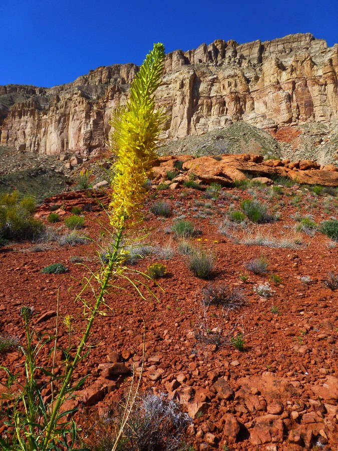
Out in the full sun, a plethora of flowers wave in a slight breeze. Mariposa
Lily, several kinds of cactus, phlox, globe mallow, banana yucca, primrose, blackbrush, mormon tea, prince's plume,
Four O'Clock, Indian Paintbrush, and even larkspur. Lovely. Bob and Ben discuss how one's experience of
something, anything, changes through the act of naming it. So much remains unnamed on the Tuckup Trace that
the experience has an original and pristine quality to it.
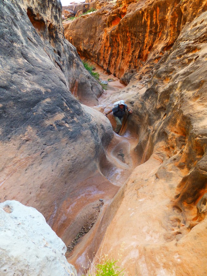
Corkscrewing to Cork Spring is laborious and circuitous and nearly canyoneering.
Down one canyon, contour above a pour-off to another canyon, sliding off slickrock into gamble oak, down,
boulder hopping and climbing. A tiny pool. Stagnant. More bouldering. Our reward is a refreshing slide
of water bordered by maidenhair ferns. Crucial. Filling 6 to 8 liters each, we decide to exit the spring
canyon more directly from the spring, using the West arm, which results in lots of creeping the contour on
the Tuckup Trace back to camp. Yet the canyon clambering (West arm) is non-technical and straightforward.
Around an endless 5 heads of tributaries. Argh. It's three and a half miles of slow going.
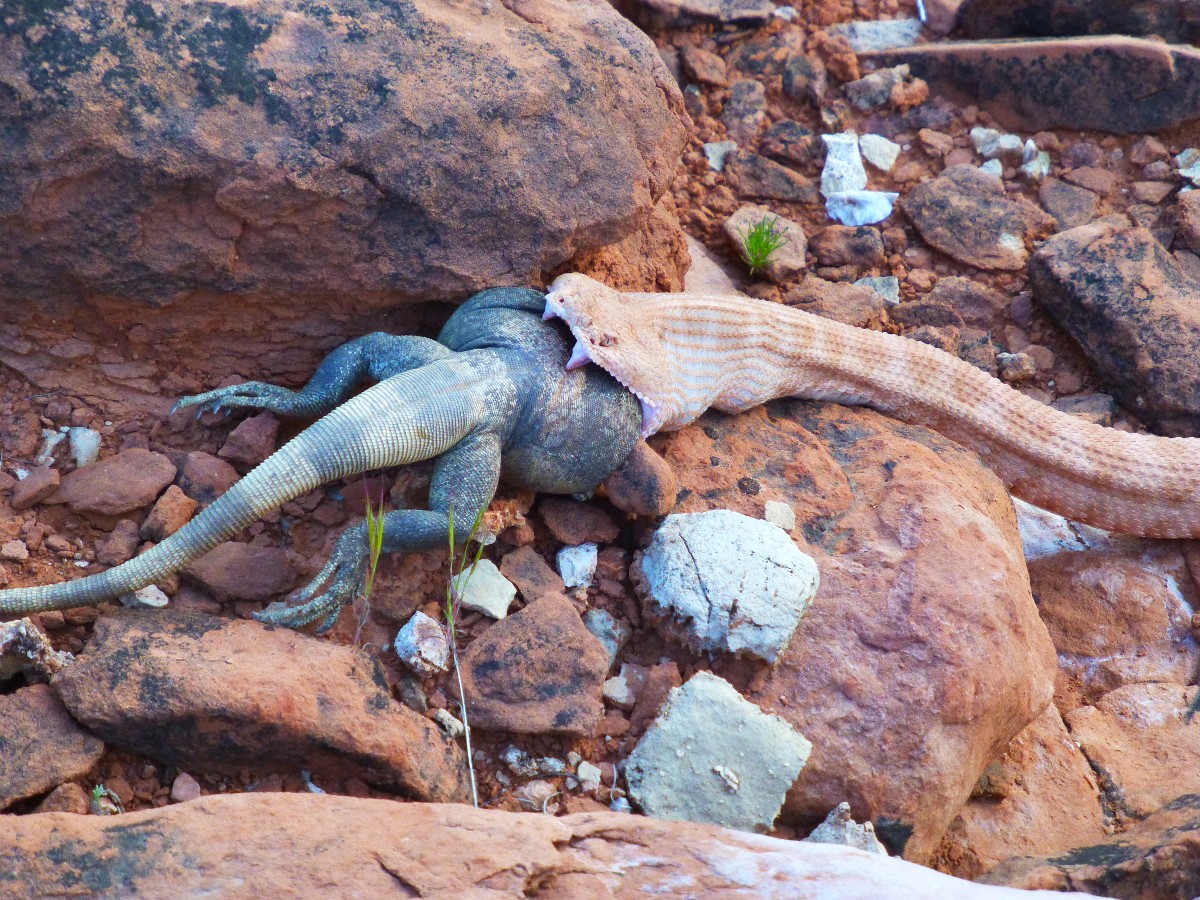
The Speckled Rattlesnake, which I initially misidentified as a GC Pink,
chokes down the Chuckwalla, or tries to. Or maybe is
choking on the Chuckwalla? A feeble shake of the rattle alerts Ben to the snake's plight, or maybe delight.
It's a big snake, yet the Chuckwalla is also large, and appears to have inflated himself prior to being seized
by the snake.
Marveling at the glutinous snake, we stumble back to camp as
the sunset glow spreads across the Esplanade.
 |
 |
 |
 |
 |
 |
 |
 |
 |
 |
 |
 |
 |
 |
 |
Day 4: Fond Froggy Return:
3.5 miles; ERM = 6.
An orange glowing sunrise spreads across the patchwork of Esplanade.
It's Day 4 on the Tuckup Trace. Not wanting to risk the improbability of future water sources and
honestly evaluating our pace around the myriad of canyon hydra heads, we reluctantly reverse course
and walk back toward the froggy potholes.
Wind decreases the glory of a bucket bath. Then it's on into the afternoon,
lounging under a wood rat overhang sipping mango green tea and discussing the meaning of life.
The solitary natural quiet of the Tuckup Trace continues. There are few
fly-overs, no air tour terrorists, no mass of hikers, no hikers at all.
Mount Sinyella collects the last of the local sunset rays as lenticular
clouds saucer across the sky and a bright planet is the first celestial body to appear.
 |
 |
 |
Day 5: Pothole Promenade; Blacktail Buzzworm. To Pothole #1:
3.6 miles; ERM = 6.
The slanted sun illuminates the nuts and bolts of the Supai level, backed
by the distant hulk of Mount Sinyella. It's Day 5 on the Tuckup Trace. And a slow start it is today, as
we debate what could possibly convince someone to vote for a hate-filled, uninformed, incurious, impulsive,
oligarchic, selfish, narcissistic, braggart who takes no responsibility for their lies and sins and proudly
assaults women and scientists and people of knowledge. I suppose that one conclusion is that Americans want
to blame others rather than take responsibility for their future, leaving decisions to the least qualified
bamboozler in chief.
Again, we are on the Trace, around an assortment of canyon heads to the first
potholes. Bob encounters another rattlesnake, this time not a Speckled Rattlesnake. It's a Blacktail Buzzworm.
At first, I thought Mojave Rattlesnake, then Diamondback, eventually settling on Blacktail. Sluggishly, the
snake slithers from sun to shade. He or she is a gorgeous slithering reptilian. It's a pregnant female Blacktail
Buzzworm. Gorgeous.
As we rest under a narrow overhang, I notice a tick lightlegging across my
pants. Yikes. Now I can feel ticks everywhere; in my hair, on my back, crawling around on the neck, in every
crack and cranny of my rumpled skin. Argh. Back to the Trace.
We soon arrive at Pothole #1 and find a shade rock for lunch and lounging.
The wind is now screaming, making it difficult to imagine a bath without a chill or losing things over the edge.
A shade and windbreak rock provides a location for a short nap. Then, it's
off to find a series of overhangs to get out of the gale and in the event that the gathering cumulonimbus
send rain. My rabbit hole is secure, yet I wonder about the population of scorpions.
It's an occasionally blustery night, and we're again surrounded by natural
quiet. The Tuckup Trace is very quiet; generally free of air tour terrorists and other corporate welfare
artists, stealing public resources for their immoral amoral gain while saddling the public with noise,
pollution, and global warming. Horrid. Yet it's quiet on the Tuckup Trace and we've seen almost no sign
of others, and no others at all.
 |
 |
 |
 |
 |
 |
| ||||
Day 6: Hotel Reunion. To Hotel Spring Canyon:
5.2 miles; ERM = 8.5.
The Finch pair flitter into our lunch #1 break overhang and nearly
onto Ben's head. Darling lovers? Maybe, and there is a nest of tiny eggs hidden in a plant hanging
from the top of the overhang. Amazing. We quickly wrap-up lunch and return the overhang to the Finches.
The robin egg blue sky sets a fine backdrop for Boysag Point.
We weave partly around yet another hydra head of canyons on the return jaunt to Hotel Spring. Then lunch #2.
The walking is easier most of today because there are not as many
canyons to circumnavigate. Five miles and we drop into the sluice box that is Hotel Spring Canyon,
where it's time for a bath and some laundry.
An orzo dinner is enjoyed as the last of the light fades salmon from
the bulbous Esplanade rim 200+ feet above.
It's a pleasant and enjoyable evening on the polished Esplanade Sandstone.
Later, in bed, I hear what I assume is a breeze rippling the groundsheet.
Wrong, it's a Canyon Tree Frog hopping toward the tadpole pools to sing with his kin. And sing they do,
chortling and baa-ing like Bighorn Sheep.
 |
 |
 |
 |
 |
 |
 |
 |
 |
 |
 |
 |
Day 7: Little Joe:
1 mile; ERM = 1.2. Explore for 3 miles.
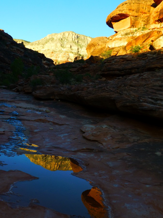
Reflections on the tadpole pools, refracting warm hues to you.
Delightful. Bats and Sphinx Moths float and dodge. It's an
introspective morning in The Canyon.
A Raven drifts down canyon, thoroughly inspecting us and our gear.
The trickle of water is now flowing between pools in Hotel Spring canyon, not hindered by high rates
of evaporation; something that the Lake Foul cheerleaders fail to observe or admit, evaporation. Of
course, the cheerleaders also ignore the exponential human population growth, global warming, extant
over-allocation of most water sources on Eaarth, etc.
Down toward 150 Mile Canyon we roll, soon finding cowman-built horse
ramps, including a zigzag down a steep slickrock drop to get around a water slide. Bits of barbed wire
and ramp remnants mark the route to the bottom. Not far below we are at the intersection with 150 Mile
Canyon. Nearby and upstream we locate Little Joe Spring.
Little Joe Spring is producing fine water and it's sad to note this last
night of camping on the bare slickrock.
 |
 |
 |
 |
 |
 |
 |
 |
 |
Day 8: Out of It:
3.5 miles; ERM = 8.
The ancient wheelbarrow wheel still turns, yet grudgingly so. It's
old enough to have a heavy iron wheel (no rubber) and has languished on the now marginal trail from
Buckhorn Spring to the rim since the work was abandoned decades ago. After wind-walking from Little
Joe Spring to Buckhorn Spring, and lounging near the trickle of Buckhorn water beneath a Cottonwood
tree, we reluctantly begin the climb through the Hermit Shale, Coconino Sandstone, Toroweap Limestone,
and the Kaibab Limestone. Up to the rim, out of The Canyon.
Then, the gnarly and then bumpy web of roads across abused and cow burnt
BLM public land back to the highway, to Fredonia, to Kanab for a well-deserved shower, and an Escobar
(cafe) gorging. A fitting end to wandering the Tuckup Trace.
 |
 |
 |
 |
 |
 |
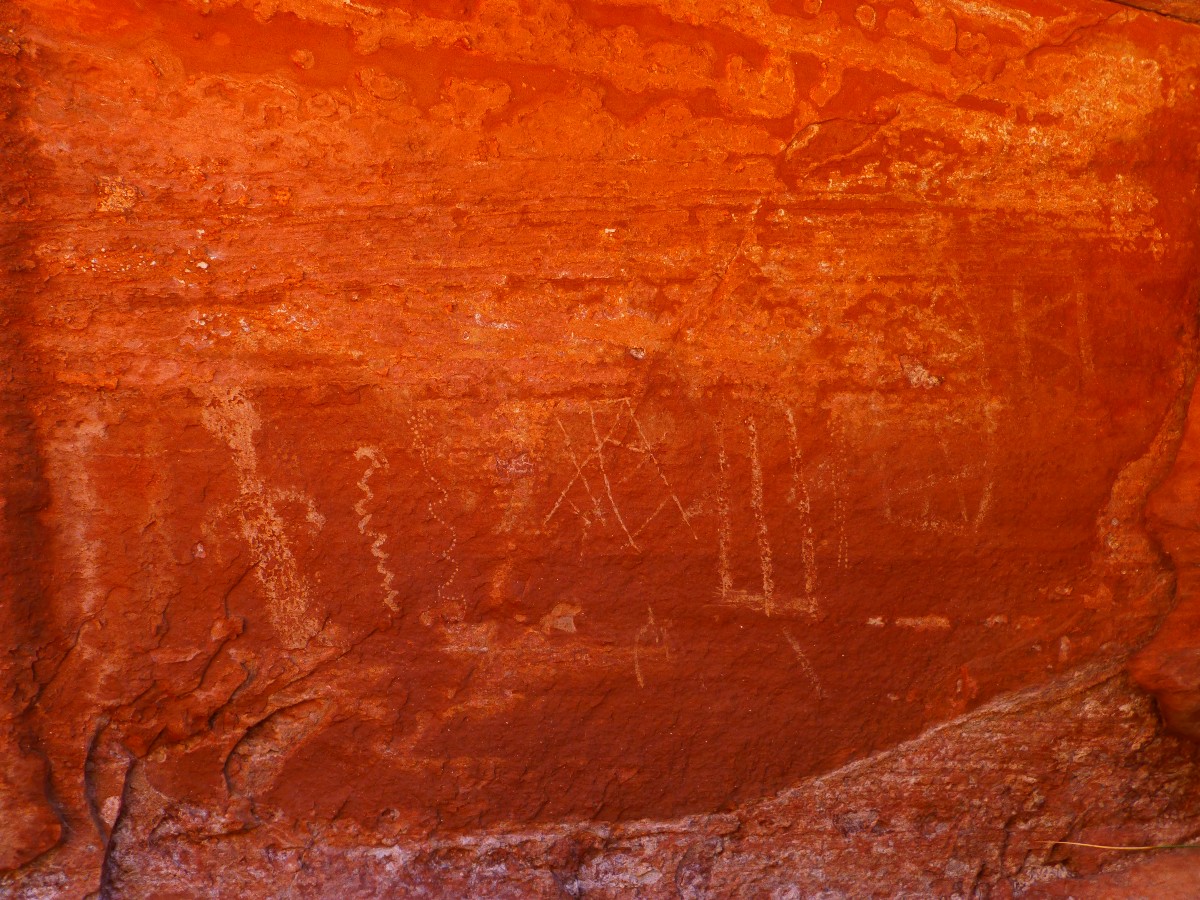
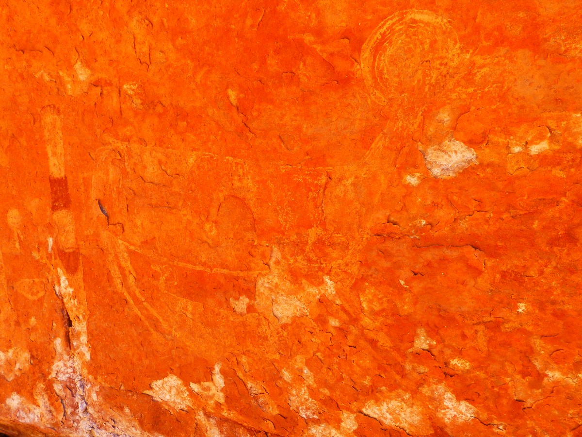
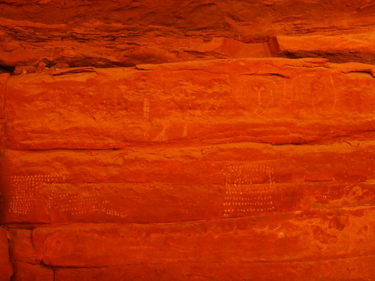
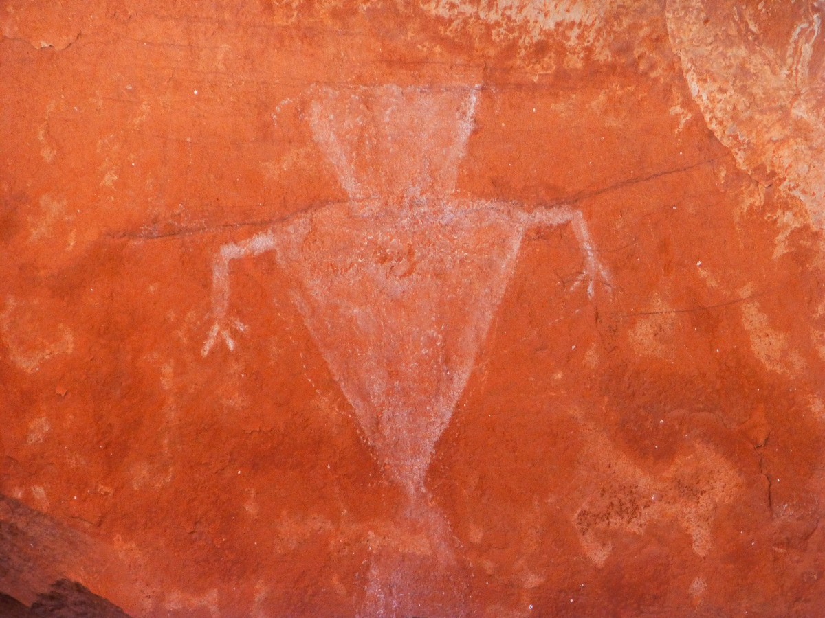
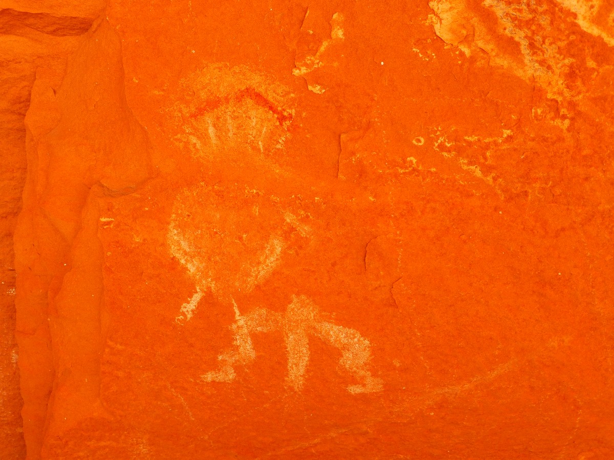
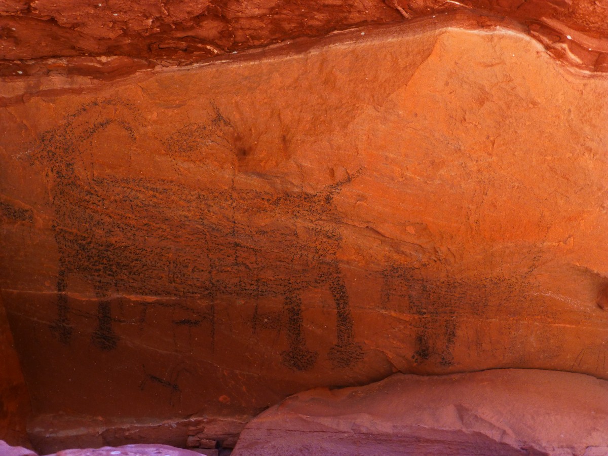
Pictos from somewhere on this trip: We're strolling and
exploring, finding what might
have been a cowboy camp or waypoint, when, Wow! Pictos! A Bighorn Sheep and suckling lamb, Yoweee.
A striped pole of red and brown. An aggressive looking ungulate beast, more pole people.
Exploring more, there are numerous difficult to see pictos, many in
brown, some charcoal, and others white.
All I am saying is that these pictographs were seen somewhere along the Tuckup
Trace, or maybe somewhere nearby...
 |
 |
 |
 |
 |
 |
 |
 |
 |
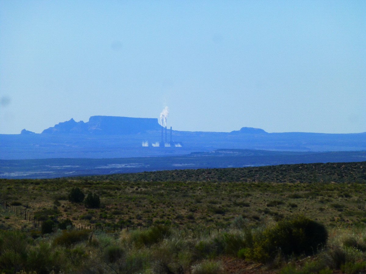
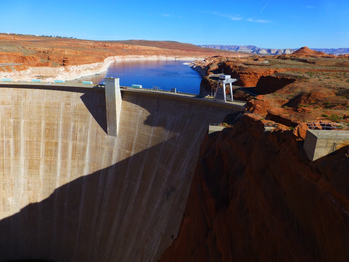
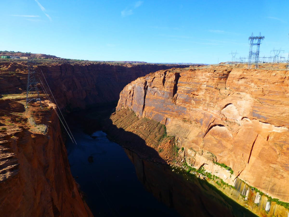
Then, on a drive across the Colorado Plateau, I see scourges of the West, the Navajo generating station, pumping tons upon tons of toxic fumes into the air. And, a gigantic sewage pond, Lake Foul, way past "peak water" and being sacrificed to keep Mead Reservois filled for the moneyed elite downstream. The bathtub ring shows how it's past time to drain it.
 |
 |
 |
Links:
Other WV reports about the Grand Canyon:
Click here or on the Looking Lizard to go to all WV reports about The Grand Canyon
| ||||
Map:
| |||||
Related Links:
Scenic Toilets of Inner Eaarth
the geology of the Grand Canyon by the NPS
Eaarth - Living on a fundamentally altered planet by Bill McKibben
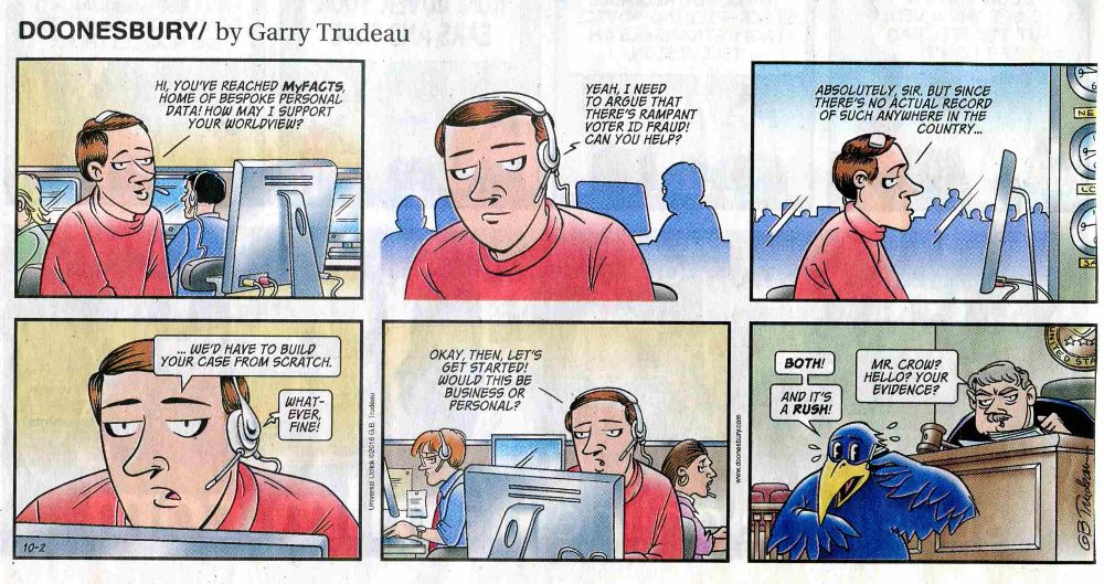
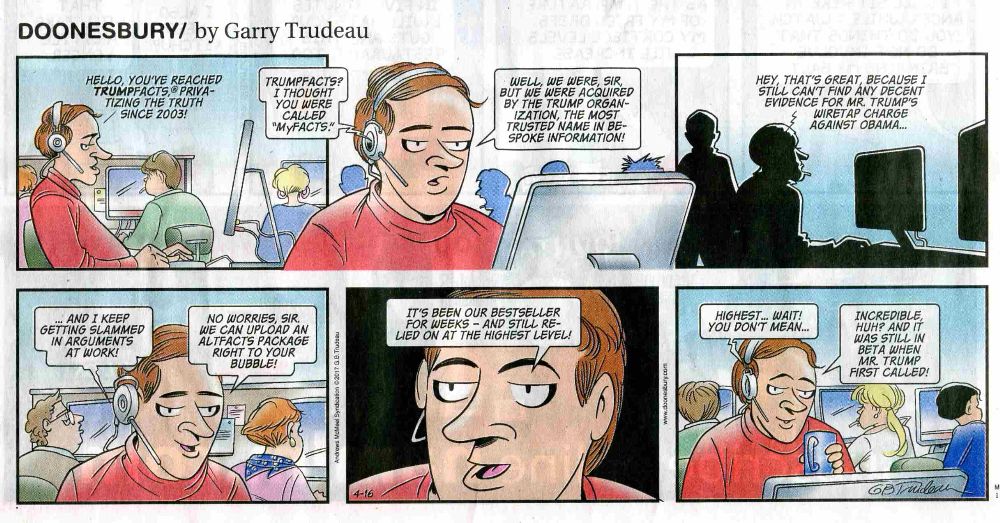
More Truth Than Joke:
| ||||
| ||||
| ||||
| ||||
|
Wild Vagabond Main |
Trip Report Index  |
Caveat  |
|---|