(March 26 - 30, 2021)
Text © copyright by Rob; and Photos © copyright by Rob Jones of the WV

|
Grand Canyon /
Hermit Horizontal Snowmageddon / Visiting: Monument Creek, Salt Creek, Granite Rapids, and Hermit Creek
(March 26 - 30, 2021) Text © copyright by Rob; and Photos © copyright by Rob Jones of the WV |
|
Co-Adventurers: Solo adventure
Total miles = 42.5; ERM 67.5. ERM = Energy Required Miles (see full description below).
camera: Panasonic DMC-ZS70
| ||||
|
| |||||
|
| |||||
|
| |||||
|
| |||||
|
| |||||
|
| |||||
.
| ||||
.
.

![]()
Map: A GPS Visualizer
version of the map for this jaunt can be found here.
.
It also shows the dalliance exploring the old Tonto at Monument. ----> click here for the GPS visualizer map - and roam at will.
Day 1 photos - Hermit Horizontal Snowmageddon


Day 1: Horizontal Snowmageddon: Rim to Monument Creek:
9.5 miles, ERM of 18.
The Elk dusts the snow from the P-Pine as she shakes off the drift which has formed
on her back. Snowing hard. Slipping, almost literally, onto the Hermit Road, there's a white expanse. Whiteout! Somewhere,
there's a road. I can barely discern the low crowning of the road in the gray light that provides little depth of field. Getting
to the trailhead is an issue, the wind is blowing snow horizontally. Yikes.
At the Hermit Rest trailhead, I bask in the warmth of the Subie Subaru while outside
the whiteout rages. Horizontal Snowmageddon. Time for the last of the coffee from the thermos and a pastry. Yummy. I
smile because I brought two pastries. I wonder how long I can hide out in the Subie and still complete my hike today, to
Monument Creek and camp?
The Microspikes go on the pack. It's looking ugly, still snowing. Wind mittens too.
Pack cover, person cover, off I go, down the initial limestone layers, stepping carefully, walking flat-footed, carefully placing
pole tips for a three-point stance at all times. That is, walking like in Idaho in the Winter. Yes, it's like that. Courage to go
leads to joy, or something like that.
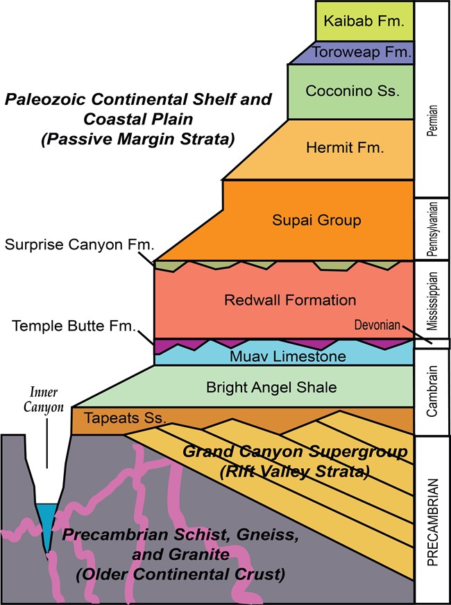
Mnemonic for the basic GC layers - Know The Canyons History, Study Rocks Made by Time
Know - Kaibab Limestone
The - Toroweap Formation
Canyon's - Coconino SS
History - Hermit Shale
Study - Supai Group (including the Esplanade)
Rocks - Redwall Limestone
Made - Mauv Limestone
By - Bright Angel Shale
Time - Tapeats SS
Know The Canyon's History, Study Rocks Made By Time.
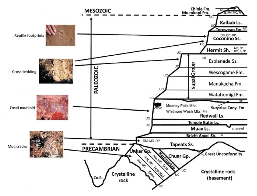
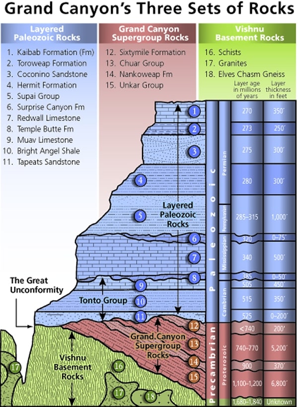
Check the links section for lots more geology stuff. Here are versions of this basic schemata:
| ||||
| ||||
| ||||
Cryptobiotic soil (once called crypto-gamic soil): a crust of cryptobiotic soil provides a
living ground cover in the high deserts of the Southwest. The soil, consisting of cyanobacteria, lichens, and mosses, forms crusts that
are resistant to wind and water erosion and provide nutrients to plant life.
Cryptobiotic soil crusts are an important part of arid and semi-arid ecosystems throughout the
world, including those in Glen Canyon National Recreation Area, Grand Canyon National Park, Canyonlands, etc. Crypto means hidden,
while biota means life. Hence these crusts are composed primarily of very small organisms that cannot be seen with the naked eye.
Well-developed cryptobiotic soil crust is often much darker than the soil it is on top of, and has a sponge-like look and texture. The
extent of crust development depends on soil structure, texture, and chemistry as well as elevation and microclimate.
Cryptobiotic soil crusts are created by living organisms such as algae, cyanobacteria,
and fungi. The bacteria within the soil release a gelatinous material that binds soil particles together in a dense matrix. The
result is a hardened surface layer made up of both living organisms and inorganic soil matter. This crust is an important means
by which arid soils resist erosion by wind and water. Many cryptobiotic soil crusts are able to absorb water more quickly than
regular soils and as a result reduce runoff and also impede evaporation. In addition, the cyanobacteria in the crust, as well as
some of the surface lichens, are nitrogen fixers, meaning that they can chemically convert atmospheric nitrogen into a form
usable by other plants. Lichens and mosses often grow on the stabilized surfaces of the crust, and can often cover the crusts.
Many unusual and unique organisms occur in association with crusts, including many rare and undescribed algal species as well
as rare lichens. It is becoming increasingly clear that the older and better developed crusts support important levels of cryptogamic
plant biodiversity. (from the NPS Grand Canyon and USGS sites)
Grand Canyon Panorama Project - by Larry Wieland, Hermit Trail.
You can see the area I hiked by visiting this site. There are many options - click on the spheres to go to a panorama from that point.
There are several panoramas taken from the Hermit Trail, for instance. Options also include: Add geology or topo map.
A super series of panos and supporting geology maps.
Grand Canyon Panorama Project - Hermit Trail (link here).
Day 2 photos - Hermit Horizontal Snowmageddon


Day 2: Salty Venture. To Salt Creek + explore. 9.2 miles.
3.4 + 5.8 exploring, ERM of 11.
Early condensation greets the dawn, wetting the tent bottom and any
gear on the ground thanks to yesterday's rain. Coolish.
I enjoy an excellent early day conversation with Jeff the Forest Service
Hydrologist on the climb out of Monument Creek and back onto the Tonto Platform. Jeff shows me the AZ wildflowers
app he is using and I make note of it.
Up the trail rises into the welcoming sun and begins Tontouring to Cedar
Spring, which is running weakly off the abyss in a Tapeats Sandstone Keyhole. Lovely. Soapstone Yucca contrast
with the snow on the North Rim. Amazing contrasts abound. It's a panorama of lovely contrasts. The low frequency
bellow of The River growls, sound bouncing in the nook of the brief slot that is Cedar Spring. A super place for a
snack and to dry the tent while gazing North at the Tower of Set and rocks made by time.
As mid morning arrives, horrid, horrible, climate and mood changing air
tour terrorists intrude into this blissful zenith of zen. Natural quiet, one of the prized Canyon resources, is shattered,
banished, longed for.
Sheila and Karine stroll along, coming from the opposite direction,
and I enjoy another excellent conversation.
Before long I see a shimmer of water sliding over polished bedrock,
and smile. There's water in Salt Creek. There's water in Salt Creek! The three neophytes I encountered earlier
today told me that "there's no water in Salt, we looked all over." I wonder if they are truly that clueless or if
they camped in a different canyon last night? Basically, how did they miss seeing the Salt Creek Water, which
they stepped in or across?
Phoenix, Las Vegas, St George come to mind as counter examples of responsible growth.
After lunch #2 and gazing at the Tower of Set, I set up camp, retrieve
water (about 100 feet below the trail crossing), and Tontour 2+ miles farther East looking for the historic tram site described by Dennis Foster.
See the map for this dalliance.
I find the old telegraph pipe pole and rolls of open wire and a guy
hook - probably for the telegraph line, but I'm unable to locate the remains of the historic tram site from 1919.
I'd like to keep looking, but I'll run out of daylight if I do.
Back at Salt Creek camp, I tolerate a brief bucket bath and cook as the
last of the low angle sunlight leaves Hopi Point. The moonglow illuminates the distant River channel, casting an
eerie hue to the walls. The Big Dipper points to the North Star as dark thirty arrives.
Bats swirl crepuscular, followed by a two hoot owl at pure dark. Delightful.
 |
 |
 |
 |
 |
 |
Day 3: Rambunctious, Hit the Beach & the Monumental Monument. To Granite Rapids. 7.5 miles,
ERM of 10.5. Additional mileage - search for the historic Tonto around Monument Creek.
The golden sliver of sunlight slips down Mojave Point, Western anchor
of the Hopi Wall and directly South of camp, as a new and deluxe day arrives in The Canyon. Superb. It's natural
quiet, all around, without the inane chatter of dithering digital insanity and the horrid air tour terrorists. Peaceful.
Revolt against the machine? Well, you're reading this digitally, and I'm writing it on the smartass, so hypocrisy has yet to exit this Cathedral of Rocks.
With a hot liter of cocoa grandé wedged between the legs, providing heat
to the blood coursing through the femoral arteries, pumping warmth to my various parts, and a stunning vista,
everyone can wax philosophic.
The Big Guy arrives. Rambunctious! Well, maybe not so Rambunctious,
because he browses along the slope, pauses to itch his jaw with a back leg, then lounges on a boulder to chew breakfast.
Good morning Sir Desert Bighorn.
I don warm gloves and hike West for the sun along the Tontour to Cedar Spring,
where I again pause to dry the tent bottom (continuing condensation from the recent rain), gather solar volts for the panel
(LightSaver by PowerFilm), and gaze at the North aspect of The Canyon. Below the Alligator. Delightfully deluxe.
Rounding the corner to where the current trail drops into Monument, I search
for the historic Tonto. Seeing what appears to be a bit of it up and across the drainage, I climb up and immediately find it.
Following this old route is mostly obvious, yet I wonder what persuaded me to explore with a full pack. Finally dropping
into and across the Monument drainage about a half a mile above the current trail, I find a lovely outcrop of ledges for lunch #1.
Feetnote to a scrumptious lunch. The old route is absent in the drainage clutter, so I surmise the way. Dead reckoning.
The way disappears and it's all guesswork and dead reckoning until I again encounter
the route rounding a hill. From here the old trail is somewhat more discernable, and badly eroded so that more guesswork is involved.
I meet 9 year old Marlo and Dad Alex as I meet the current trail and we shuffle along to
the trail split. An engaging and very verbal young lady. It's most excellent to see youngsters on the trail.
Down to the Monument on the new trail, coming in from the West side. I pause for lunch
#2 and a well-earned liter of mango green tea upon reaching the drainage bottom. This is a good thing because the trickle of
water disappears from here almost to The River.
I find a nook on the far East beach and go back for water. I talk with Dean of Seattle for
awhile, and when I return, a small group of trump rafters has set up a groover (toilet system) near my camp. So very hospitable.
This forces me to relocate to a lesser spot near the stream. "Excellent social skills," I mutter as I relocate.
Orion sparkles to the West as I finish dinner and these notes. And The River rushes and
froths below as it's pulled silky smooth over the drop into Granite Rapids, providing thunderous white noise for the evening.
Tamarisk, (Tamarix spp.) commonly known as salt cedar: is an exotic (non-native)
shrub or tree that grows in dense stands along rivers and streams in the West. Tamarisk, introduced to the U.S. in the 19th century
as an erosion control agent, spread through the West and caused major changes to natural environments. Tamarisk reached the
Grand Canyon area during the late 1920s and early 1930s, becoming a dominant riparian zone species along the Colorado River
in 1963 (following completion of Glen Canyon Dam).
The impacts caused by tamarisk in the Southwest are well documented. These prolific
non-native shrubs displace native vegetation and animals, alter soil salinity, and increase fire frequency. Salt cedar is an
aggressive competitor, often developing monoculture stands and lowering water tables, which can negatively affect wildlife
and native vegetative communities. In many areas, it occupies previously open spaces and is adapted to a wide range of
environmental conditions. Once established in an area, it typically spreads and persists. (from the NPS Grand Canyon page)
| ||||
 |
 |
 |
 |
 |
 |
 |
 |
 |
 |
 |
 |
| ||||
Day 4: Hermit Hop. To Hermit Creek, and more.
8 miles; 4.5 by trail, the rest exploration miles. ERM of 12.
Again with the crimson glow on the East-facing abutments.
Never boring, never a "been there, done that" experience. Instead, it's "Yoweee!"
No need for warm gloves here. Yesterday became a very warm day,
and today starts like an even warmer one.
Up through the basement rocks, then, crossing through the unconformity
of missing layers, through the Tapeats Sandstone, and onto the Tontour on the comparatively creamy Bright Angel
Shale I plod to a view of Hermit Rapids, where the trump boaters are lining up to go, and onto the junction with
the Hermit Trail, where a limestone boulder provides welcome shade for a footnote and footbreak.
On to Hermit Creek, where the sun toasted camp areas don't beckon. I
stake claim to one by laying out the groundsheet and then go upstream into the shade for lunch #1, water work,
and excellent lounging.
Baking out of my shade nook, I store the pack and ratsack and go for a
tour of the old Hermit Concession camp. Most of the concession work was performed by the Santa Fe Railroad
corporation after they bought out the Hermit, Bóucher. There's remnants of the tram from the rim, tent platforms,
a very short guest road, cement paths, heating tubes (? ductwork running through concrete raceways, perhaps
where hot woodstove exhaust was piped - to heat the tent cabins?), other curiosities. And, of course, a
spectacular scenic toilet. Then, down the Hermit Rapids Trail, hung on a rock wall, to Hermit Creek proper, and
down this glorious desert stream for awhile, admiring the narrow ribbon oasis.
Back at camp, I lug the pack and ratsack to the West side of the creek for
lunch #2. The lure of cool water is too much, and I'm soon floating in a Hermit jacuzzi, the agitating action removing
desert grime. Ahh. A choir of Canyon Tree Froggies perform a sound test as the afternoon shade engulfs the
stream. Harmonics.
Crouching unmoving, the singing again starts and I try video, audio, still
photos. Frogs are inflating air sacks, sounding off, pushing, wrestling, piling on, all in earnest. Delightful.
Shadows from the huge walls engulf the camp area and it's time to set up camp.
A hear the chorus of amphibian pugilists below as I'm enjoying dinner.
Best entertainment around.
 |
 |
 |
 |
 |
 |
 |
 |
 |
Day 5: Rim Return. To Hermits Rest.
8.2 miles, up 3500'. ERM of 16.
I start across the short stretch of Tonto and turn up, up toward
the Cathedral Stairs, then roam restfully across the Supai Traverse, and stop for second breakfast in the
Santa Maria Resthouse, making good use of the "Rest-bit" rocker. It's cool, so I move out onto a smooth
plate of Supai overlooking Hermit Canyon and into full sun. Ahhh. An excellent place to complete what
has now become lunch #1. Along the way today, I chat with Jenna and get a photo of her at Lookout Point.
Not far beyond the Dripping Springs/Bóucher - Hermit Trail
intersection, I meet Ann and Gary S., who are coming into The Canyon to tour the Bóucher and Gems
section (Travertine, Topaz, Slate, Agate, Sapphire, Turquoise, Ruby, et al.). Earlier, Ann and Gary hiked in
a cache of water to the Esplanade Extension, below Yuma Point, and are headed there today for a scenic
vista camp before continuing down the Bóucher and out onto the Gems route. We lounge under an oak
and talk of trips yet enjoyed.
The Supai transitions into the Coconino Sandstone as I plod up the
armored trail. The pre-amphibian tracks, the 800' below the rim sign, the trail crew etchings entertain during this climb.
Wow, it's certainly different at the trailhead than when I went down
into The Canyon so few days ago. It's sunny, warm, the ground is dry, the wind light.
The line of vehicles, crammed with tin can tourists, stretches for
more than half a mile from the NPS entrance station toward Tusayan. Yikes. I'll need some quiet Arizona
Trail time after witnessing this crushing car cacophony. For now, I can revisit memories of The Hermit and
find fine solace there.
| ||||
 |
 |
 |
 |
 |
 |
 |
 |
 |
.
*ERM: Energy Required Miles, are there data to support this
mileage adjustment?
Journal of Outdoor Recreation, Education and Leadership
Petzoldt first proposed his theory in his 1976 book “Teton Trails” to
help backpackers plan trips and calculate their energy needs on mountain trails. “Petzoldt defined one
energy mile as the energy required to walk one mile on the flat. He recommended adding two energy miles
for every 1,000 feet of elevation gain, so a person hiking one mile and 1,000 feet upward would use the
equivalent of three energy miles,” Phipps said.
Petzoldt’s energy mile theory was just a reflection of the mountaineer’s
“gut feeling,” Phipps said. The theory had never been tested in a laboratory before the study began in WCU’s
Exercise Physiology Laboratory in the spring of 2010, Phipps said.
To determine the validity of the theory, the study measured the energy cost
and perceived exertion for walking on flat ground, with and without a 44.5-pound backpack, and up an elevation
gain of 1,000 feet, with and without the backpack, through the collection of metabolic data, Phipps said.
Twenty-four student, faculty and staff volunteers, including 12 males and 12
females, went through four testing sessions as the research continued into fall semester of 2010. The study
results showed that the additional energy cost for ascending 1,000 feet ranged from 1.34 to 2.02 energy mile
equivalents, for an average of about 1.6 miles, compared to Petzoldt’s use of two energy miles for each 1,000
feet. The range revealed by the study was due to the “hikers” personal weight differences, Phipps said.
“It is remarkable that Petzoldt’s energy mile theory is so close to the actual energy cost measured during our
study,” Phipps said. “In the field of outdoor education, it’s important for leaders to include an estimation
of energy requirements during the planning of hiking trips.”
Phipps said the energy required for hiking up steep mountain trails would vary
for individuals and groups, and the variables of the trail would also factor in, but he recommends that
backpackers stick with Petzoldt’s idea of adding two energy miles for every 1,000 feet of elevation gain when
planning trips.
The Validity of Petzoldt's Energy Mile Theory, 2010
Authors: Maridy McNeff Troy, Maurice L. Phipps
Publication: Journal of Outdoor Recreation, Education, and Leadership
.
Links:
Link to all WV trip reports about The Canyon (WV)
Grand Canyon Panorama Project - Hermit Trail.
Canyon Tree Frog (hear them here, mp3, 112kb)
the geology of the Grand Canyon by Canyon Dave
Falter - Has the Human Game Begun to Play Itself Out on this Eaarth? by Bill McKibben
Other WV reports about the Grand Canyon:
Click here or on the Looking Lizard to go to all WV reports about The Grand Canyon
| ||||
More Truth Than Joke:
| ||||
| ||||
| ||||
| ||||
| ||||
| ||||
| ||||
| ||||
| ||||
| ||||
| ||||
|
Wild Vagabond Main |
Trip Report Index  |
Caveat  |
|---|