Kelsey, Babe's Hole, Geronimo, Dorsey, Winter Cabin Springs, and Sycamore Canyon
by Rob Jones, Wild Vagabond
May 12 - 14, 2020
Text © copyright by Rob; and Photos © copyright by Rob Jones

|
Strolling Sycamore Canyon Wilderness:
Kelsey, Babe's Hole, Geronimo, Dorsey, Winter Cabin Springs, and Sycamore Canyon by Rob Jones, Wild Vagabond May 12 - 14, 2020 Text © copyright by Rob; and Photos © copyright by Rob Jones |
|
Total = 21.3 miles, ERM = 37.2
Co-adventurer - Solo jaunt
Camera - photos from the S-10 Smartass (sadly, the Panasonic ZS-60 died during the Rock Art Rhapsody Cruise)
|
| |||||
|
| |||||
|
| |||||
|
| |||||
| ||||
.

| ||||
Another version of the map can be found here.
This version can be enlarged and may be more useful than the above map ----> click here.
Overview: Strolling Sycamore Canyon Wilderness is yet another
short adventure close to home that makes the most of social distancing and not impacting others during these constrained
times of the EtV (Evil trump Virus).
It's a short outing, yet one I enjoyed because on impending cabin fever meltdown. Here's the report, along with some photos.
Driving: 0 at turn off Hwy 66 onto Woody Mtn Rd/FR132.
ERM = Energy Required Miles. A mile is added for
every 500' elevation gain or
loss. It's a very serviceable method of estimating energy required miles. ERM was initially used in Trails
of the Tetons (long out of print) by Paul Petzold, founder of NOLS. It's a wonderfully useful concept and
application. Add one mile for each 500' up AND down to distance = ERM. I use ERMs to calculate what the actual
day is like. It's a very serviceable method of estimating energy required miles. Remember, however, that the
ERMs are estimates because they depend on GPS satellite coverage and math functions.
13.5 - R onto FR 538
15.2 - L, stay on 538
19.3 - R onto FR538E
19.8 - Dorsey Sp park (FR538G continues to Kelsey TH)
Using ERMs does not account for the 'texture' of the route or trail - that
is, rocky, boulders, no trail, slimy mud, etc., yet does help approximate the route.
See more information about ERMs at the end of this report.
| ||||
| ||||
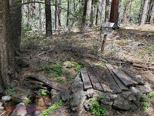
Day 1: Geronimoooo. To Winter Cabin, visiting Geronimo Springs along the way
9.2 miles; ERM = 17. Up 1590', down 2460'. Camp @ 6200' near Winter Cabin.
"Geronimo!" I mutter as the feeble trail drops like trump's ratings, i.e., plummets; through
P-Pines into Alligator Juniper and Oaks, to the boulder-strewn floor of Sycamore Canyon. Over the short mile from Babe's Hole
Spring, an amazingly cold burbler of clear water, the trail to Geronimo has lost about 800', most of it in the final quarter mile.
And it's worth it. Geronimo is gushing and there's a small overhang camp across the way. Yellow Monkey Flowers, purple Wild
Iris, Phlox, and Columbine grace the edge of the riparian zone. Gorgeous.
The canyon floor is choked with heaps of rounded river boulders, looking like very
tough walking.
Chugging back to Babe's Hole Spring, I enjoy lunch #1 before moving on to Dorsey
Spring for the next snack. 6.3 miles so far. During both lunches, I lounge on my sitting pad with my bare feet propped up on
the boots. Ahh, a footnote to delight.
The day starts early with a teeth chattering drive on washboard road FR 231, to FR 538,
to FR 538E, to Dorsey Spring trailhead. From the carpark near Casner Tank, where FR 538E meets FR 538G, I road walk FR 538G
to Kelsey Spring TH (downhill going this direction on the road), and slip into the Sycamore Canyon Wilderness, continuing downhill
to Babe's Hole Spring. FR is Forest Road. Before leaving the tarmac, I herd a gorgeous girl off the road, where she was warming up
on the black asphalt (Great Basin gopher snake (Pituophis catenifer deserticola)). I tell her to stay safe from the EtV and off the road,
hoping she has more common sense than the "open up without testing or contact tracing - sacrifice your lives for the economy" group.
From Dorsey, Trail 03, the Kelsey Trail, continues South through a low saddle adjacent to
a volcanic neck, through a quarter of a mile of nasty, clothes shredding barberry oakbrush, and lilts through small side drainages
to end at Winter Cabin. There's water here, albeit not flowing as pristine as the previous water, yet lovely all the same. The Winter
Cabin Spring is clogged with mud, so one gets decent water from the streambed. The fussy Sawyer filter refuses to filter, so I resort
to the trusty AquaMira.
After gathering two gallons of water and treating it, I suffer a partial bucket bath in the brisk
wind and cooling temperatures.
On the way to camp, lugging the treated water, my ancient 2-liter Platypus squirts out of
where it had been secured to the top of the pack, hits the ground and spurts water from the seams. "Full catastrophe living!" I
exclaim, albeit knowing that's a joke.
Finding a camping spot a good distance off the trail, I set up the TarpTent under a spreading
monarch Alligator Juniper and soon have on a wool t-shirt, a wool hoody, and a light down jacket. The wind trails off, finally, about
sunset, bringing out a feeble squadron of busy mosquitoes. It's into the TarpTent I go, to finish these notes, snuggled in the fluffy
bag. Deluxe.
| ||||
 |
 |
 |
 |
 |
 |
 |
 |
 |
Day 2: Petrified Watermelon Walk. To Sycamore Canyon, and back
9.0 miles. ERM = 16.2; Up 1800', down 1800'
The quest for today is Taylor Cabin. The route starts at about 6200' on Trail 70, the
Winter Cabin Trail, as it passes Ott Lake and drops precipitously to Sycamore Creek, followed by back and forth across the
streambed on Trail 63, the Sycamore Basin Trail, passing Trail 35, the Taylor Cabin Trail, and finally to Taylor Cabin at approximately 4400'.
And, it remains a quest, a future quest, I note as I lean against a delightful sandstone
wall in deep shade at the edge of the boulder clutter that is Sycamore Creek. Swirling crossbedding in the sandstone delights
in this most interesting part of the wilderness. I've dropped drastically on rolling basalt and fractured sandstone on what at
times is a trace of a trail obscured by brush. While happy to have reached the bottom of this plunge, my spirits sink as I see
the texture, the foot-level topography, of walking the streambed. Argh. The cutover trail is nowhere to be found as I teeter
downcanyon, thinking I can cut across to the Taylor Cabin Trail, which apparently receives a lot more traffic than this route.
At least that's what's depicted on the USGS quadrangle of my Gaia mapping program as well as the USFS Sycamore Wilderness map.
Nope. The trail is on the map but gone from the ground. So, I stall out near one of the scooped out intermittent pools of water for
a break before starting back, again gamboling across the expanse of petrified watermelons, rounded basalt boulder shaped like
watermelons. Although many of these would win the "best in show," certainly by weight and also size, I'm not planning to bring
one of these melons home. It's hot enough in the low country to add a bit of poor hiker's electrolyte (salt) to drinks.
The wind cools as I inch back to camp. A bucket bath and extra treats for dinner revive me.
No people today, yet an early morning whitetail deer and, later, a "Yoweee!" encounter with an AZ Black (Arizona Black Rattlesnake,
Crotalus cerberusa) getting reved up in the sun, and later still a well warmed snake punctuate the day. This Ms. Snake whips away so
quickly that all I see is the tapered tail, no rattles. A calm evening envelops my Monarch Alligator camp as a mellow salmon sunset
announces the end of Day 2.
 |
 |
 |
 |
 |
 |
 |
 |
 |
 |
 |
 |
 |
 |
 |
Day 3: Hog Hill Hello 133: Completing the loop
2.9 miles. ERM = 4.0.
800' up
Total = 21.3 miles, ERM = 37.2.
It's cool enough for two shirts and a down jacket when I limber the joints and
greet the sun for cocoa-coffee grańdé and couscous with raisins and Mandarin oranges. Yummy.
Onto Trail 133, the Hog Hill Trail, I roll, finding the initial portion of the trail quite
steep, and of course on rolly rocks. It lapses into an old abandoned road as the hogs gain easier purchase climbing toward
Casner Tank. It's mostly a fine inclined plane to the completioń of this loop with legs roving the Sycamore Canyon Wilderness.
 |
 |
 |
 |
 |
 |
*ERM: Energy Required Miles, are there data to support this
mileage adjustment?
Journal of Outdoor Recreation, Education and Leadership
Petzoldt first proposed his theory in his 1976 book ?Teton Trails? to
help backpackers plan trips and calculate their energy needs on mountain trails. ?Petzoldt defined one
energy mile as the energy required to walk one mile on the flat. He recommended adding two energy miles
for every 1,000 feet of elevation gain, so a person hiking one mile and 1,000 feet upward would use the
equivalent of three energy miles,? Phipps said.
Petzoldt?s energy mile theory was just a reflection of the mountaineer?s
?gut feeling,? Phipps said. The theory had never been tested in a laboratory before the study began in WCU?s
Exercise Physiology Laboratory in the spring of 2010, Phipps said.
To determine the validity of the theory, the study measured the energy cost
and perceived exertion for walking on flat ground, with and without a 44.5-pound backpack, and up an elevation
gain of 1,000 feet, with and without the backpack, through the collection of metabolic data, Phipps said.
Twenty-four student, faculty and staff volunteers, including 12 males and 12
females, went through four testing sessions as the research continued into fall semester of 2010. The study
results showed that the additional energy cost for ascending 1,000 feet ranged from 1.34 to 2.02 energy mile
equivalents, for an average of about 1.6 miles, compared to Petzoldt?s use of two energy miles for each 1,000
feet. The range revealed by the study was due to the ?hikers? personal weight differences, Phipps said.
?It is remarkable that Petzoldt?s energy mile theory is so close to the actual energy cost measured during our
study,? Phipps said. ?In the field of outdoor education, it?s important for leaders to include an estimation
of energy requirements during the planning of hiking trips.?
Phipps said the energy required for hiking up steep mountain trails would vary
for individuals and groups, and the variables of the trail would also factor in, but he recommends that
backpackers stick with Petzoldt?s idea of adding two energy miles for every 1,000 feet of elevation gain when
planning trips.
The Validity of Petzoldt's Energy Mile Theory, 2010
Authors: Maridy McNeff Troy, Maurice L. Phipps
Publication: Journal of Outdoor Recreation, Education, and Leadership
| ||||
.
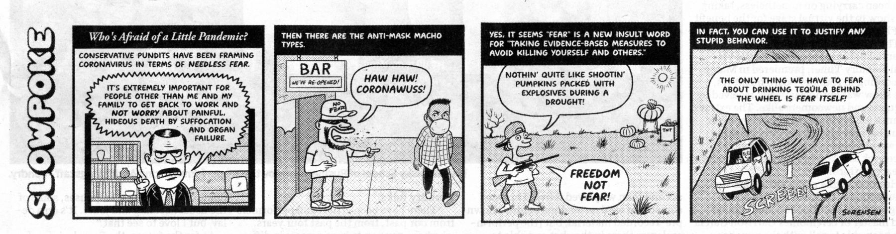
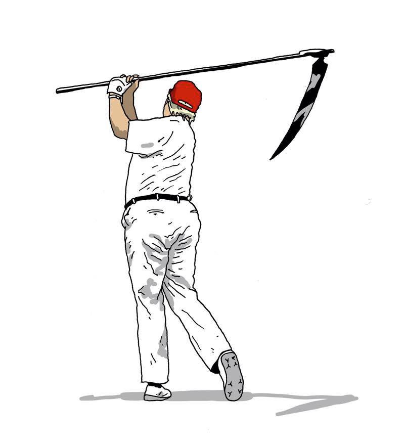
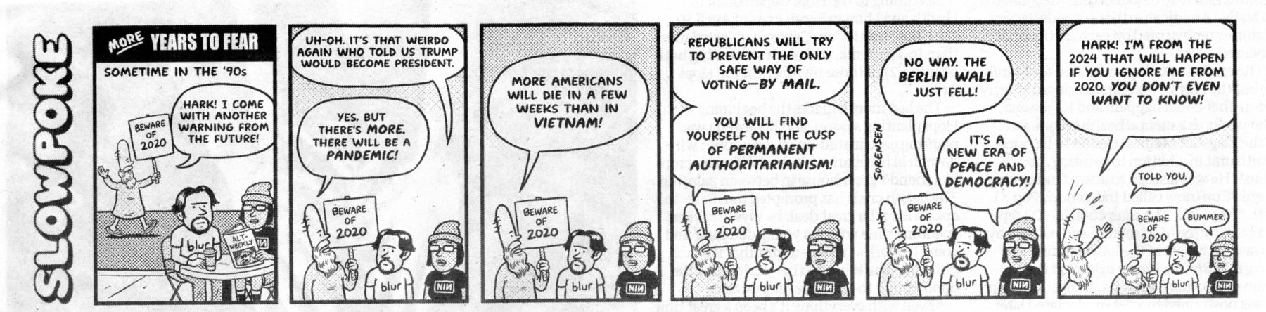
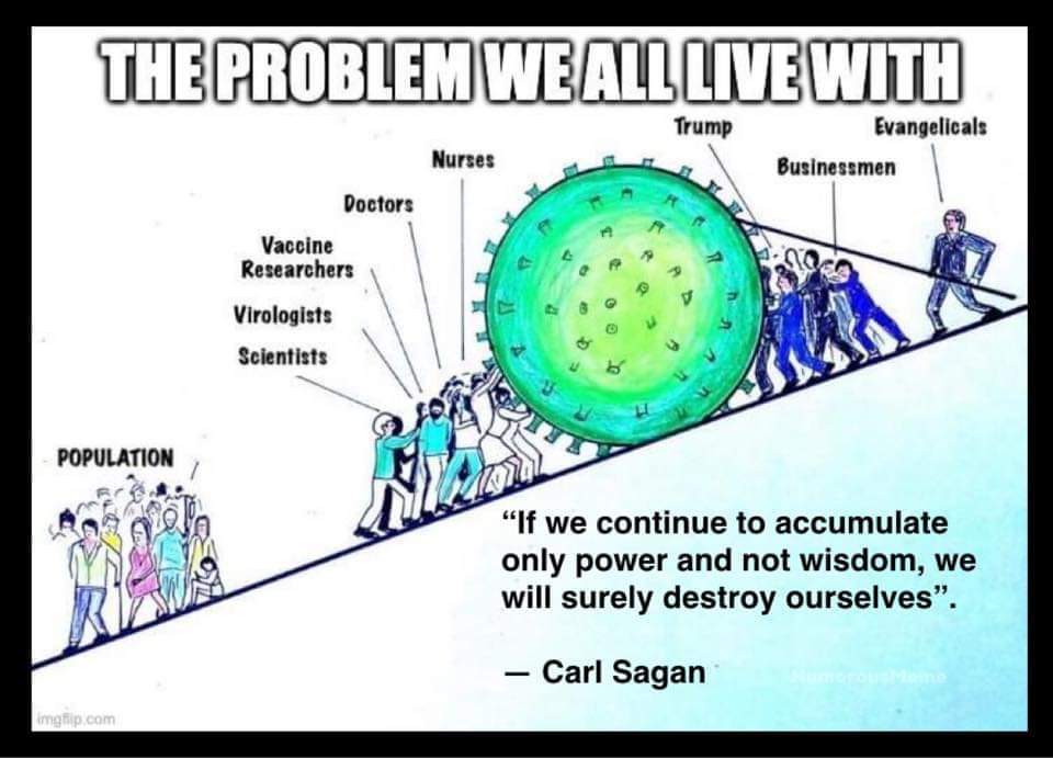
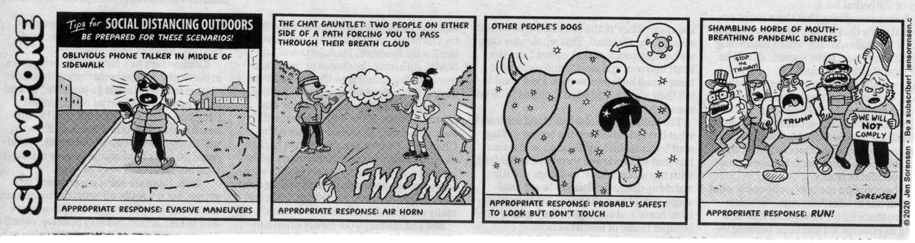
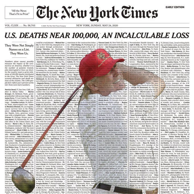
trump is responsible for the nearly nonexistent and deadly late response to COVID-19.
trump has blood on his hands. Lots of it. If you doubt the veracity of this statement, look at the progress of the US vs. South Korea (which acted with strong federal government action when the WHO (World Health Organization) issued their warnings - the same warning trump ignored and tried to suppress, now blaming those who brought the news).
I thought I would post a little history lesson for everyone who has forgotten or never paid attention to the value of people-centered government (rather than the me, Me, ME! of trumpism). I think it’s important that we understand the truth, especially come November when it’s time to vote. Forgive the length, but hey, we all have time on our hands to read, correct?
President Obama and Ebola. Altogether, the CDC, under President Obama, trained 24,655 medical workers in West Africa, educating them on how to prevent and control the disease before a single case left Africa or reached the U.S.
Working with the U.N. and the World Health Organization President Obama
ordered the re-routing of travelers heading to the U.S. through certain specific airports equipped to handle mass testing.
Back home in America, more than 6,500 people were trained through mock
outbreaks and practice scenarios. That was done before a single case hit America.
Three months after President Obama activated this unprecedented response,
on September 30, 2014, we detected our first case in the U.S.A. A man had traveled from West Africa to Dallas and
somehow slipped through the testing protocol. He was immediately detected and isolated. He died a week later.
Two nurses who tended to him contracted Ebola but later recovered. All the protocols had worked. It was contained.
The Ebola epidemic could have easily become a pandemic, but thanks to the
actions of our government under President Obama, it never did. Those THREE EBOLA CONFIRMED CASES were the
ONLY cases of Ebola in the U.S.A. because Obama did what needed to be done THREE MONTHS PRIOR TO THE FIRST CASE.
Ebola is even more contagious than COVID-19. Had Obama not acted swiftly,
millions of Americans would have died horrible, painful, deaths like something out of a horror movie (if you’ve never
seen how Ebola kills, it’s horrific).
It's ironic because since President Obama acted decisively we forget about his actions since the disease never reached our shores in the waves that COVID-19 has.
Now the story of COVID-19 and Trump’s response that we know about so far:
Before anyone even knew about the disease (even in China) Trump disbanded
the pandemic response team that Obama had put in place. He cut funding to the CDC, and he cut our contribution to
the World Health Organization (WHO).
Trump fired Rear Admiral Timothy Ziemer, the person on the National Security
Council in charge of stopping the spread of infectious diseases before they reach our country - a position created by
the Obama administration.
When the outbreak started in China, Trump assumed it was China’s problem and
sent no research, supplies or help of any kind. We were in a trade war, why should he help them?
In January he received a briefing from our intelligence organizations that the
outbreak was much worse than China was admitting and that it would definitely hit our country if something wasn’t
done to prevent it. He ignored the report, not trusting our own intelligence.
When the disease spread to Europe, the World Health Organization offered a
plethora of tests to the United States. Trump turned them down, saying private companies here would make the tests
“better” if we needed them. However, he never ordered U.S. companies to make tests and they had no profit motive
to do so on their own.
According to scientists at Yale and several public university medical schools,
when they asked for permission to start working on our own testing protocol and potential treatments or vaccines,
they were denied by Trump’s FDA.
When Trump knew about the first case in the United States he did nothing. It
was just one case and the patient was isolated. When doctors and scientists started screaming in the media that this
was a mistake, Trump claimed it was a “liberal hoax” conjured up to try to make him “look bad after impeachment failed.”
The next time Trump spoke of COVID-19, we had SIXTY-FOUR CONFIRMED
CASES but Trump went before microphones and told the American public that we only had FIFTEEN cases “and pretty
soon that number will be close to zero.” All while the disease was spreading, he took no action to get more tests.
What Trump did was to stop flights from China from coming here. This was too
late and accomplished nothing according to scientists and doctors. By then the disease was worldwide and was already
spreading exponentially in the U.S. by Americans, not Chinese people as Trump would like you to believe.
As the unknown number of cases explodes and the death count mounts (little
testing, remember, we just don't know the full scope of this pandemic in the US), trump has stated "I don't take
responsibility, none at all." He passes responsibility to the states so that he has none, although he preens each day
during his rallies disguised as "press conferences." He is not going to help, but wants to take credit for anything that
might go well. By the time you read this, many more horrible things will have happened, many preventable if we had
a government for the people rather than for trump and the corporations. If you're (rightly) upset about the continuing
restrictions and want the "economy" to open soon, blame trump, he's the one responsible for the lack of response,
the late response (months of wasted time), the refusal to help with materials and testing, the lack of responsible behavior.
Either trump should not be president because he refuses to help the people, or he should
not be president because he's incompetent; or both. He's only there because the Senate republicans refuse to do the right
thing and remove trump from office. Remember, come November.
Elections have consequences. In the case of the GOP science-deniers and transfer of wealth to the rich and corporate welfare artists in the trump administration, life and death consequences. It didn't have to be this way. Policy centered around glorifying trump, no interest in governing or protecting the people from corporations, from pandemics is what trump has wrought on us. Now trump is pushing false equivalencies of economy over life and magical thinking about how the economy will quickly recover if those (people-centered governors) obstructionists will just do the right thing (wherever trump's whim of the day leads his gut). Forget science, trump is god.
Flush the turds on November 3rd.
Related Links:
More Truth Than Joke, notes about failed leadership in the time of the EtV (Evil trump Virus, COVID-19):
| ||||
| ||||
| ||||
| ||||
| ||||
| ||||
| ||||
| ||||
| ||||
| ||||
| ||||
|
Wild Vagabond Main |
Trip Report Index  |
Caveat  |
|---|


 w.jpg)