| ||||
| ||||
| ||||
Co-Adventurers: Keith Thompson, Zig Sondelski, & Dave Rumbellow
Redux - brought back, revisited.
Zen - enlightenment by the most direct possible means.
ERM - Energy Required Miles. A mile is added for every 500' elevation gain or loss. It's a very serviceable method of estimating energy required miles.
Total trip - (per my GPS) of 62.8 miles, ERM = 104.2.

| ||||
for a full-resolution map, click here. Caution - do not use this map or gps track for navigating the route.
 |
 |
 |
 |
 |
 |
 |
 |
 |
 |
 |
 |
 |
 |
 |
 |
 |
 |
There are several banks of photos. Keep scrolling and reading....
Click here to see the Cathedral of The Narrows, Part 1, 2001
the Cathedral of The Narrows, Part 2, 2002
the first Zenith of Zion Zen, 2004
Ode to Orderville! Touring Orderville Canyon and THE Subway of Zion, 2007
The quality of Being… is the lesson of Nature. Walt Whitman
Preliminary Day 1: Condor! Condor!
As I step out of the truck at the bridge over Marble Canyon (of The Colorado River -
in what tiny bit is left of Glenn Canyon), to stretch legs and urinate, I look up - plank-like wings, white on the
leading edge. Humm, no Turkey Vulture, yet surely a vulture. Humm. Condor! Condor! Two of them, swooping down
into The Canyon.
Number 73 sits on the arch of Navajo Bridge and preens. I wait, he won't soar.
Damn, I missed the shot.
Over to the land of Zion and propagation to camp, meeting Keith and Dave in
camp. Zig will arrive tomorrow. We walk to the Zion Visitor Center to get preliminary info about water
sources and such. Most excellent news, the springs are flowing.
Preliminary Day 1 photos - by Rob


Preliminary Day 2: Cache and Stash and Annular Eclipse. @ 6 miles.
The narrow golden disc surrounds the black sphere as the moon almost
eclipses the sun. Gorgeous and amazing. The light around us fades a bit. An annular eclipse.
To exalt in this view, we drive down from the obscuring and towering
Navajo SS (SandStone) walls to more open ground - I meet folks with telescopes with protective filters.
Sharing the view, a terrific experience!
The day starts with filling 8 gallons of wine bladders and jugs
(with water, not wine), loading food into a 5-gallon bucket, driving to the Wildcat TH and then hiking
in the 8 gallons of water and the bucket of food to just East of Russell Gulch. We also leave 3 gallons
of water, some crackers, and a economy size tin of sardines near the Hop Valley TH. Cache and stash.
Lots of work. Is it worth it? Glad to be free of the horribly unbalanced pack (32 pounds of water is
difficult to pack high, and balanced, in the pack), we return to the Wildcat TH and see a redhead at
the now scenic toilet. Lovely. We camp a second night at the Watchman CG. A very warm sun shower
completes the day. Refreshing. It's good to see old friends again. We chat in the gathering darkness
about the cache, about the eclipse, about trips of yore and yet to come.....
 |
 |
 |
Day 1: Jerkin LaVerkin. to near Beatty Spring, look for Kolob Arch.
6.93 miles; ERM = 10.0; camp near 5280'.
The near albino Canyon Tree Frog blasts into song, and it echoes around
the hundreds of feet tall Navajo SS spires. The sunlight creeps up the ruby and white neopolitan rock,
signaling local sunset and cooler temperatures. And, a grand scenic show.
A hike up the side canyon to photograph Kolob Arch is a bust. The sun
is right into our eyes/lenses, and we see mostly the outline of this grand (second largest) arch. Drat.
We start today from Watchman CG, drive to Lee Pass TH in the Kolob Canyons
section of the park, and start out downhill into Timber Creek, which today harbors froggies in clear water.
The oaks look lush and it's grand hiking the intermittent shade provided by Cottonwood, Box Elder, Pinyon
and Ponderosa Pine, junipers - quite a tree diversity. Lilting East, we drop into LaVerkin, also running
fairly clear, and we jerk along into the heat of the day. How hot? About 90F?
It's approaching 8p. now, the black flies give us some respite and the
air cools as Zig and Keith enjoy the scene from inside mosquito net tents, and I finish these notes of jerkin LaVerkin.
 |
 |
 |
 |
 |
 |
Day 2: Hopping Up and Up Again into Hop Valley. Into Hop Valley and to Russell Gulch.
13.1 miles; ERM = 20.4; camp at 7200'.
The Hop Valley water glides widely over the sandy plane, bordered by
curious tracks and overseen by shimmering rusty red Navajo SS cliffs. The curious tracks? After some study,
I'm guessing frog or toad. Interesting. We've climbed the first hop into Hop Valley. Cruising Hop Valley
early in the day is a delight - reflections in the water, green grass contrasts with the red walls above.
Probably, it's not so lovely in full sun. Sections of deep sand walking are a bit less than fun. And,
it's loveliness is quite diminished when the cattle are let loose - but not today.
At the end of the flats, another hop - this time to Hop Valley TH and the
first water cache. Seven plus miles so far today. I've been dreaming of a sardine snack - yet Zig, Keith,
Dave all catch rides to Wildcat TH, taking the sardines and crackers with them, so I hike the Connector Trail
solo, as far-ranging views to the South open. Unrequited dreams, yet a bonus vista instead. Along the way,
I encounter Hailey from Quebec and we chat for quite awhile. Universal health care anyone? Yes! The worse
kind of 'socialized' health care is the one we have - where those without coverage force everyone to pay for
their emergency room visits. As long as private profit is involved in health care, we will have horrible,
costly, and unequal coverage, with little or no preventive care.
My feet are a bit bruised by the time I reach Wildcat Trail, and I take
another break and then continue to the food/water cache East of Russell Gulch. Black flies mob us as we
set camp - although a strong breeze helps some. Here there are big trees, oak, and an open meadow. It's
tough to find a good and level spot, but we finally succeed. It is cooling rapidly at sunset. Wind howls
in the gulch, yet does not impact us, ensconced in the trees.
 |
 |
 |
 |
 |
 |
 |
 |
 |
 |
 |
 |
 |
 |
 |
 |
 |
 |
Day 3: Hurricane Hollow. To Potato Hollow, visit Sawmill Spring. 9.8 miles; ERM = 15.3; camp at 6800'.
The hurricane zephyr rips through Potato Hollow, bending oaks and making
Ponderosa shudder; flapping, slapping the TarpTent until it hums its own tune. Amazingly, it's cool enough
to wear long pants and shirt and dream of down bags and down coats. This, and it's near 100F in St George.
The air seems to be clearing of smoke that rolled in (last night?), occluding the views.
Today, we get an early start and work our way up to the Lava Point junction,
rolling around Wildcat Canyon. Wildcat Spring is running and clear, yet little camping can be found nearby -
except for a group of two, and this is at the trail crossing of Wildcat. We drop the cache bucket at the Lava
Point TH - giving it to day hikers, then continue onto the West Rim Trail to Potato Hollow - pausing to inspect
Sawmill Spring (also flowing well and .3 mile off the main trail). Today, the Potato Hollow Spring is most excellent.
On the way to the spring, I encounter a huge gopher snake. We eye each other.
I think, @#%@# my camera is in camp. She thinks, @#%@# I hate backing up in these scratchy reeds. She does.
I admire her flexibility. The winds abate near sundown. Lovely.
 |
 |
 |
 |
 |
 |
 |
 |
 |
Day 4: Wondrous West Rim. To near Cabin (West Rim) Spring; jibber jabber.
5.5 miles; ERM = 9.5;camp near 6700'.
The stark crenellated, carved, curved, cones and domes and mesa and mountains
and bishop dicks of mostly Navajo SS (sometimes with a cap rock of Temple Butte formation) cover the near to
far horizon. Wondrous West Rim. A foreground of yellow Mules Ears and phlox of violet, blue, and magenta
provide contrast to the Navajo SS scene laid out panorama style along the West Rim Trail. Yowee.
And, the view from camp is also deluxe, providing a glimpse of the terrain
for tomorrow. Venturing to the West Rim Spring, I find violet Shooting Stars and two more spring areas while
looking for the shelter structure noted on my GPS (it's not on the USGS map). Zig finds it - directly in
the trail up Telephone Canyon - and it's only the ring of a stone foundation that remains. Is this the cabin
for which Cabin Spring is named?
The morning at Potato Hollow started out quite cool and we waited for the
sun and got up with it. Then, it warmed quickly. As I started the climb out of the hollow, a throng of
jibber-jabbering women - clogging the trail for over a quarter mile - march past, each seeming to be
talking full speed and loud. Is anyone listening, or is disruption of natural quiet the goal? Jibber
jabber. Horrid. And, just as friendly as the ground squirrel who stalks Keith - Keith literally beat
it back with hiking sticks. Rabid?
A fine day indeed (once the jibber jabberers have gone). Now, at sunset,
I'm sitting in my TarpTent Notch, watching the low-angle light play across the islands of diversity
that make Zion special, in a scenic and a biological sense. A staircase of cliffs, layers and formations,
stepping up to the Bryce Canyon level. Bryce helps form the top step, and Zion is the second from the top.
The Grand Canyon is the bottom step. The Grand Staircase.
| ||||
| ||||
| ||||
 |
 |
 |
 |
 |
 |
 |
 |
 |
 |
 |
 |
 |
 |
 |
Day 5: The End of Nature?! to Watchman CG. 5.0 miles; ERM = 10.3; camp in a throng of overpopulation.
Certainly, I am looking at the end of nature (book by Bill McKibben) with
the hoard of unsupervised children from neighboring camps, each mother has 4+ under the age of 8 years.
They're running, tearing out grass, assaulting lizards, hanging from trees and breaking their branches,
and generally hastening mutilation of this park. Republican parents, they'll be no funding for the park
service. With the excessive tax exemptions and tithing to the a, or a the, church, they also rape the
education fund and add to all government deficits, adding exponentially to resource abuse, budget deficit,
education and infrastructure needs, accelerating climate change, all while paying far less than their fair
share. Deplorable. Tents large enough to house nurseries and bounce houses, it's a scene of anti-nature.
The ninth ward of the lard has arrived. Argh.
The day starts on the quiet West Rim, cool and breezy. Wool hat and down
coat soon give way to shorts. Clouds hustle across the sky - providing an excellent backdrop for panoramas
and other photos. The CCC have etched the trail into the near vertical Navajo SS, providing egress from the
glorious West Rim. Stained to rust by remnants of Temple Butte Formation, there're glorious photos and views
to be had. However, approaching Scout Lookout, the throng throbs unhealthy and thick, like a viscous goo
slopped upon this Eaarth (again, Bill McKibben book title).
We lilt down Walter's Wiggles and through Refrigerator Canyon and on down
to the Grotto, catching the bus to the visitor center and camp.
Sadly, Keith must leave unexpectedly and Dave goes to a Zen retreat tomorrow
- so Zig and I will continue the through-hike. We enjoy a delectable Stromboli at the pizza noodle. Yum.
| ||||
| ||||
 |
 |
 |
 |
 |
 |
 |
 |
 |
 |
 |
 |
 |
 |
 |
Day 6: All Clothes on the Eastern Front. to near Stave Spring. 5.4 miles; ERM = 11.3; camp near 6560'.
It's down to Zig and me. Now in camp across a low ridge from Stave Spring,
and up a draw from the trail to Cable and Deertrap Mountains, we've on most of our clothes and we're partially
in the sleeping bags. Burr. The high winds and utter cold front continues. Predicted canyon high of 70F, with
perhaps a high of 50F up here, contrasts with 100F a few days ago in the canyon. Chilly. The occasional sun
helps, and we're mostly out of the wind, so things are OK.
The day starts with another shuttle - this time to the East Entrance to place
a car for the end of this hike. The shuttle is short in length but slow going. Where is the logic in
restricting bicycles from the tunnels but catering to behemoth RVs, holding up traffic for long periods
while these climate changers blast pollutants. Then, back in Zion Canyon, we're on the shuttle bus ride to
Weeping Rock, where we start the East Rim section, on the East Rim/Echo Canyon Trail. Lovely - a more wild
trail (once we pass the Observation Point junction) which leads through Echo basin, not on the rim as was
our prior hike portion. Marked by cairns and not highly traveled, this trail has a more native character.
Features similar to Checkerboard Mesa and views across the canyon astound and abound.
The wind screams, prompting near hypothermia, as we edge along the abyss
of Echo. We wander a bit, looking for a decent place to camp - far enough from the spring and trail. And,
we find our own spring just up the trail to Cable/Deertrap and set up in a green mini meadow, which is OK,
for today we cherish the warming sun.
| ||||
 |
 |
 |
Day 7: Overlooking Zion. Visit Cable and Deertrap Mountains (day hikes). 10.7 miles;
ERM = 17.5; return to camp 6.
Frost coats the TarpTent and ice clogs half of a water bottle. Burr.
Yet, my water baby (heated water bottle) has saved the comfort of the evening. Ahh.
Zig and I are off on a day hike today, to visit Cable and then Deertrap
Mountain and overlook Zion. Wondrous. The sun is up and has mostly dried the tents and restored our hiking
ambition, so, first to Cable Mountain, where clear-cut Ponderosa were cabled down to near Weeping Rock, far,
far below - bound for the propagation of St. George, etc. One can see where this state of despair, utah, a
somewhat great state, gets its republican tradition. Cut all the trees from the public plateau, as many as
you can, and sell them off for private profit. Socialize the loss, privatize the gain - sounds like a banker
or wall streeter, doesn't it? No, only a typical utah republican.
First, to Cable Mountain, where views of Zion Canyon, replete with extreme
exposure, abound. Here, we enjoy lunch #1, then hike back to the junction and toward Deertrap. Adrian of
LA, who has driven all night from snow-coated Yellowstone to visit the land of Zion, smiles despite a
grueling long day hike. Inspiration. The trail rolls over a mound of Temple Cap formation and around the
head of Hidden and other Canyons. Here, the views are wider-ranging, as we peek into Clear Creek - where
the East Entrance road enters the park - and up and down across Zion Canyon. Big pussy cat tracks dot
the trail. Wild.
Back at our spring, a Ruby-throat hummer and a Warbler join me in dipping
water from a sandstone pool.
| ||||
 |
 |
 |
 |
 |
 |
 |
 |
 |
Day 8: Sandlot Highway. to the East Entrance. 6.4 miles; ERM = 9.9. Camp in a bed with a warm woman.
Trip totals are 62.8 miles (about 52 miles of through hike) and ERM of
about 104.2 (about 87 ERM for just the through hike portion).
Again, we are up to frost and frozen water bottles. Burr. The sun quickly
warms our pygmy meadow, rays passing easily through the now cloudless sky, and we're hiking in t-shirts before
long. The trail beyond Stave Spring is at times a deep sand slog. Wide enough to road in a sawmill (apparently
how come it is so wide), the character of this section of the hike is quite different from what we have hiked
to date. After dropping off the White Cliffs, we range along a long elbow around Jolley Gulch, nearly
touching the Park boundary. A cautious Coyote slips between Zig and me as we hike the curving route. Stealthy.
It's truly getting warm as we approach the East Entrance TH. After
finishing the shuttle, it's time to part ways, each of us returning home, yet recalling the beauty and
simplicity of walking meditation, the zenith of zion Zen, among the temples any human would love to call "church."
 |
 |
 |
 |
 |
 |
 |
 |
 |
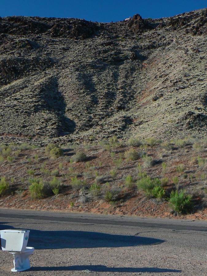
 wzion2012-scenic-toilet-4 Dave and Keith crowd roadside toilet.jpg |
 |
 |
Going to church doesn't make you a Christian any more than standing in a garage makes you a car.
"Reality has a well-known liberal bias." - Stephen Colbert.
“If a free society cannot help the many who are poor, it cannot save the few who are rich.” - John F. Kennedy
“We may have democracy, or we may have wealth concentrated in the hands of a few, but we cannot have both.” - Supreme Court Justice Louis Brandeis
“I believe that there should be a very much heavier progressive tax on very large incomes, a tax which should increase in a very marked fashion for the gigantic incomes.” - Theodore Roosevelt
Who will prefer the jingle of jade pendants once they have heard stone growing in the cliff? - Tao Te Ching
Nature is an infinite sphere whose center is everywhere and circumference nowhere. - Blaise Pascal
Links:
Map:
| ||||
for a full-resolution map, click here. Caution - do not use this map or gps track for navigating the route.
Books:
Eaarth : making a life on a tough new planet, McKibben, Bill,
Time Books, 2010.
Maybe one : an environmental and personal argument for single-child families, McKibben, Bill, Simon & Schuster,
1998.
The end of nature, McKibben, Bill, Random House, 1989.
Other WV reports about the Zion area:
the Cathedral of The Narrows, Part 1, 2001
the Cathedral of The Narrows, Part 2, 2002
the first Zenith of Zion Zen, 2004
Ode to Orderville! Touring Orderville Canyon and THE Subway of Zion, 2007
Population Links:
7 billion and counting - will anyone
survive?
World population clock - watch the number spin, geometrically,
and be frightened, very frightened.
Arithmetic, population, and energy - the geometric
function (youtube mini-lecture on math)
We Are Breeding Ourselves to Extinction (click here for full article)
or at:
Breeding ourselves to extinction?
All measures to thwart the degradation and destruction of our ecosystem will be useless
if we do not cut population growth. By 2050, if we continue to reproduce at the current
rate, the planet will have between 8 billion and 10 billion people, according to a recent
U.N. forecast. This is a 50 percent increase. And yet government-commissioned reviews,
such as the Stern report in Britain, do not mention the word population. Books and
documentaries that deal with the climate crisis, including Al Gore’s “An Inconvenient
Truth,” fail to discuss the danger of population growth. This omission is odd, given
that a doubling in population, even if we cut back on the use of fossil fuels, shut
down all our coal-burning power plants and build seas of wind turbines, will plunge
us into an age of extinction and desolation unseen since the end of the Mesozoic era,
65 million years ago, when the dinosaurs disappeared.
We are experiencing an accelerated obliteration of the planet’s life-forms—an estimated
8,760 species die off per year—because, simply put, there are too many people. Most of
these extinctions are the direct result of the expanding need for energy, housing, food
and other resources. The Yangtze River dolphin, Atlantic gray whale, West African black
rhino, Merriam’s elk, California grizzly bear, silver trout, blue pike and dusky seaside
sparrow are all victims of human overpopulation. Population growth, as E.O. Wilson says,
is “the monster on the land.” Species are vanishing at a rate of a hundred to a thousand
times faster than they did before the arrival of humans. If the current rate of extinction
continues, Homo sapiens will be one of the few life-forms left on the planet, its members
scrambling violently among themselves for water, food, fossil fuels and perhaps air until
they too disappear. Humanity, Wilson says, is leaving the Cenozoic, the age of mammals, and
entering the Eremozoic—the era of solitude. As long as the Earth is viewed as the personal
property of the human race, a belief embraced by everyone from born-again Christians to
Marxists to free-market economists, we are destined to soon inhabit a biological wasteland.
More Truth Than Joke:
| ||||
| ||||
| ||||
| ||||
| ||||
| ||||
|
Wild Vagabond Main |
Trip Report Index  |
Caveat  |
|---|


