| Wild Vagabond Trip Reports |
Weminuche Wilderness
Hiking the Continental Divide
Scrambling: Rio Grande Pyramid, LaVaca Pk, Ute Pk., Nebo Pk., & Hunchback Pk.
August 6 to 14, 1994
by Rob Jones
(Text and Photos © copyright by Rob Jones)
(Thanks to George Cole for the html design and image scanning!)
Click on the THUMBNAILS below to see the full size images.
Prologue: This area was named for the Weminuche (pronounced Wem-in-ooch) Indians of the Ute tribe. Its 487,400 acres are part of the Rio Grande and the San Juan National Forests. The Weminuche Wilderness (one of the largest in the contiguous 48 states) includes three of Colorado's famous "14ers": Mt. Eolus (14,083 feet), Mt. Windom (14,082 feet), and Sunlight Peak (14,059 feet). Elevation ranges from 7910 feet to 14,083 feet, with an average elevation exceeding 10,400 feet, making the San Juan Mountains of the Weminuche Wilderness the highest mountain range in North America. Over 500 inches of snow falls annually, and two major rivers, the San Juan and the Rio Grande, originate in the wilderness. Access is from numerous trailheads, and also by means of the Durango and Silverton Narrow Gauge Railroad, which takes backpackers to and from trailheads at Needleton and Elk Park. About 500 miles of trails provide basic access to and through the area, yet large primeval areas remain untapped by trails. The Continental DivideTrail (CD; which only dips below timberline 3 times) runs for 80 miles from Wolf Creek Pass to the Silverton area. Many of the trails through the area have been used since the early days. The Window near Rio Grande Pyramid is a famous landmark mentioned often in diaries and reports of early travelers and explorers.
The following is a description of a "loop" hike in the Weminuche (with a short shuttle required at the end or start). The hike is in the upper Rio Grande River valley and visits portions of the CD. I estimate that the trip was about 65 miles, but check the maps before you go. There are lots of options for hiking the area....
Day 1: Driver. Sherrod and I left SLC about 9 a.m. and drove the 410 miles to Durango, then we looked through three stores in order to collect four quadrangles and a Weminuche Wilderness map. After an extraordinary mocha latte and Chinese food from the City Market, we were back on the road through Pagosa Springs and to the foot of Wolf Creek Pass. We camped in a small and delightful old-style FS camp, Wolf Cr. It had been a long day of driving, but we were finally out of the explosive heat of Utah.
Day 2: Weminuche' Guchi Pass.
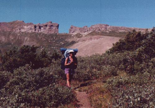
After a relatively late start from Wolf Creek CG, we drove over Wolf Creek Pass and down to South Fork (a town on the Rio Grande), then on Hwy 149 to Creed, an old mining town, which now should be named "Texas Condo Conundrum." Everywhere, there were those characteristically awful-driver texans, stopped in the middle of the road, weave right - turn left, driving at 5 MPH, etc. Looping through Creed, we continued up the Rio Grande River valley and eventually to the trailhead (TH) at Thirty Mile campground (CG) - just below Rio Grande Reservoir dam. It was 670 miles from SLC to the TH. Thunder storms were brewing as we completed packing. Ah, finally we are on the trail, slowly propelling the monster packs up toward Weminuche Pass at 10,700', a low spot in the continental divide. The trees were numerous and some were cloaked in moss. We saw a giant bull moose and two deer on the way in. Sherrod saw a pine martin. It was a slog, up only 1,000', but the packs were very heavy. Why? Because we had food for a heavenly 10 days. After about 4 hours we had covered the 4+ miles to the low open pass. It didn't rain today.
Time to camp. We saw two more young deer near dusk, and a total of 8 people on the trail today. Not bad. Sherrod wore her new guchi hat to Weminuche' Pass. (overnight low was a refreshing 42)
Day 3: Cow curve.
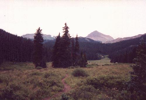
It's cloudy this morning. After getting back on the trail, we took a brief wrong turn (toward the N. Fk. of Pine Cr.) then got back on route. We later learned that the route following the Continental Divide (CD) began near the posts alongside Weminuche Cr. at the pass. It was a steep climb, into the meadows and firs of La Rincon LaVaca (curve of the cow?). We are now on the Continental Divide Scenic Route, along the fringe of tree line. The Skyline route begins near the CD "sign" posts alongside Weminuche Cr. and goes up and around the ridge, rejoining the CD route below The Window. Soon, we will see The Window and the looming Rio Grande Pyramid. It was mid-afternoon by now - but the weather was still holding, although there were lots of thunder heads, patrolling without grumbling. We hiked up and located the poorly-marked end of the Skyline Trail and then found the route up the R.G. Pyramid. We got up to the first level when Sherrod decided the weather was unsafe and she headed down. I had no choice but to follow, after all, I had all the equipment in my pack. We ate dinner and got partly cleaned-up before the rain front jumped into our tiny basin. An hour later and it's still raining hard. A tiring day even though we hiked only 3 or so miles with, and perhaps two more without, packs. We saw two groups of hikers and 2 abandoned horse camps. On it rains. It rained much of the night and we awoke to 40 degree temperatures and cloudy skies.
Day 4: Panic Pyramids.
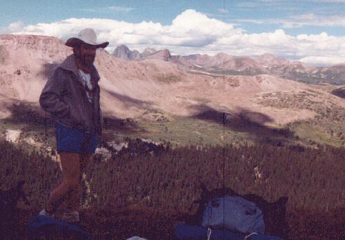
It's time to head for the Rio Grande Pyramid. The weather was on-and-off rain as we hoofed it back to the Skyline Trail, then up the first level to the saddle. The next levels up were routes (obvious) up granulated basalts of various types....walking up the uneven staircase to heaven on the blocks of brechia, black basalt, and gray lava. Gasping at the altitude, I reached the summit of the 13,821' Rio Grande Pyramid and signed-in on the Colorado Mountain Club roster that is kept in a plastic pipe. I was surrounded by oceans of peaks - especially to the N and W, where they were veiled in clouds and mist. After coming down, we ascended the now-named LaVaca (or Panic) Peak on the E side of the saddle. It's 13,278'. Back down and accompanied by a spritzing rain, we cut cross-country across the rincon, then back into camp for soup and enchiladas and squash. Not a bad menu, although there would be an extra charge for substitutions. We saw only 3 hikers (from MI) today, but they told of groups of 20 in Ute Canyon and 15 somewhere down below. I guess our timing for not seeing people is good so far. (40 degree low today).
Day 5: Beaut, and Ute.
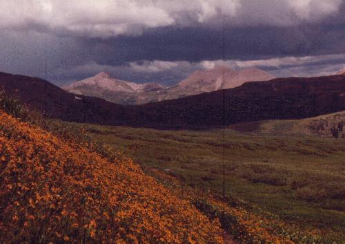
We awoke to clear skies - a first. I got up and started the stove, putting left-over enchiladas on top to warm (on top of a pan of hot water, a back-country steam table). As I went back to bed to continue my nap, gray jays discovered the enchiladas and climbed inside the pan. They ate them all. I wondered if their gizzards burned from eating the spicy-hot gumbo. We got up and dried equipment while eating breakfast - but no enchiladas for us, we had to settle for millet cereal. Up the trail we went, passing below The Window and past the pond near the terminus of the Skyline Trail. What a beaut of a day. Up and up to the pass at 12,617', a high one indeed. Down off the pass, we intersected with the E Ute Creek Trail and two bubbling female hikers. They told more tales of encountering (phantom?) horse packing groups. We have yet to see any, although we've been following what must be splay-toed llama tracks for a few miles. It's still a shirt-sleeve and shorts day, yahoo. Across the wide saddle, we followed the CD, crossing the terminus of Rincon LaOsas (circle of the bear). Soon, we stopped, dropped packs, and fast-footed it up and down Ute Peak (12,892') in 45 minutes. The summit offered great views of The Window and Rio Grande Pyramid to the E and a glimpse of big drainages and Ute Lake to the W. Big thunder-heads cued-up like waves on the sea of mountains. Around the lip of the rincon and through Gunsight Pass we marched, accompanied by thunder. Sherrod was in a panic, fearing a close encounter with the Weminuche Electric Company - so we only glanced at the map. In brief, we ended up at the S end of the E Flint Lakes. This was a fortuitous mistake, a great spot, very different from the volcanics we've seen - here there are rows and rows of glacially-polished whale-backs quartzite. Small evergreens marched over the whale rocks. But no people. It was trying to rain, so we found a good location and put up the tent. Dinner was a scrumptious lentil casserole with couscous and chocolate pudding. It did start raining about 7 p.m. and at dusk the thunder is still playing in the mountains to the W. The big storms seem to be coming from the W or SW, yet smaller and lower clouds often sneak in from the E. Clouds on two or three levels glide or thrash the sky. This is a different kind of country. It surpasses the Tetons in electric instability, at least this week.
Day 6: Divide Discouragement.
I'm marooned in the tent and it's mid-afternoon and raining and hailing. We are a few hundred yards above Middle Ute Lake, listening to the rolling thunder and disagreeing about whether (or is that "weather?") we should have continued to W. Ute Lake or slightly beyond. It's a molding experience.
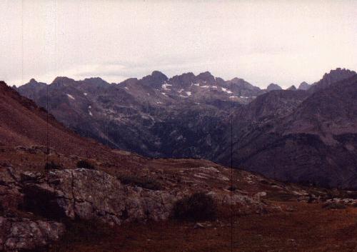
After the rain stopped, we packed and headed to where we thought W. Ute Lake was. Up a lovely rock channel we walked, the green-tinted walls obviously polished by ancient glaciers. The walkway was carpeted by a cornucopia of wildflowers. Add to this beauty the shroud of low clouds and mist and one enjoys a wondrously wild experience. Never mind that this was not the way we wanted to go. At the pass, which read 12,400' on my altimeter, we noted deep drainages - draining the wrong direction. Too high, wrong way. Disappointment divide. We could continue into the Valleceto area and up to Nebo Creek, or return to near Middle Ute Lake and reconnoiter. The low clouds thickened and it began to drizzle. Argh. We returned to Middle Ute.
Two hours after leaving our storm site, we were back there once again setting-up camp as the light faded. No sign of the correct trail. While leaving the pass, another lost hiker came up with a distraught facial expression and asked "this isn't the way to W. Ute, is it?" No. I feel like a navigation klutz, why did we make this error? Wrong direction, wrong altitude, etc. I'm allowing the mushy fringe to take over, I guess. (38 degree low.)
Day 7: Nebo or naught. It's sunny and nice today. We compass-sighted to try to find the trail, but it wasn't where the map said. Then, we saw a horse group coming, picking their way through the clutter of willows. We watched and picked up the "trail." It really doesn't exist, but we made the connection and we were overlooking W. Ute Lake in ˝ hour. A good place for a snack. Down to W. Ute we hiked, then set up camp just below the junction of the CD trail (not on the map) and W. Ute Trail, which trails out to the upper end of the reservoir. We ate one of our dinners, hash browns, for lunch. We had planned an extra meal, and it was good to change the trip tempo. I packed day stuff and went to explore the CD trail and look for the route to the (Nebo) Pass and into the Valleceto drainage and up to Hunchback Pass and Peak. The CD trail is the one leading to Nebo Pass. Here's a trail in fine condition that's not on the map, while the M. Ute to W. Ute intersection is on the map but not on the ground.
I intended to hike Nebo Peak (13,205') but it turned into a climb/scramble. I earned this one. First, I had to climb a finger of fate, then drop down on large quartzite boulders, then ascend Nebo, on shale. It was nice on the summit, although I was physically and emotionally spent. How to get back to camp? I consulted the map and then went down Nebo by a different, circuitous route, hiking the long traverse around W. Ute Mountain, which is much larger than it looks. I did see a velvet-antlered deer hiding in one of the drainages. I returned after nearly 4 hours of hiking - tired. Instead of naught for Nebo, it was a satisfying "yes!"
Day 8: Hunchback, mossback, or scrunchback?
We day-hiked over Nebo Pass to discover a delight of wildflowers on the Nebo Cr. side of the pass. Down and down to the Valleceto Creek Trail, where we turned and went up to 12,493' Hunchback Pass - about 1,000' of climbing. Then, a delightful rock-stroll up Hunchback Mountain (13,136').
Day 9: Down and out, times 2. Time to pack up and trudge out. Two more days would have been just right.
On the trail by 7 a.m., I told Sherrod I would shuttle the car and see her at the TH. Now I'm on the other side of the Rio Grande Pyramid, past the junction of W and Middle Ute to form Ute Creek, past the distant Window. It was a long 14 miles out, but I only noticed the last few miles. Out of the alpine, along the growing, rushing Ute Creek, into the aspens (are some of them turning fall colors?) and conifers, down to the busier parts of the forest, I walked.
After wading Ute Creek near the TH, I found myself sitting on the civilized side of the creek, rebooting. With pre-flattened feet, I continued toward the road. Before reaching it, an old Ford pickup clattered by then disappeared around a turn in the road, probably THE vehicle today. I was feeling the wear of the long day. I walked a mile or more, then got a ride to near the CG. As I walked the final ˝ mile into the CG, I was joined by a cold, driving rain. Cookies in the car, and quiet and warm inside.
We drove back, mostly in the rain while in Colorado, N on highway 149, to Grand Junction, to Green River, to Price, to Smog Lake. 425 miles to the smog bowl via this route. If it's 1 a.m., it must be Smog Lake. I hung up the wet tent, etc. and attempted to crash. Beat and back to the heat. Resplendent, with less than normal-shaped feet and the dull humming brought on by too much caffeine and miles and miles of miles and miles. The house was spinning, the world was spinning...or was it just me. It was a great trip, with many wonderful moments. As I drifted off to sleep, I mused that I am in my snugly Marmot bag - somewhere on the great divide...... :-))