

| ||
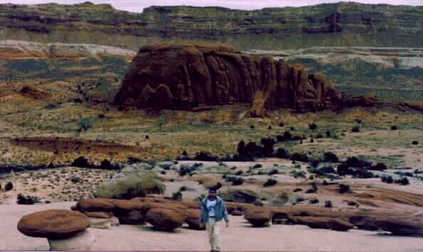
| Several views of the Hamburger Rocks - photos by Rob | ||
|---|---|---|
Hamburger Helper:
Capitol Reef N.P.
Bucolic Bullfrog Bay:
Halls Creek Overlook, Hamburger Rocks, Muley Tanks, Surprise, and Headquarters Canyons
(Also: Starr Springs BLM CG; drive length of Notum Road)
December 30, 1997 to January 3, 1998
by Rob Jones
|
| ||
| Several views of the Hamburger Rocks - photos by Rob | ||
|---|---|---|
See the Background Info at the links at the bottom of the report.
Summary: On this adventure, I would drive the lower portion of the Notum-Bullfrog Road - all the way to Lake Foul (this is the first time I have visited the lower portion). I explored the back route and the easy way to Starr Springs (BLM) CG. I also visited Halls Creek Overlook and hiked off it to the Hamburger Rocks, the Muley Tanks, and the lower exit of the Lower Muley Creek hike. I hiked Surprise and Headquarters Canyons, day hikes along the Notum Road, near The Post. This was the first time I have driven Hwy 276, and it was a lovely, quiet time of the year to do so. Hint, don't try this during the hectic Summer season, even if you are a professional driver, the track will not be closed.
Night 1: A Song Dog Introduction:I'm parked on the Holt Draw access (off Hwy 24) to Sulphur and Chimney Rock Canyons, just west of the park boundary. It is cold and the stars are glaring so vividly that it's difficult to see the dipper amidst the plethora of 0 and 1 magnitude-looking stars. A while ago I heard brother song dog (coyotes) howl. It is frosty, and I'm glad I have my fluffy down bag. On the drive down, I was reminded of why it's best to drive these secondary roads in the day. Just beyond Loa, I too-closely encountered two ebony horses trotting down the center of the road. If not for a local who had flashed their car lights at me, I might not have been ready for them. Then it would have been a close encounter of the folded-fender kind. Even so, it was a temporary heart-stopper.
Day 1: Headquarters Surprise: I awoke as the light hit the giant Wingate Sandstone wall in my backyard. The water in the pans and my contact stuff were frozen. I got the stove blasting and performed the Hayduke mantra... "chemicals, chemicals, I need chemicals (from Edward Abbey, The Monkey Wrench Gang)." See this wondrous book for some intriguing descriptions of the canyon country.
I went back to Torrey - and it was a good thing I did because I put 3 gallons of propane in the tank... a couple of more nights and I would have been without fuel. I stopped at the Capitol Reef Visitor Center and then at the cascades of the Fremont River. Here, the ice domes look like the big biscuits at Mammoth hot springs in Yellowstone.
Then, I drove down the Notum-Bullfrog Road. I hiked Surprise Canyon, continuing off-route up over a low pass and down the canyon north of Surprise. It's a wonderful semi-slot canyon deep enough to cut out the sun where it knifes through the Reef. And, then I hiked Headquarters Canyon, near The Post. There is more of Headquarters to hike than I did, because I stopped at a short fall at the head of an interesting sandstone sidewalk. It's getting late.

| ||
| Sunrise at Halls Creek Overlook | ||
|---|---|---|
I headed south, leaving the tarmac after a mile and bumping past shadowy outcrops and bobbing jack rabbits, up to Halls Cr. Overlook. It was dark by now, and I lurched to where the headlights shined into - nothingness. I got out to sense the nothingness, my toes hanging off slickrock and sensing open space below... A whole lot of lovely, sacred, nothingness. It's the edge of the beyond, an abyss. I backed off the rim and camped at the small turn around at the overlook. Today I had hiked some in shirt sleeves, and some in a pile coat and hat. All this publicity about the neighboring newly-designated Escalante-Grand Staircase NM has resulted in overcrowding, because four vehicles went by on my trip down the Notum today.
|
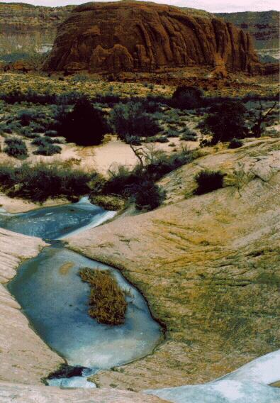
| Frozen Mule Tanks and Halls Creek Canyon, on the Navajo SS of the Reef |
|---|
It's an hour down to the canyon floor, then 2+ hours North before I see the Hamburger Rocks, Dark Carmel Formation clam-shaped disks on necks, perched on the buffy Navajo sandstone, just on the horizon-blotting slab and not far from the trail. I walked up the naked Navajo to the hamburgers, enjoyed a snack, then contoured around, hoping to see the Muley Tanks. I did see a tank nestled below, down slope on the funneling Navajo, but I thought it was not part of the Muley tanks. Continuing to crab-walk along on the inclined reef, I encountered a sheer cleft and I was forced to walk down to the gulch. Here, I stumbled upon a small alcove, with lots of cowboy inscriptions, and one "Wm V. Moffett U.S.G.L.D. Survey 1923" that looked genuine. It looks like it was scribed with axle grease. There are chert shards all around, they litter the ground outside the alcove. Why? Is this an historic lithic site? I also found the cleft and it developed into a wondrous canyon - but I left it for later exploration and headed north again, soon encountering the vaguely marked route into Lower Muley Twist Canyon.
This is it - I have now hiked from The Post to Halls Overlook. Calculating the time to return, opps, I headed back toward camp. The occasional low-angle sun glowed on the rice grass crowns, gracing them with halos. It was warm enough for two shirts and a warm hat, delightfully so. I was surprised that the return trail nearly went into the alcove with the "U.S.G.L.D. Survey" inscription. (I had not seen the trail when I came off the Navajo SS.) The other part of the trail I missed had a sign for the Muley Tanks - the bottom tank is just 100 yards off the trail and can be seen from the trail if you know exactly where to look. There are three Muley Tanks, all ice-covered and dotted with tiny islands of cattails. But, bits of water slid down the raceway between levels. I was tiring, but I snacked and slogged on. I saw birds, a few rabbits, heard a song from God's dog, but I did not see people or their tracks.
Back at the foot of the Halls Overlook route, it's decision time. Should I attempt a quick visit to Brimhall Natural Bridges, or leave this exploration for a later venture? I wandered into the side canyon leading to Brimhall, a delightful canyon, but I was stopped by an ice-ringed pool I didn't want to wade. Besides, it's late. The light faded from the Waterpocket Fold walls as I trudged back up the Overlook trail. It had been 8 hours and 11+ miles of hiking. My legs and other body parts already feel it, like Hamburger Helper. I missed the foremost fading of what must have been another brilliant sunset, judging by the remnant purple rays.
Day 3: Circle A Starr: OK, so there's another 27,256-color sunrise. In summary: Soon, I was on my way to the East, exploring the long loop to Starr Springs, a BLM CG in the scrub oak at about 6000'+, then to Hwy 276 and south to tiny Ticabo. From Bullfrog at Lake Foul, I went back up the Notum-Bullfrog Road to complete the circle to Halls Cr. Overlook and also complete the length of the Notum-Bullfrog Road. Whew!
|
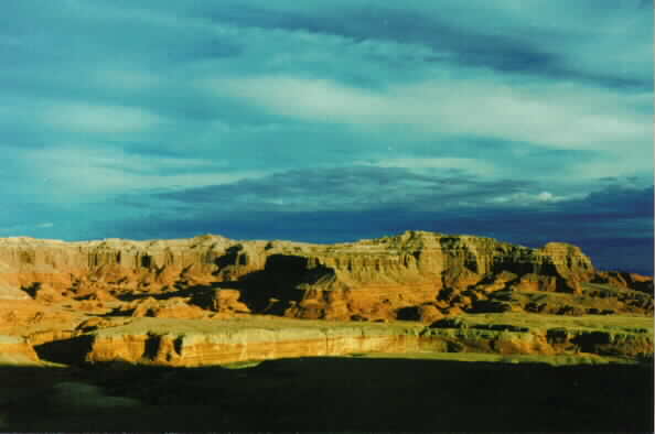
| Bullfrog Canyon |
|---|
|
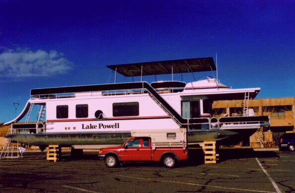
| A campermobile overshadowed by a "Water Winnehogo", ARGH! |
|---|
I drove up the Notum-Bullfrog Road, back to the junction where I had started today, paralleling the livid reds of Bullfrog Canyon, layers of color highlighted by a back drop of distant hulking mountains. I realized I was in Garfield County, where every citizen is required to own 2 road graders, when I encountered pavement (!) that is intermittent from the NRA boundary N of the ford of Bullfrog Creek to the junction of the Starr Springs Road, where I had been surprised by this tarmac on Day 1. This completes my grand Starr-spangled loop for the day.
As the sun set, I went back to Bullfrog, and explored N and S Bullfrog and Stanton Cr. Primitive camps on the bay of Lake Foul. I am writing from Stanton Cr., an unlikely red desert mini-delta alongside Lake Foul. Earlier, I went into Bullfrog to investigate the ferry landing. I found a suitcase in the dumpster at the landing (it's in great condition, what a treasure!). And, I saw the prize of the day, a big, fluffy coyote investigating, like me, the small and closed convenience store in Bullfrog. I felt a certain oneness with this God's Dog, Canus Latrans, Brother Coyote, The Trickster...
Day 4: Quiet Return: It's difficult to believe, but this is the first time I have driven Hwy 276 to where it meets Hwy 95. I saw only 3 cars between Bullfrog and the junction with Hwy 95, and the stretch to Hanksville was almost as quiet. I chuckled about the sign pointing out Hwy 276, where it had been altered to read "Lake Foul" (it had once read "Lake Powell.") Entirely appropriate.
Snow bits flew as I climbed Soldier Summit, but it turned out to be no big deal. It's better, from a traffic point of view, to return on Saturday, avoiding the Sunday rush to return toward the center of the earth at Smog Lake. It's time also to finish the year-end letter and the 1997 journal. Happy New Year!
| For your reference, see the following Park Service links: | |
| National Park Service site: | http://www.nps.gov/ |
| Lower Muley Backpack route: | http://www.nps.gov/care/lomule.htm |
|
Wild Vagabond Main |
Trip Report Index |
Caveat |
|---|